


<< Text Pages >> Fairy Well (Barrow Gurney) - Holy Well or Sacred Spring in England in Somerset
Submitted by Anne T on Tuesday, 17 October 2017 Page Views: 2073
Springs and Holy WellsSite Name: Fairy Well (Barrow Gurney)Country: England
NOTE: This site is 1.299 km away from the location you searched for.
County: Somerset Type: Holy Well or Sacred Spring
Nearest Town: Long Ashton Nearest Village: Barrow Gurney
Map Ref: ST532686
Latitude: 51.414475N Longitude: 2.674342W
Condition:
| 5 | Perfect |
| 4 | Almost Perfect |
| 3 | Reasonable but with some damage |
| 2 | Ruined but still recognisable as an ancient site |
| 1 | Pretty much destroyed, possibly visible as crop marks |
| 0 | No data. |
| -1 | Completely destroyed |
| 5 | Superb |
| 4 | Good |
| 3 | Ordinary |
| 2 | Not Good |
| 1 | Awful |
| 0 | No data. |
| 5 | Can be driven to, probably with disabled access |
| 4 | Short walk on a footpath |
| 3 | Requiring a bit more of a walk |
| 2 | A long walk |
| 1 | In the middle of nowhere, a nightmare to find |
| 0 | No data. |
| 5 | co-ordinates taken by GPS or official recorded co-ordinates |
| 4 | co-ordinates scaled from a detailed map |
| 3 | co-ordinates scaled from a bad map |
| 2 | co-ordinates of the nearest village |
| 1 | co-ordinates of the nearest town |
| 0 | no data |
Internal Links:
External Links:
I have visited· I would like to visit
hevveh visited on 21st Aug 2022 - their rating: Cond: 1 Access: 4
Ramblesnbrambles have visited here
The Northern Antiquarian (TNA) have a page for this almost lost sacred well - see their entry for the Fairy Well, Barrow Gurney, Somerset.
TNA give directions for finding the site, together with a brief archaeology & history and local folklore. They note that "Little of historical nature is known of this site, found in the dip near the stream, though it was much frequented in bygone centuries as a curative place for sore eyes ... It is likely that the fairy association here derived from the proximity of a nearby prehistoric tomb, cairn or similar archaeological remain."
Note: Have you visited this site? Do you have any photographs or information to add?
You may be viewing yesterday's version of this page. To see the most up to date information please register for a free account.
 (PID:246268)")
 (PID:246267)")
Do not use the above information on other web sites or publications without permission of the contributor.
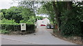
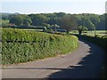
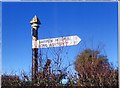
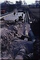
Nearby Images from Geograph Britain and Ireland:
©2016(licence)
©2010(licence)
©2019(licence)
©2021(licence)
©2021(licence)
The above images may not be of the site on this page, they are loaded from Geograph.
Please Submit an Image of this site or go out and take one for us!
Click here to see more info for this site
Nearby sites
Key: Red: member's photo, Blue: 3rd party photo, Yellow: other image, Green: no photo - please go there and take one, Grey: site destroyed
Download sites to:
KML (Google Earth)
GPX (GPS waypoints)
CSV (Garmin/Navman)
CSV (Excel)
To unlock full downloads you need to sign up as a Contributory Member. Otherwise downloads are limited to 50 sites.
Turn off the page maps and other distractions
Nearby sites listing. In the following links * = Image available
2.6km WNW 286° Flax Bourton Ancient Cross* Ancient Cross (ST5066269369)
3.2km NE 43° Long Ashton Cross* Ancient Cross (ST5539070910)
3.2km SSW 194° Felton Village Bowl Barrow* Round Barrow(s) (ST52386550)
3.5km NNW 340° Wraxall Camp* Ancient Village or Settlement (ST52057193)
3.8km W 261° Backwell Hillfort Hillfort (ST49406805)
3.9km SSW 196° Felton Hill Bowl Barrow T30A* Round Barrow(s) (ST52126490)
3.9km W 265° Backwell Church Cross* Ancient Cross (ST4931268323)
4.0km W 261° Backwell Cave* Cave or Rock Shelter (ST49246801)
4.0km SSW 198° Felton Bowl Barrows T28 & T29* Round Barrow(s) (ST51966480)
4.0km SSW 203° Felton Hill Long Barrow T26* Chambered Tomb (ST51626491)
4.0km SSW 199° Felton Common Suck Stone* Natural Stone / Erratic / Other Natural Feature (ST5187164800)
4.5km N 0° Snake's Well and Spring* Holy Well or Sacred Spring (ST53287308)
4.8km SSE 167° Leigh Down* Stone Circle (ST542639)
4.9km ESE 116° Dundry Long Barrow* Long Barrow (ST57606645)
5.2km SW 216° The Waterstone* Burial Chamber or Dolmen (ST5006464403)
5.3km NNE 34° Burwalls Camp* Promontory Fort / Cliff Castle (ST562730)
5.3km NW 308° Wraxhall Churchyard Cross* Ancient Cross (ST4902371945)
5.4km WSW 252° Chelvey Batch Settlement Ancient Village or Settlement (ST480670)
5.5km NNE 30° Stokeleigh Camp* Promontory Fort / Cliff Castle (ST560733)
5.5km NNE 12° Abbots Leigh Churchyard Cross* Ancient Cross (ST5445274007)
5.6km WSW 254° Tap's Combe Camp* Promontory Fort / Cliff Castle (ST47796708)
5.8km NE 35° Clifton Down Camp* Hillfort (ST56587329)
5.9km SSW 212° Red Hill Longbarrow Chambered Tomb (ST49956361)
6.1km SSW 194° Butcombe Barrow* Round Barrow(s) (ST51646273)
6.5km WNW 298° Whirley Pool* Holy Well or Sacred Spring (ST475717)
View more nearby sites and additional images


 We would like to know more about this location. Please feel free to add a brief description and any relevant information in your own language.
 Wir möchten mehr über diese Stätte erfahren. Bitte zögern Sie nicht, eine kurze Beschreibung und relevante Informationen in Deutsch hinzuzufügen.
 Nous aimerions en savoir encore un peu sur les lieux. S'il vous plaît n'hesitez pas à ajouter une courte description et tous les renseignements pertinents dans votre propre langue.
 Quisieramos informarnos un poco más de las lugares. No dude en añadir una breve descripción y otros datos relevantes en su propio idioma.