


<< Text Pages >> Cromlech de Theix - Stone Circle in France in Bretagne:Morbihan (56)
Submitted by holger_rix on Saturday, 14 May 2016 Page Views: 1153
Neolithic and Bronze AgeSite Name: Cromlech de TheixCountry: France
NOTE: This site is 3.361 km away from the location you searched for.
Département: Bretagne:Morbihan (56) Type: Stone Circle
Nearest Town: Vannes Nearest Village: Theix
Latitude: 47.652300N Longitude: 2.6183W
Condition:
| 5 | Perfect |
| 4 | Almost Perfect |
| 3 | Reasonable but with some damage |
| 2 | Ruined but still recognisable as an ancient site |
| 1 | Pretty much destroyed, possibly visible as crop marks |
| 0 | No data. |
| -1 | Completely destroyed |
| 5 | Superb |
| 4 | Good |
| 3 | Ordinary |
| 2 | Not Good |
| 1 | Awful |
| 0 | No data. |
| 5 | Can be driven to, probably with disabled access |
| 4 | Short walk on a footpath |
| 3 | Requiring a bit more of a walk |
| 2 | A long walk |
| 1 | In the middle of nowhere, a nightmare to find |
| 0 | No data. |
| 5 | co-ordinates taken by GPS or official recorded co-ordinates |
| 4 | co-ordinates scaled from a detailed map |
| 3 | co-ordinates scaled from a bad map |
| 2 | co-ordinates of the nearest village |
| 1 | co-ordinates of the nearest town |
| 0 | no data |
Internal Links:
External Links:
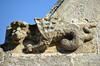
Near the chapel, 4 stones are arranged in rectangle.
More information and Pictures:
t4t35.fr
You may be viewing yesterday's version of this page. To see the most up to date information please register for a free account.
Do not use the above information on other web sites or publications without permission of the contributor.
Nearby Images from Flickr
The above images may not be of the site on this page, but were taken nearby. They are loaded from Flickr so please click on them for image credits.
Click here to see more info for this site
Nearby sites
Click here to view sites on an interactive map of the areaKey: Red: member's photo, Blue: 3rd party photo, Yellow: other image, Green: no photo - please go there and take one, Grey: site destroyed
Download sites to:
KML (Google Earth)
GPX (GPS waypoints)
CSV (Garmin/Navman)
CSV (Excel)
To unlock full downloads you need to sign up as a Contributory Member. Otherwise downloads are limited to 50 sites.
Turn off the page maps and other distractions
Nearby sites listing. In the following links * = Image available
5.1km WSW 244° Dolmen De Theix* Burial Chamber or Dolmen
7.6km SSE 151° Dolmens de Talhouët Burial Chamber or Dolmen
7.9km S 176° Menhirs de Bergard* Standing Stones
8.0km SSE 147° Dolmen de Rangliac* Burial Chamber or Dolmen
9.4km WNW 296° Lec'h de la Chapelle Notre-Dame-du-Loc* Standing Stone (Menhir)
10.5km W 273° Musée d'Archéologie du Morbihan* Museum
10.7km WSW 243° Gornevez Dolmen* Burial Chamber or Dolmen
11.2km SSE 155° Dolmen de Kergloanec Burial Chamber or Dolmen
11.5km WSW 242° Dolmen de l'île de Boëd 1 Burial Chamber or Dolmen
11.6km WSW 243° Dolmen de l'île de Boëd 2 Burial Chamber or Dolmen
12.1km N 5° Dolmens du Château de Kerfily Burial Chamber or Dolmen
12.2km NNE 21° Dolmen des Miches 2 Burial Chamber or Dolmen
12.2km NNE 21° Dolmen des Miches 1 Burial Chamber or Dolmen
12.5km NE 35° Menhir de Clos Bono* Standing Stone (Menhir)
12.8km NNE 22° Allée Couverte de Coëby Passage Grave
12.9km NNE 21° Menhir de Ker-Antoine Standing Stone (Menhir)
12.9km N 9° La Loge au Loup* Burial Chamber or Dolmen
13.1km W 264° Dolmen dit Er-Roch Burial Chamber or Dolmen
13.1km SSE 162° Menhir du Bois (Ambon) Standing Stone (Menhir)
13.2km NNE 13° La Pierre Branlante (Trédion)* Burial Chamber or Dolmen
13.2km NNW 346° Dolmen de la Grée Burial Chamber or Dolmen
13.2km SSW 199° Caden tumulus Chambered Tomb
13.2km N 3° Menhirs du Bois de Kerfily Standing Stone (Menhir)
13.3km N 3° Allée Couverte de Kerfily Passage Grave
13.4km E 81° Boquignac tumulus Chambered Tomb
View more nearby sites and additional images


 We would like to know more about this location. Please feel free to add a brief description and any relevant information in your own language.
 Wir möchten mehr über diese Stätte erfahren. Bitte zögern Sie nicht, eine kurze Beschreibung und relevante Informationen in Deutsch hinzuzufügen.
 Nous aimerions en savoir encore un peu sur les lieux. S'il vous plaît n'hesitez pas à ajouter une courte description et tous les renseignements pertinents dans votre propre langue.
 Quisieramos informarnos un poco más de las lugares. No dude en añadir una breve descripción y otros datos relevantes en su propio idioma.