


<< Our Photo Pages >> Backbury - Hillfort in England in Herefordshire
Submitted by byll on Sunday, 22 August 2010 Page Views: 8219
Iron Age and Later PrehistorySite Name: BackburyCountry: England
NOTE: This site is 2.216 km away from the location you searched for.
County: Herefordshire Type: Hillfort
Nearest Town: Hereford Nearest Village: Prior's Frome
Map Ref: SO587389
Latitude: 52.046944N Longitude: 2.603625W
Condition:
| 5 | Perfect |
| 4 | Almost Perfect |
| 3 | Reasonable but with some damage |
| 2 | Ruined but still recognisable as an ancient site |
| 1 | Pretty much destroyed, possibly visible as crop marks |
| 0 | No data. |
| -1 | Completely destroyed |
| 5 | Superb |
| 4 | Good |
| 3 | Ordinary |
| 2 | Not Good |
| 1 | Awful |
| 0 | No data. |
| 5 | Can be driven to, probably with disabled access |
| 4 | Short walk on a footpath |
| 3 | Requiring a bit more of a walk |
| 2 | A long walk |
| 1 | In the middle of nowhere, a nightmare to find |
| 0 | No data. |
| 5 | co-ordinates taken by GPS or official recorded co-ordinates |
| 4 | co-ordinates scaled from a detailed map |
| 3 | co-ordinates scaled from a bad map |
| 2 | co-ordinates of the nearest village |
| 1 | co-ordinates of the nearest town |
| 0 | no data |
Internal Links:
External Links:
")
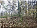
Oddly there is a 'chasm' in the protruding rock at the centre of the enclosure. It must be at least 8 foot deep you certainly would not wnat to slip over the edge of it. There are areas of cliff inside the enclosure too.
You may be viewing yesterday's version of this page. To see the most up to date information please register for a free account.
")
")
")
Do not use the above information on other web sites or publications without permission of the contributor.
Nearby Images from Geograph Britain and Ireland:
©2021(licence)
©2021(licence)
©2021(licence)
©2022(licence)
©2022(licence)
The above images may not be of the site on this page, they are loaded from Geograph.
Please Submit an Image of this site or go out and take one for us!
Click here to see more info for this site
Nearby sites
Key: Red: member's photo, Blue: 3rd party photo, Yellow: other image, Green: no photo - please go there and take one, Grey: site destroyed
Download sites to:
KML (Google Earth)
GPX (GPS waypoints)
CSV (Garmin/Navman)
CSV (Excel)
To unlock full downloads you need to sign up as a Contributory Member. Otherwise downloads are limited to 50 sites.
Turn off the page maps and other distractions
Nearby sites listing. In the following links * = Image available
2.4km NE 44° St Edith's Well (Herefordshire)* Holy Well or Sacred Spring (SO604406)
3.8km SSW 195° Cherry Hill* Hillfort (SO577352)
6.0km S 174° Capler Camp* Hillfort (SO593329)
6.8km WSW 248° Dinedor Camp* Hillfort (SO524364)
6.9km WSW 253° Rotherwas Ribbon* Ancient Trackway (SO52053690)
7.6km W 275° St Ethelbert's Well (Hereford)* Holy Well or Sacred Spring (SO5112239684)
7.6km NW 311° The Wergin's Stone* Standing Stone (Menhir) (SO5297543981)
7.7km WSW 239° Holy Well (Dinedor)* Holy Well or Sacred Spring (SO52013501)
7.7km SE 144° Oldbury Camp (Herefordshire)* Hillfort (SO632326)
7.8km W 276° Hereford Museum and Art Gallery* Museum (SO5090039851)
7.9km W 276° The King's Ditch Natural Stone / Erratic / Other Natural Feature (SO50873974)
9.3km SW 233° St Ann's Well (Aconbury)* Holy Well or Sacred Spring (SO51173338)
9.7km NW 320° Sutton Walls* Hillfort (SO525464)
10.1km SW 235° Aconbury Hill* Hillfort (SO504331)
10.3km E 95° Redhill Wood Hillfort* Hillfort (SO690380)
10.5km SSE 166° Holy Well (Hole in the wall)* Holy Well or Sacred Spring (SO6109028682)
10.5km E 93° Wall Hills Camp* Hillfort (SO692382)
10.6km SW 225° Higgin's Well* Holy Well or Sacred Spring (SO51163141)
11.1km NW 317° St Ethelbert's Well (Marden)* Holy Well or Sacred Spring (SO512471)
11.7km ENE 67° Bosbury Church Stone* Standing Stone (Menhir) (SO695434)
12.6km SSW 192° Picts Cross Stone (Sellack) Standing Stone (Menhir) (SO560266)
13.3km W 271° Eaton Camp* Promontory Fort / Cliff Castle (SO454393)
13.5km WNW 284° Holy Well (Garway)* Holy Well or Sacred Spring (SO45554224)
14.5km ESE 110° Haffield Camp* Hillfort (SO72303390)
14.6km NNW 332° Dinmore Hill Hillfort (SO520519)
View more nearby sites and additional images


 We would like to know more about this location. Please feel free to add a brief description and any relevant information in your own language.
 Wir möchten mehr über diese Stätte erfahren. Bitte zögern Sie nicht, eine kurze Beschreibung und relevante Informationen in Deutsch hinzuzufügen.
 Nous aimerions en savoir encore un peu sur les lieux. S'il vous plaît n'hesitez pas à ajouter une courte description et tous les renseignements pertinents dans votre propre langue.
 Quisieramos informarnos un poco más de las lugares. No dude en añadir una breve descripción y otros datos relevantes en su propio idioma.