


<< Our Photo Pages >> Gallowsclough Cob - Round Barrow(s) in England in Cheshire
Submitted by vicky on Tuesday, 23 July 2002 Page Views: 16145
Neolithic and Bronze AgeSite Name: Gallowsclough Cob Alternative Name: GarruslowCountry: England
NOTE: This site is 4.316 km away from the location you searched for.
County: Cheshire Type: Round Barrow(s)
Nearest Town: Northwich Nearest Village: Cuddington
Map Ref: SJ570713 Landranger Map Number: 117
Latitude: 53.236979N Longitude: 2.645712W
Condition:
| 5 | Perfect |
| 4 | Almost Perfect |
| 3 | Reasonable but with some damage |
| 2 | Ruined but still recognisable as an ancient site |
| 1 | Pretty much destroyed, possibly visible as crop marks |
| 0 | No data. |
| -1 | Completely destroyed |
| 5 | Superb |
| 4 | Good |
| 3 | Ordinary |
| 2 | Not Good |
| 1 | Awful |
| 0 | No data. |
| 5 | Can be driven to, probably with disabled access |
| 4 | Short walk on a footpath |
| 3 | Requiring a bit more of a walk |
| 2 | A long walk |
| 1 | In the middle of nowhere, a nightmare to find |
| 0 | No data. |
| 5 | co-ordinates taken by GPS or official recorded co-ordinates |
| 4 | co-ordinates scaled from a detailed map |
| 3 | co-ordinates scaled from a bad map |
| 2 | co-ordinates of the nearest village |
| 1 | co-ordinates of the nearest town |
| 0 | no data |
Internal Links:
External Links:
")
One of the best-recorded excavations in the Central Ridge area is that of the scheduled tumulus of Gallowsclough, built on the salmon-pink sand on a hilltop contour. This mound lies close to a hedge on Gallowsclough Lane, to the north of the Chester to Northwich road, opposite a break in the Mid Cheshire Ridge known as the Mouldsworth gap. The gravels and sands of this central ridge were undoubtedly the largest area of open land in prehistoric Cheshire.
Excavations were carried out during two weeks in August 1960 by James Forde-Johnston, who was later to investigate the barrow in the grounds of Sutton Hall near Macclesfield. The main barrow mound was found to be composed of layers of brown sandy soil of varying shades, defined within a circular bank or kerb of sand. Under this lay a clay cap or dome composed of a yellow sandy mass with patches of red clay. Below was a further layer of whitish sand, the last few feet of which had turned grey. Next came another dome of yellow clay covering a mass of ashy dark grey sand with considerable amounts of charcoal and patches of bright red and orange sandy clay.
Finally excavations revealed a roughly circular pit, approximately one foot in diameter, containing a cremation. No urn accompanied these remains, they were merely placed in a shallow scoop in the ground. Many of the bones were deeply embedded in the dark grey ashy material forming the sides of the pit. There was also a great deal of charcoal on the old ground surface and around the clay cap, indicating that the barrow may have been constructed on the actual site of the cremation. The main burial is unusual in that it is not placed in the centre as was normally the case. It is in fact 7ft south-south-west of the true centre as defined by the kerb. Could it be that the centre was reserved for ritual or was it simply because of the local topography?
As for the covering mound, the appearance of turf suggests that it was not made by digging soil out of a ditch as at some other sites, but from scraping the surface of the surrounding area. Other bones, almost certainly from secondary burials, were found elsewhere in the mound. Further remains may originally have been located in the upper portion of the barrow which have since been ploughed and dispersed elsewhere. The bones of the main burial were those of an adult male (over 21 years of age) who had a full set of teeth at the time of death, was about 5ft 5in in height and was probably right handed. He was quite muscular but not heavily built. The second burial was also that of an adult but the fragments were insufficient in quantity to determine age and sex.
References
Cheshire County Sites and Monuments Record
D.M.Longley “Prehistory” in C.R.Elrington (ed) “The Victoria History of the County of Chester, volume 1, Oxford University Press (1987)
J. Forde-Johnston. “The excavation of a round barrow at Gallowsclough Hill, Delamere Forest, Cheshire”, TLCAS, volume 70 (1960)
You may be viewing yesterday's version of this page. To see the most up to date information please register for a free account.
Do not use the above information on other web sites or publications without permission of the contributor.
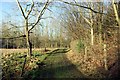
Nearby Images from Geograph Britain and Ireland:
©2012(licence)
©2012(licence)
©2011(licence)
©2022(licence)
©2012(licence)
The above images may not be of the site on this page, they are loaded from Geograph.
Please Submit an Image of this site or go out and take one for us!
Click here to see more info for this site
Nearby sites
Key: Red: member's photo, Blue: 3rd party photo, Yellow: other image, Green: no photo - please go there and take one, Grey: site destroyed
Download sites to:
KML (Google Earth)
GPX (GPS waypoints)
CSV (Garmin/Navman)
CSV (Excel)
To unlock full downloads you need to sign up as a Contributory Member. Otherwise downloads are limited to 50 sites.
Turn off the page maps and other distractions
Nearby sites listing. In the following links * = Image available
2.5km SW 221° Castle Ditch Eddisbury* Hillfort (SJ553694)
3.4km WNW 292° Glead Hill Cob Round Barrow(s) (SJ538726)
3.5km S 170° Oakmere* Ancient Village or Settlement (SJ576678)
4.1km WNW 301° Castle Cob* Round Barrow(s) (SJ535734)
4.2km S 184° Seven Lows* Round Barrow(s) (SJ567671)
4.2km SW 233° Delamere Stone Circle (SJ536688)
4.3km S 188° Seven Lows Round Barrow(s) (SJ56336703)
4.6km SE 141° Long Stone Cross* Ancient Cross (SJ599677)
4.9km SSW 206° Whistlebitch Well* Holy Well or Sacred Spring (SJ548669)
5.3km SSW 196° High Billinge* Round Barrow(s) (SJ5548066242)
5.4km SW 225° Kelsborrow Castle* Hillfort (SJ5315567509)
6.3km NNW 330° Bradley Earthworks* Hillfort (SJ539768)
7.3km NW 306° Woodhouses* Hillfort (SJ511757)
8.1km NW 319° Synagogue Well Holy Well or Sacred Spring (SJ51687742)
8.3km SSW 192° Salterswell* Holy Well or Sacred Spring (SJ552632)
8.5km ESE 102° Moultonbank Farm Round Barrow(s) (SJ653694)
8.7km WNW 298° Helsby Hill* Hillfort (SJ493754)
9.3km NNE 30° Whitley Village Round Barrow(s) (SJ617793)
10.4km SW 224° Brookhouse Farm Ancient Village or Settlement (SJ497639)
11.2km NE 54° Robin Hoods Butts Round Barrow(s) (SJ662778)
11.3km W 263° St Plegmund's Well* Holy Well or Sacred Spring (SJ457701)
11.4km S 177° Robin Hood's Tump* Round Barrow(s) (SJ575599)
12.5km SSW 194° Beeston Castle* Hillfort (SJ538592)
13.2km WNW 284° St Mary (Thornton Le Moors)* Ancient Cross (SJ44157455)
13.9km S 191° Peckforton Mere* Ancient Village or Settlement (SJ543577)
View more nearby sites and additional images


 We would like to know more about this location. Please feel free to add a brief description and any relevant information in your own language.
 Wir möchten mehr über diese Stätte erfahren. Bitte zögern Sie nicht, eine kurze Beschreibung und relevante Informationen in Deutsch hinzuzufügen.
 Nous aimerions en savoir encore un peu sur les lieux. S'il vous plaît n'hesitez pas à ajouter une courte description et tous les renseignements pertinents dans votre propre langue.
 Quisieramos informarnos un poco más de las lugares. No dude en añadir una breve descripción y otros datos relevantes en su propio idioma.