


<< Text Pages >> Elsdon Stone Circle - Stone Circle in England in Northumberland
Submitted by Anonymous on Tuesday, 17 September 2002 Page Views: 8529
Neolithic and Bronze AgeSite Name: Elsdon Stone CircleCountry: England
NOTE: This site is 1.733 km away from the location you searched for.
County: Northumberland Type: Stone Circle
Map Ref: NT700060 Landranger Map Number: 80
Latitude: 55.347105N Longitude: 2.47461W
Condition:
| 5 | Perfect |
| 4 | Almost Perfect |
| 3 | Reasonable but with some damage |
| 2 | Ruined but still recognisable as an ancient site |
| 1 | Pretty much destroyed, possibly visible as crop marks |
| 0 | No data. |
| -1 | Completely destroyed |
| 5 | Superb |
| 4 | Good |
| 3 | Ordinary |
| 2 | Not Good |
| 1 | Awful |
| 0 | No data. |
| 5 | Can be driven to, probably with disabled access |
| 4 | Short walk on a footpath |
| 3 | Requiring a bit more of a walk |
| 2 | A long walk |
| 1 | In the middle of nowhere, a nightmare to find |
| 0 | No data. |
| 5 | co-ordinates taken by GPS or official recorded co-ordinates |
| 4 | co-ordinates scaled from a detailed map |
| 3 | co-ordinates scaled from a bad map |
| 2 | co-ordinates of the nearest village |
| 1 | co-ordinates of the nearest town |
| 0 | no data |
Internal Links:
External Links:
Stone Circle in Northumberland
Have you visited this site? Please contribute a description or any thoughts by adding a comment.
You may be viewing yesterday's version of this page. To see the most up to date information please register for a free account.
Do not use the above information on other web sites or publications without permission of the contributor.
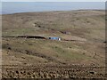
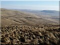
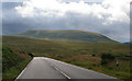
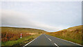
Nearby Images from Geograph Britain and Ireland:
©2023(licence)
©2023(licence)
©2008(licence)
©2021(licence)
©2012(licence)
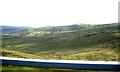
The above images may not be of the site on this page, they are loaded from Geograph.
Please Submit an Image of this site or go out and take one for us!
Click here to see more info for this site
Nearby sites
Key: Red: member's photo, Blue: 3rd party photo, Yellow: other image, Green: no photo - please go there and take one, Grey: site destroyed
Download sites to:
KML (Google Earth)
GPX (GPS waypoints)
CSV (Garmin/Navman)
CSV (Excel)
To unlock full downloads you need to sign up as a Contributory Member. Otherwise downloads are limited to 50 sites.
Turn off the page maps and other distractions
Nearby sites listing. In the following links * = Image available
4.2km N 352° Knock Hill Cairn Cairn (NT69451016)
4.4km NW 321° Shaw Craigs Hillfort (NT67270945)
5.8km NNE 19° Moor Head (Brundean Laws)* Standing Stones (NT7193111439)
6.8km NNW 342° Edgerston Hillfort (NT67981245)
6.9km NE 54° Upper Hindhope* Standing Stones (NT75641008)
7.3km WNW 297° Southdean Law* Hillfort (NT63500938)
8.4km SW 228° The Kielder Stone* Natural Stone / Erratic / Other Natural Feature (NT63690050)
8.4km NNE 21° Dark Wood* Cairn (NT73111377)
8.6km NE 52° Hindhope Hill Hillfort* Hillfort (NT76811127)
8.9km NE 53° Hindhope Hill Cairn* Cairn (NT7710811310)
9.0km SE 124° Three Kings* Stone Circle (NT7742500922)
9.1km ESE 119° Byrness Forest Office Site Rock Art (NT7794101470)
9.4km NE 46° Woden Law* Hillfort (NT76771254)
9.9km ESE 112° Dour Hill Long Cairn c* Rock Art (NT7917002158)
9.9km NNE 28° Falla Knowe Cairn* Cairn (NT74711475)
10.0km ESE 112° Dour Hill Long Cairn d & e Rock Art (NT7920002140)
10.0km ESE 112° Dour Hill Long Cairn b* Rock Art (NT7920302142)
10.0km ESE 112° Dour Hill Long Cairn a Rock Art (NT7920302130)
10.0km ESE 112° Dour Hill (Rochester)* Chambered Cairn (NT79230212)
10.5km E 83° Outer Golden Pot (Otterburn)* Marker Stone (NT8044207234)
10.8km NNE 28° Dere Street Cairn* Round Cairn (NT75061552)
10.8km NNE 28° Black Knowe (Borders)* Standing Stone (Menhir) (NT75131554)
10.9km NE 50° Standard Knowe Cairn (NT78411300)
11.2km NNE 26° Five Stanes B Stone Circle (NT7516)
11.2km E 88° Middle Golden Pot (Otterburn)* Marker Stone (NT8122006330)
View more nearby sites and additional images


 We would like to know more about this location. Please feel free to add a brief description and any relevant information in your own language.
 Wir möchten mehr über diese Stätte erfahren. Bitte zögern Sie nicht, eine kurze Beschreibung und relevante Informationen in Deutsch hinzuzufügen.
 Nous aimerions en savoir encore un peu sur les lieux. S'il vous plaît n'hesitez pas à ajouter une courte description et tous les renseignements pertinents dans votre propre langue.
 Quisieramos informarnos un poco más de las lugares. No dude en añadir una breve descripción y otros datos relevantes en su propio idioma.