 with our Megalithic Portal iPhone app")


<< Our Photo Pages >> Old Biot - Holy Well or Sacred Spring in England in Cheshire
Submitted by TimPrevett on Wednesday, 07 February 2007 Page Views: 9439
Springs and Holy WellsSite Name: Old BiotCountry: England
NOTE: This site is 0.931 km away from the location you searched for.
County: Cheshire Type: Holy Well or Sacred Spring
Nearest Town: Nantwich
Map Ref: SJ64965243
Latitude: 53.067951N Longitude: 2.524385W
Condition:
| 5 | Perfect |
| 4 | Almost Perfect |
| 3 | Reasonable but with some damage |
| 2 | Ruined but still recognisable as an ancient site |
| 1 | Pretty much destroyed, possibly visible as crop marks |
| 0 | No data. |
| -1 | Completely destroyed |
| 5 | Superb |
| 4 | Good |
| 3 | Ordinary |
| 2 | Not Good |
| 1 | Awful |
| 0 | No data. |
| 5 | Can be driven to, probably with disabled access |
| 4 | Short walk on a footpath |
| 3 | Requiring a bit more of a walk |
| 2 | A long walk |
| 1 | In the middle of nowhere, a nightmare to find |
| 0 | No data. |
| 5 | co-ordinates taken by GPS or official recorded co-ordinates |
| 4 | co-ordinates scaled from a detailed map |
| 3 | co-ordinates scaled from a bad map |
| 2 | co-ordinates of the nearest village |
| 1 | co-ordinates of the nearest town |
| 0 | no data |
Internal Links:
External Links:
")
This is a spring which likely founded the original settlement at Nantwich, during the Roman period, or maybe earlier. A spring from which flows Salt Water is an obvious economic source, as well as benefit for food preservation and health.
In the Iron Age, the British Tribe ruling the area from The Wrekin in Shropshire (The Cornovii) were thought to have been particularly well off - due to the fact that 3 of the 4 inland salt sources were in their territory and under their control. (Those 3 are now all in Cheshire: Nantwich, Middlewitch and Northwich, the 4th being Droitwich).
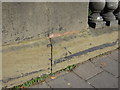
There is no water to be seen running here, as the spring is still in use supplying nearby Nantwich Swimming Pool. The small plaque and stone are found on the east side of The River Weaver, and a few yards to the north of the Bridge onto Welsh Row, on the road named Waterlode. Not particularly impressive to view, but is a reminder of the immense importance of this spring to Nantwich, and the area throughout at least two millennia, and it is still enjoyed today at the pool to the North East.
You may be viewing yesterday's version of this page. To see the most up to date information please register for a free account.
Do not use the above information on other web sites or publications without permission of the contributor.
coldrum has found this location on Google Street View:
Nearby Images from Geograph Britain and Ireland:
©2009(licence)
©2010(licence)
©2017(licence)
©2015(licence)
©2015(licence)
The above images may not be of the site on this page, they are loaded from Geograph.
Please Submit an Image of this site or go out and take one for us!
Click here to see more info for this site
Nearby sites
Key: Red: member's photo, Blue: 3rd party photo, Yellow: other image, Green: no photo - please go there and take one, Grey: site destroyed
Download sites to:
KML (Google Earth)
GPX (GPS waypoints)
CSV (Garmin/Navman)
CSV (Excel)
To unlock full downloads you need to sign up as a Contributory Member. Otherwise downloads are limited to 50 sites.
Turn off the page maps and other distractions
Nearby sites listing. In the following links * = Image available
1.9km WNW 290° Church of St Mary the Virgin (Acton)* Ancient Cross (SJ63175308)
8.8km S 173° St James the Great, Audlem* Round Barrow(s) (SJ66004365)
8.8km S 173° The Bear Stone* Natural Stone / Erratic / Other Natural Feature (SJ66004365)
10.5km NW 315° Robin Hood's Tump* Round Barrow(s) (SJ575599)
11.9km WNW 296° Peckforton Mere* Ancient Village or Settlement (SJ543577)
13.0km WNW 301° Beeston Castle* Hillfort (SJ538592)
13.7km NE 52° Sandbach Crosses* Ancient Cross (SJ7587760825)
14.5km NW 317° Salterswell* Holy Well or Sacred Spring (SJ552632)
14.8km SSE 158° Bradling Stone* Standing Stone (Menhir) (SJ70333864)
15.1km W 271° Maiden Castle (Cheshire)* Hillfort (SJ49805286)
15.7km SSE 158° Devil's Ring and Finger* Holed Stone (SJ7072737783)
16.1km NNW 341° Long Stone Cross* Ancient Cross (SJ599677)
16.1km SSE 164° Betton Standing Stone (Menhir) (SJ69193691)
16.1km ENE 78° Church Lawton South* Stone Circle (SJ808557)
16.2km SSE 161° The Ineaz Stone Standing Stone (Menhir) (SJ70223706)
16.3km ENE 77° Church Lawton Barrows* Barrow Cemetery (SJ809559)
16.4km SSE 160° The Blew Stone Standing Stone (Menhir) (SJ705370)
16.7km NW 325° High Billinge* Round Barrow(s) (SJ5548066242)
16.8km NNW 330° Seven Lows* Round Barrow(s) (SJ567671)
16.9km NNW 329° Seven Lows Round Barrow(s) (SJ56336703)
17.0km N 1° Moultonbank Farm Round Barrow(s) (SJ653694)
17.0km NNW 334° Oakmere* Ancient Village or Settlement (SJ576678)
17.5km ENE 79° All Saints (Church Lawton)* Artificial Mound (SJ82165573)
17.7km NW 325° Whistlebitch Well* Holy Well or Sacred Spring (SJ548669)
17.7km W 279° St Winefride's (Clutton)* Holy Well or Sacred Spring (SJ47395524)
View more nearby sites and additional images


 We would like to know more about this location. Please feel free to add a brief description and any relevant information in your own language.
 Wir möchten mehr über diese Stätte erfahren. Bitte zögern Sie nicht, eine kurze Beschreibung und relevante Informationen in Deutsch hinzuzufügen.
 Nous aimerions en savoir encore un peu sur les lieux. S'il vous plaît n'hesitez pas à ajouter une courte description et tous les renseignements pertinents dans votre propre langue.
 Quisieramos informarnos un poco más de las lugares. No dude en añadir una breve descripción y otros datos relevantes en su propio idioma.