 with our Megalithic Portal iPhone app")

<< Our Photo Pages >> Stantonbury Camp - Hillfort in England in Somerset
Submitted by SolarMegalith on Monday, 31 October 2011 Page Views: 7019
Iron Age and Later PrehistorySite Name: Stantonbury CampCountry: England County: Somerset Type: Hillfort
Nearest Town: Bath Nearest Village: Marksbury
Map Ref: ST67256366
Latitude: 51.371047N Longitude: 2.471864W
Condition:
| 5 | Perfect |
| 4 | Almost Perfect |
| 3 | Reasonable but with some damage |
| 2 | Ruined but still recognisable as an ancient site |
| 1 | Pretty much destroyed, possibly visible as crop marks |
| 0 | No data. |
| -1 | Completely destroyed |
| 5 | Superb |
| 4 | Good |
| 3 | Ordinary |
| 2 | Not Good |
| 1 | Awful |
| 0 | No data. |
| 5 | Can be driven to, probably with disabled access |
| 4 | Short walk on a footpath |
| 3 | Requiring a bit more of a walk |
| 2 | A long walk |
| 1 | In the middle of nowhere, a nightmare to find |
| 0 | No data. |
| 5 | co-ordinates taken by GPS or official recorded co-ordinates |
| 4 | co-ordinates scaled from a detailed map |
| 3 | co-ordinates scaled from a bad map |
| 2 | co-ordinates of the nearest village |
| 1 | co-ordinates of the nearest town |
| 0 | no data |
Internal Links:
External Links:
I have visited· I would like to visit
achiersnakes visited on 24th May 2016 - their rating: Cond: 2 Amb: 4 Access: 3 Great site with amazing views. Access is not actually signposted from one direction although the path is identifiable. Site has a public footpath opposite campsite on the main road.
4clydesdale7 visited on 7th May 2012 - their rating: Cond: 3 Amb: 4 Access: 3 Worth a visit just to examine the Wansdyke - one of the few places in Somerset where the Dyke can be appreciated
Average ratings for this site from all visit loggers: Condition: 2.5 Ambience: 4 Access: 3
")
Read More at Pastscape.
You may be viewing yesterday's version of this page. To see the most up to date information please register for a free account.
")
")
")
")
Do not use the above information on other web sites or publications without permission of the contributor.
Nearby Images from Geograph Britain and Ireland:
©2011(licence)
©2011(licence)
©2006(licence)
©2016(licence)
©2011(licence)
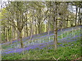
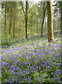
The above images may not be of the site on this page, they are loaded from Geograph.
Please Submit an Image of this site or go out and take one for us!
Click here to see more info for this site
Nearby sites
Key: Red: member's photo, Blue: 3rd party photo, Yellow: other image, Green: no photo - please go there and take one, Grey: site destroyed
Download sites to:
KML (Google Earth)
GPX (GPS waypoints)
CSV (Garmin/Navman)
CSV (Excel)
To unlock full downloads you need to sign up as a Contributory Member. Otherwise downloads are limited to 50 sites.
Turn off the page maps and other distractions
Nearby sites listing. In the following links * = Image available
4.6km SSE 165° Tunley Camp Hillfort (ST684592)
5.2km SE 134° Duncorn Hill Hillfort (ST7160)
5.8km N 5° Bitton Round Barrow* Round Barrow(s) (ST67806945)
6.1km N 9° Bitton Camp* Misc. Earthwork (ST68276968)
6.4km NE 34° North Stoke Promontory Fort* Promontory Fort / Cliff Castle (ST70886888)
6.6km NE 36° Lansdown Tumuli* Barrow Cemetery (ST7114968962)
6.7km NE 38° Lansdown Camp* Misc. Earthwork (ST71446892)
7.0km NE 50° St Alphages Well* Holy Well or Sacred Spring (ST72606815)
7.1km W 271° Hautville's Quoit* Chambered Tomb (ST60176380)
7.1km W 267° Stanton Drew NE Avenue* Multiple Stone Rows / Avenue (ST60126334)
7.1km W 267° Stanton Drew NE Circle* Stone Circle (ST60096334)
7.2km W 267° Stanton Drew - Avenue* Multiple Stone Rows / Avenue (ST60076331)
7.2km W 267° Stanton Drew* Stone Circle (ST60006330)
7.2km W 267° Stanton Drew Great Circle* Stone Circle (ST59996328)
7.3km W 265° Stanton Drew SSW* Stone Circle (ST59926308)
7.4km SE 129° Twinhoe Stone Circle (ST730590)
7.4km SSE 155° Peasedown St John Henge Henge (ST703569)
7.5km W 265° Stanton Drew - The Cove* Standing Stones (ST59756310)
7.5km SSE 167° Rowberrow Field Barrow Round Barrow(s) (ST68925630)
7.6km WNW 288° Maes Knoll* Hillfort (ST600660)
7.7km SSE 167° Roundhill Barrow* Round Barrow(s) (ST69005616)
7.9km E 82° Sacred Spring, Bath* Holy Well or Sacred Spring (ST7505364726)
7.9km E 80° Bath Postal Museum* Museum (ST7504564998)
8.3km W 268° Lower Tyning Standing Stones (ST58986337)
8.3km SSE 154° Braysdown Barrow Long Barrow (ST70915619)
View more nearby sites and additional images


 We would like to know more about this location. Please feel free to add a brief description and any relevant information in your own language.
 Wir möchten mehr über diese Stätte erfahren. Bitte zögern Sie nicht, eine kurze Beschreibung und relevante Informationen in Deutsch hinzuzufügen.
 Nous aimerions en savoir encore un peu sur les lieux. S'il vous plaît n'hesitez pas à ajouter une courte description et tous les renseignements pertinents dans votre propre langue.
 Quisieramos informarnos un poco más de las lugares. No dude en añadir una breve descripción y otros datos relevantes en su propio idioma.