 with our Megalithic Portal iPhone app")


<< Our Photo Pages >> St. Catherine's Well (Sugnall) - Holy Well or Sacred Spring in England in Staffordshire
Submitted by HOLYWELL on Sunday, 02 January 2011 Page Views: 6237
Springs and Holy WellsSite Name: St. Catherine's Well (Sugnall) Alternative Name: Holy WellCountry: England
NOTE: This site is 1.381 km away from the location you searched for.
County: Staffordshire Type: Holy Well or Sacred Spring
Nearest Town: Stafford Nearest Village: Sugnall
Map Ref: SJ798306
Latitude: 52.872490N Longitude: 2.301549W
Condition:
| 5 | Perfect |
| 4 | Almost Perfect |
| 3 | Reasonable but with some damage |
| 2 | Ruined but still recognisable as an ancient site |
| 1 | Pretty much destroyed, possibly visible as crop marks |
| 0 | No data. |
| -1 | Completely destroyed |
| 5 | Superb |
| 4 | Good |
| 3 | Ordinary |
| 2 | Not Good |
| 1 | Awful |
| 0 | No data. |
| 5 | Can be driven to, probably with disabled access |
| 4 | Short walk on a footpath |
| 3 | Requiring a bit more of a walk |
| 2 | A long walk |
| 1 | In the middle of nowhere, a nightmare to find |
| 0 | No data. |
| 5 | co-ordinates taken by GPS or official recorded co-ordinates |
| 4 | co-ordinates scaled from a detailed map |
| 3 | co-ordinates scaled from a bad map |
| 2 | co-ordinates of the nearest village |
| 1 | co-ordinates of the nearest town |
| 0 | no data |
Internal Links:
External Links:
 (PID:71958)")
In Sugnall Park, on the edge of Bigwood, is a Holy or St. Catherine’s Well. The well is unmarked on the current O/S and only as W on earlier editions, where the dedication originated is unclear but it is known as such in the village and in Stafford County Archives. The well is source of a small brook which flows to fill Cop Mere. It is covered by small square sandstone well house with pyramidal roof. The roof was said to have been surmounted by cross of which only base remains, but there does not appear to be any evidence of breakage. The well looks like an ‘improvement’ made when the estate was developed in the 1700s with a Gothic boathouse and walled garden. The well is thought to date from 1770 when a temple was constructed in the park. It has been given a grade II listing. To find it turn left (signposted Sugnall walled garden) from the village, after passing the walled garden, just before Ginger Lane, there is a small ornate gate in the left hand side of the wood. This is a permissive path through the woods (as such it may be closed in the future) and the well is soon seen on the left hand side a few yards from this entrance.
You may be viewing yesterday's version of this page. To see the most up to date information please register for a free account.
 (PID:71959)")
Do not use the above information on other web sites or publications without permission of the contributor.
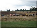
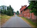
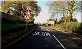
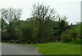
Nearby Images from Geograph Britain and Ireland:
©2006(licence)
©2006(licence)
©2011(licence)
©2005(licence)
©2011(licence)
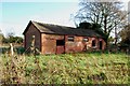
The above images may not be of the site on this page, they are loaded from Geograph.
Please Submit an Image of this site or go out and take one for us!
Click here to see more info for this site
Nearby sites
Key: Red: member's photo, Blue: 3rd party photo, Yellow: other image, Green: no photo - please go there and take one, Grey: site destroyed
Download sites to:
KML (Google Earth)
GPX (GPS waypoints)
CSV (Garmin/Navman)
CSV (Excel)
To unlock full downloads you need to sign up as a Contributory Member. Otherwise downloads are limited to 50 sites.
Turn off the page maps and other distractions
Nearby sites listing. In the following links * = Image available
3.3km ESE 116° Holy Trinity Church, Eccleshall* Ancient Cross (SJ82752917)
6.1km WNW 299° Bishop's Wood Hillfort (SJ745336)
6.5km ESE 108° All Saints (Chebsey)* Ancient Cross (SJ85982856)
6.7km NE 47° Swynnerton bowl barrow* Barrow Cemetery (SJ8474635109)
7.2km SE 141° St Anne's Well (nr Lawnhead) Holy Well or Sacred Spring (SJ84262498)
8.6km N 353° Berth Hill* Hillfort (SJ788391)
9.8km NE 51° Saxon's Lowe* Round Barrow(s) (SJ8750136662)
10.0km ENE 58° Bury Bank (Staffordshire)* Hillfort (SJ883359)
11.3km NW 304° The Blew Stone Standing Stone (Menhir) (SJ705370)
11.5km NW 304° The Ineaz Stone Standing Stone (Menhir) (SJ70223706)
11.5km NW 308° Devil's Ring and Finger* Holed Stone (SJ7072737783)
12.3km WNW 301° Betton Standing Stone (Menhir) (SJ69193691)
12.3km NNE 33° St Mary and All Saints (Trentham)* Ancient Cross (SJ8654640940)
12.4km NW 310° Bradling Stone* Standing Stone (Menhir) (SJ70333864)
12.9km SE 136° Berry Ring* Hillfort (SJ887212)
13.5km E 93° St Rufin's Well Holy Well or Sacred Spring (SJ93372995)
13.8km ENE 78° Hollywood enclosure* Misc. Earthwork (SJ9338033501)
14.5km SSE 165° St Edith's Well (Church Eaton)* Holy Well or Sacred Spring (SJ83521653)
14.8km SSW 196° Pave Lane Hillfort* Misc. Earthwork (SJ756164)
15.3km SSE 147° Webb Stone* Standing Stone (Menhir) (SJ881177)
16.2km NNE 18° Market Cross (Newcastle-under-Lyme) Ancient Cross (SJ8485745979)
16.6km NNE 29° Stoke Minster* Ancient Cross (SJ8788745169)
17.1km ESE 112° Kings Low Long Barrow (SJ9567023990)
17.3km SW 222° Wall Camp* Hillfort (SJ681178)
17.7km S 177° Blymhill Marsh Holy Well or Sacred Spring (SJ80511290)
View more nearby sites and additional images


 We would like to know more about this location. Please feel free to add a brief description and any relevant information in your own language.
 Wir möchten mehr über diese Stätte erfahren. Bitte zögern Sie nicht, eine kurze Beschreibung und relevante Informationen in Deutsch hinzuzufügen.
 Nous aimerions en savoir encore un peu sur les lieux. S'il vous plaît n'hesitez pas à ajouter une courte description et tous les renseignements pertinents dans votre propre langue.
 Quisieramos informarnos un poco más de las lugares. No dude en añadir una breve descripción y otros datos relevantes en su propio idioma.