 with our Megalithic Portal iPhone app")


<< Our Photo Pages >> Petroglyph Beach - Rock Art in United States in Alaska
Submitted by bat400 on Monday, 19 February 2024 Page Views: 6627
Rock ArtSite Name: Petroglyph Beach Alternative Name: LithographCountry: United States
NOTE: This site is 161.014 km away from the location you searched for.
Region: Alaska Type: Rock Art
Nearest Village: Wrangell, AK
Latitude: 56.484380N Longitude: 132.39114W
Condition:
| 5 | Perfect |
| 4 | Almost Perfect |
| 3 | Reasonable but with some damage |
| 2 | Ruined but still recognisable as an ancient site |
| 1 | Pretty much destroyed, possibly visible as crop marks |
| 0 | No data. |
| -1 | Completely destroyed |
| 5 | Superb |
| 4 | Good |
| 3 | Ordinary |
| 2 | Not Good |
| 1 | Awful |
| 0 | No data. |
| 5 | Can be driven to, probably with disabled access |
| 4 | Short walk on a footpath |
| 3 | Requiring a bit more of a walk |
| 2 | A long walk |
| 1 | In the middle of nowhere, a nightmare to find |
| 0 | No data. |
| 5 | co-ordinates taken by GPS or official recorded co-ordinates |
| 4 | co-ordinates scaled from a detailed map |
| 3 | co-ordinates scaled from a bad map |
| 2 | co-ordinates of the nearest village |
| 1 | co-ordinates of the nearest town |
| 0 | no data |
Internal Links:
External Links:
")
The observation deck overlooking the beach has several replica carvings for visitors to make their own rubbings as a memento of their visit. The location given is for the beach area and not for any particular petroglyph design.
Wrangell Island visitor's information.
You may be viewing yesterday's version of this page. To see the most up to date information please register for a free account.
Do not use the above information on other web sites or publications without permission of the contributor.
Nearby Images from Flickr
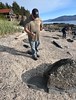
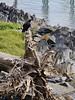
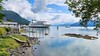
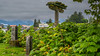
The above images may not be of the site on this page, but were taken nearby. They are loaded from Flickr so please click on them for image credits.
Click here to see more info for this site
Nearby sites
Click here to view sites on an interactive map of the areaKey: Red: member's photo, Blue: 3rd party photo, Yellow: other image, Green: no photo - please go there and take one, Grey: site destroyed
Download sites to:
KML (Google Earth)
GPX (GPS waypoints)
CSV (Garmin/Navman)
CSV (Excel)
To unlock full downloads you need to sign up as a Contributory Member. Otherwise downloads are limited to 50 sites.
Turn off the page maps and other distractions
Nearby sites listing. In the following links * = Image available
75.7km WSW 258° On-Your-Knees Cave* Cave or Rock Shelter
170.7km WNW 293° Hidden Falls Ancient Village or Settlement
267.4km SSE 155° Lucy Islands Ancient Village or Settlement
324.6km ESE 113° 'Ksan Historical Village and Museum* Museum
454.4km S 171° Gwaii Haanas Caves Cave or Rock Shelter
494.9km NNW 343° Yukon Beringia Interpretive Centre* Museum
588.4km SE 139° Nuxalk Petroglyphs Rock Art
663.4km ESE 112° Beaverly Workshop Ancient Mine, Quarry or other Industry
837.9km SE 143° Ancient clam gardens on Quadra Island* Ancient Mine, Quarry or other Industry
904.3km SE 144° Comox Estuary* Ancient Village or Settlement
905.0km SE 141° Pictographs near Powell River ferry terminal Rock Art
905.3km SE 144° Comox Harbor Ancient Fish Trap* Ancient Mine, Quarry or other Industry
942.8km SE 145° Sproat Lake Petroglyphs* Rock Art
954.7km SE 139° Salmon Inlet Barrow Cemetery
969.2km SE 140° shíshálh Nation tems swiya Museum Museum
993.0km SE 141° Lock Bay Site* Rock Art
993.7km SE 142° Petroglyph Provincial Park (British Columbia)* Rock Art
999.9km SE 141° Cedar by the Sea Petroglyphs* Rock Art
1001.9km SE 141° Degnen Bay Site* Rock Art
1007.8km SE 139° Museum of Anthropology - University of British Columbia* Museum
1008.3km SE 138° Coast Salish Stone Fish Weir* Stone Row / Alignment
1008.4km SE 138° Skalsh Rock* Rock Outcrop
1010.0km SE 138° Xwayzway Village* Ancient Village or Settlement
1030.9km SE 138° Glenrose Cannery* Ancient Village or Settlement
1031.0km SE 138° Sewqueqsen Settlement at St.Mungo Cannery* Ancient Village or Settlement
View more nearby sites and additional images


 We would like to know more about this location. Please feel free to add a brief description and any relevant information in your own language.
 Wir möchten mehr über diese Stätte erfahren. Bitte zögern Sie nicht, eine kurze Beschreibung und relevante Informationen in Deutsch hinzuzufügen.
 Nous aimerions en savoir encore un peu sur les lieux. S'il vous plaît n'hesitez pas à ajouter une courte description et tous les renseignements pertinents dans votre propre langue.
 Quisieramos informarnos un poco más de las lugares. No dude en añadir una breve descripción y otros datos relevantes en su propio idioma.