

<< Text Pages >> Cloverdale Stone - Rock Art in United States in The West
Submitted by KaiHofmann on Thursday, 27 September 2012 Page Views: 4023
Rock ArtSite Name: Cloverdale StoneCountry: United States
NOTE: This site is 26.894 km away from the location you searched for.
Region: The West Type: Rock Art
Nearest Town: Cloverdale
Latitude: 38.840466N Longitude: 123.0177W
Condition:
| 5 | Perfect |
| 4 | Almost Perfect |
| 3 | Reasonable but with some damage |
| 2 | Ruined but still recognisable as an ancient site |
| 1 | Pretty much destroyed, possibly visible as crop marks |
| 0 | No data. |
| -1 | Completely destroyed |
| 5 | Superb |
| 4 | Good |
| 3 | Ordinary |
| 2 | Not Good |
| 1 | Awful |
| 0 | No data. |
| 5 | Can be driven to, probably with disabled access |
| 4 | Short walk on a footpath |
| 3 | Requiring a bit more of a walk |
| 2 | A long walk |
| 1 | In the middle of nowhere, a nightmare to find |
| 0 | No data. |
| 5 | co-ordinates taken by GPS or official recorded co-ordinates |
| 4 | co-ordinates scaled from a detailed map |
| 3 | co-ordinates scaled from a bad map |
| 2 | co-ordinates of the nearest village |
| 1 | co-ordinates of the nearest town |
| 0 | no data |
Be the first person to rate this site - see the 'Contribute!' box in the right hand menu.
Internal Links:
External Links:
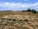
Rock Art in Sonomo County, California.
Stone near the russian river north of Cloverdale with cup-marks and lines. The stone is associated with Pomo culture fertility rites.
link with more information
You may be viewing yesterday's version of this page. To see the most up to date information please register for a free account.
Do not use the above information on other web sites or publications without permission of the contributor.
Nearby Images from Flickr
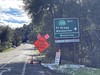
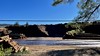

The above images may not be of the site on this page, but were taken nearby. They are loaded from Flickr so please click on them for image credits.
Click here to see more info for this site
Nearby sites
Click here to view sites on an interactive map of the areaKey: Red: member's photo, Blue: 3rd party photo, Yellow: other image, Green: no photo - please go there and take one, Grey: site destroyed
Download sites to:
KML (Google Earth)
GPX (GPS waypoints)
CSV (Garmin/Navman)
CSV (Excel)
To unlock full downloads you need to sign up as a Contributory Member. Otherwise downloads are limited to 50 sites.
Turn off the page maps and other distractions
Nearby sites listing. In the following links * = Image available
38.5km SE 128° Knight's valley stone Rock Art
50.1km S 188° Duncans Landing Rockshelter* Cave or Rock Shelter
58.1km S 183° Bodega Harbor Shellmound* Artificial Mound
59.7km S 184° Bodega Head Shellmound* Artificial Mound
83.7km NW 306° Van Damme State Park Shellmounds* Artificial Mound
113.1km SSE 156° Ring Mountain Carving
124.9km SSE 150° West Berkeley Shell Mound* Artificial Mound
128.3km SSE 150° Emeryville Shellmound* Artificial Mound
151.3km S 175° East Bay Walls* Stone Row / Alignment
153.9km E 94° Maidu Indian Interpretive Center* Ancient Village or Settlement
164.4km SSE 150° Coyote Hills Shellmound ALA 329* Artificial Mound
217.5km SSE 156° Scotts Valley City Hall Artifact Display* Museum
220.2km SSE 160° Sand Hill Bluff Shellmound* Artificial Mound
233.3km SSE 149° Chitactac-Adams Heritage County Park* Ancient Village or Settlement
240.4km NNW 336° Indian Island Shellmounds* Artificial Mound
250.7km SSE 154° Moss Landing Shellmound* Artificial Mound
252.6km E 98° Miwok Salt Basins Ancient Mine, Quarry or other Industry
267.2km SSE 158° Monterey Indian Stone* Rock Art
294.1km NNE 13° Mount Shasta* Natural Stone / Erratic / Other Natural Feature
309.8km NNE 12° Pluto's Cave* Cave or Rock Shelter
326.8km E 92° Pillars (Nevada)* Cairn
350.2km ENE 64° Winnemucca Lake Petroglyphs* Rock Art
382.9km E 79° Grimes Point Arch. Area* Cave or Rock Shelter
403.0km ENE 71° Lovelock Cave* Cave or Rock Shelter
430.1km SSE 153° Morro Creek* Ancient Village or Settlement
View more nearby sites and additional images


 We would like to know more about this location. Please feel free to add a brief description and any relevant information in your own language.
 Wir möchten mehr über diese Stätte erfahren. Bitte zögern Sie nicht, eine kurze Beschreibung und relevante Informationen in Deutsch hinzuzufügen.
 Nous aimerions en savoir encore un peu sur les lieux. S'il vous plaît n'hesitez pas à ajouter une courte description et tous les renseignements pertinents dans votre propre langue.
 Quisieramos informarnos un poco más de las lugares. No dude en añadir una breve descripción y otros datos relevantes en su propio idioma.