


<< Our Photo Pages >> Lower Memaloose Island - Barrow Cemetery in United States in The West
Submitted by bat400 on Saturday, 14 January 2017 Page Views: 3160
Neolithic and Bronze AgeSite Name: Lower Memaloose Island Alternative Name: Island of the Dead, Memaloose, MimaluseCountry: United States
NOTE: This site is 66.907 km away from the location you searched for.
Region: The West Type: Barrow Cemetery
Nearest Town: The Dalles, OR Nearest Village: Mosier, OR
Latitude: 45.703000N Longitude: 121.34W
Condition:
| 5 | Perfect |
| 4 | Almost Perfect |
| 3 | Reasonable but with some damage |
| 2 | Ruined but still recognisable as an ancient site |
| 1 | Pretty much destroyed, possibly visible as crop marks |
| 0 | No data. |
| -1 | Completely destroyed |
| 5 | Superb |
| 4 | Good |
| 3 | Ordinary |
| 2 | Not Good |
| 1 | Awful |
| 0 | No data. |
| 5 | Can be driven to, probably with disabled access |
| 4 | Short walk on a footpath |
| 3 | Requiring a bit more of a walk |
| 2 | A long walk |
| 1 | In the middle of nowhere, a nightmare to find |
| 0 | No data. |
| 5 | co-ordinates taken by GPS or official recorded co-ordinates |
| 4 | co-ordinates scaled from a detailed map |
| 3 | co-ordinates scaled from a bad map |
| 2 | co-ordinates of the nearest village |
| 1 | co-ordinates of the nearest town |
| 0 | no data |
Internal Links:
External Links:
I have visited· I would like to visit
bat400 saw from a distance on 1st May 2015
")
One of multiple cemetery islands in the Columbia River named Memaloose, after the Chinook Memaloose Ilahee, "Land of the Dead," or memalust, "to die." This is the best known and one of the largest islands at the current river level. Historically (and by extension, before outside contact) Chinookian speaking people of the Columbia River brought dead to these islands for final rest with the remains wrapped in robes, reed mats, or leather, or placed in above ground cedar plank cases or canoes.
Lewis and Clark recorded in October 1805 "... passed three large rocks in The river the middle rock is large long and has Several Squar vaults on it. we call this rockey Island the Sepulchar." The next year on their return they briefly landed on the island and counted 13 structures full of bodies.
Unfortunately, by the second half of the nineteenth century, epidemics had reduced the native populations. Although the islands were still used as the resting places of the dead, without the regular visitation and guardianship of larger populations, the islands were also increasingly rifled by Europeans taking grave goods and human remains for a variety of reasons, from "scientific" study of the day, for profit, and for idle curiosity. By the approach of 1900 a frequent excuse for looting and vandalism was that the cemeteries were "abandoned."
A visitor, Jenny Lown, wrote in 1899 about a visit she had made several years earlier:
"... tourists seem unable to visit these places ... without carrying off some souvenir of the trip, and they are sure to walk away with skulls and bones..."
But no such unhallowed desires filled the hearts of our party as we put off from the shore. An Indian guide stood sponsor to the guard upon the island for our good behavior—for the red man has taken this method of protecting the bones of his forefathers, after having appealed to the best instincts of his white brethren, which did no good, and to his government, which did but little more."
The little shanties for storing the bodies are of rough, unpainted boards, and so near the color of the sagebrush as to be quite unnoticed from the river.
Before being brought to Mimaluse the dead are tightly wound with many bandages, but whether the material be fine muslin or a gaudy patchwork quilt, it is done with loving care, and to this is due in large part the excellent preservation of the bodies. An outside wrapping of rope completes the burial costume."
The face has a mere cloth covering, which in time becomes a veritable mask. I looked through a large crack in one of the boxes in which a number of bodies were stored, directly upon the face of the topmost one, and could scarcely believe it embalm them; there is no secret process, as some have thought. The balmy breezes from the ocean perform the work thoroughly and well. This disposition of the dead was orderly and respectful until the white man came. By their side were placed the implements they used in life - pots, pans, spoons, etc., all strung together. Sometimes there were articles of value, quaint carvings and arrow-points, covered with a cloth, so perfect was the outline."
Some of the huts were in complete ruin—the boxes broken, and the place one mass of bodies, most of them pulled apart and the bones scattered about. "
A year or two after my visit the waters of the Columbia rose to an unusual height, and I afterward learned that the island I had explored had been entirely submerged, and that the receding flood had left little upon it: huts, bodies, bones, the cause of so much heartburning and controversy, had gone where they would never be disturbed."
In the 1930's dams on the river caused a rising water level and the remain human remains on Lower Memaloose were removed and interred at cemeteries on shore. The only visible sign of the previous active use of the island is gravestone memorial from 1883 for Vic Trevitt, a settler from the Dalles. He requested that he be buried “with my Indian friends.”
Lower Memaloose may be viewed from the State Park on the Oregon shore of the river. There is also an overlook along highway 84.
Note that the Access rating refers to the viewing points along the river shore, not access to the island itself.
You may be viewing yesterday's version of this page. To see the most up to date information please register for a free account.
Do not use the above information on other web sites or publications without permission of the contributor.
Nearby Images from Flickr
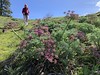

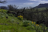
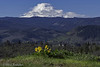
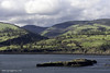

The above images may not be of the site on this page, but were taken nearby. They are loaded from Flickr so please click on them for image credits.
Click here to see more info for this site
Nearby sites
Click here to view sites on an interactive map of the areaKey: Red: member's photo, Blue: 3rd party photo, Yellow: other image, Green: no photo - please go there and take one, Grey: site destroyed
Download sites to:
KML (Google Earth)
GPX (GPS waypoints)
CSV (Garmin/Navman)
CSV (Excel)
To unlock full downloads you need to sign up as a Contributory Member. Otherwise downloads are limited to 50 sites.
Turn off the page maps and other distractions
Nearby sites listing. In the following links * = Image available
19.5km ESE 111° Columbia Hills State Park* Rock Art
41.5km E 91° Maryhill Stonehenge* Modern Stone Circle etc
106.6km W 259° Portland Art Museum* Museum
152.3km NE 46° Whale Island Petroglyphs Rock Art
156.3km E 80° Matalam Ancient Village or Settlement
161.9km S 175° Redmond Lava Caves Cave or Rock Shelter
172.4km NE 36° Vantage Petroglyphs* Rock Art
174.2km NNW 338° Skystone* Natural Stone / Erratic / Other Natural Feature
177.9km ENE 70° Columbia Park* Ancient Village or Settlement
204.9km NW 325° Qwu?gwes Ancient Village or Settlement
230.0km NNW 342° Burke Museum of Natural History and Culture* Museum
242.3km NNW 338° Haleets* Rock Art
258.2km S 172° Cougar Mountain Cave Cave or Rock Shelter
259.4km S 175° Fort Rock Cave Cave or Rock Shelter
314.6km NNW 330° Tse-whit-zen Barrow Cemetery
318.9km NNE 27° Balance Rock Omak* Natural Stone / Erratic / Other Natural Feature
327.0km SE 136° Stinkingwater Medicine Wheels* Stone Circle
333.1km S 169° Paisley Caves* Cave or Rock Shelter
333.1km NNW 331° Race Rocks Ecological Reserve* Ring Cairn
339.4km ENE 76° Red Elk Rock Shelter* Rock Art
359.6km ESE 101° Hells Canyon Archeological District* Rock Art
367.6km E 95° Snake River Archaeological Site* Rock Art
371.7km SSE 159° Petroglyph Lake Rock Art
373.1km NE 50° Indian Painted Rocks (Spokane) Rock Art
373.9km NW 318° Wedding Rock* Rock Art
View more nearby sites and additional images


 We would like to know more about this location. Please feel free to add a brief description and any relevant information in your own language.
 Wir möchten mehr über diese Stätte erfahren. Bitte zögern Sie nicht, eine kurze Beschreibung und relevante Informationen in Deutsch hinzuzufügen.
 Nous aimerions en savoir encore un peu sur les lieux. S'il vous plaît n'hesitez pas à ajouter une courte description et tous les renseignements pertinents dans votre propre langue.
 Quisieramos informarnos un poco más de las lugares. No dude en añadir una breve descripción y otros datos relevantes en su propio idioma.