 with our Megalithic Portal iPhone app")


<< Our Photo Pages >> Bishop Eastern Sierra Petroglyphs - Rock Art in United States in The West
Submitted by Martin_L on Friday, 01 February 2013 Page Views: 25595
Rock ArtSite Name: Bishop Eastern Sierra Petroglyphs Alternative Name: Volcanic Tablelands petroglyphsCountry: United States
NOTE: This site is 31.127 km away from the location you searched for.
Region: The West Type: Rock Art
Nearest Town: Fresno Nearest Village: Bishop
Latitude: 37.361140N Longitude: 118.408477W
Condition:
| 5 | Perfect |
| 4 | Almost Perfect |
| 3 | Reasonable but with some damage |
| 2 | Ruined but still recognisable as an ancient site |
| 1 | Pretty much destroyed, possibly visible as crop marks |
| 0 | No data. |
| -1 | Completely destroyed |
| 5 | Superb |
| 4 | Good |
| 3 | Ordinary |
| 2 | Not Good |
| 1 | Awful |
| 0 | No data. |
| 5 | Can be driven to, probably with disabled access |
| 4 | Short walk on a footpath |
| 3 | Requiring a bit more of a walk |
| 2 | A long walk |
| 1 | In the middle of nowhere, a nightmare to find |
| 0 | No data. |
| 5 | co-ordinates taken by GPS or official recorded co-ordinates |
| 4 | co-ordinates scaled from a detailed map |
| 3 | co-ordinates scaled from a bad map |
| 2 | co-ordinates of the nearest village |
| 1 | co-ordinates of the nearest town |
| 0 | no data |
Internal Links:
External Links:
I have visited· I would like to visit
Catrinm would like to visit
mfrincu visited on 16th Nov 2014 - their rating: Cond: 4 Access: 3 Not very easy to find from the main road. You need to have prior knowledge of the few sites accessible by dirt roads only or you can spend a few days exploring. The Sierra Nevada mountains are amazing too but the petroglyphs themselves are splendid!
Andy B have visited here
")
The reference recommends to “visit the Paiute - Shoshone Indian Cultural Center on West Line Street in Bishop, California, before you head off to the sites”. Therefore the coordinates for this page are set for West Line Street.
The Chalfant and Yellow Jacket Ptroglyph sites are listed on the National Register of Historic Places for Mono County. Other rock art sites exist in the same area in ajoining Inyo County. The sites feature concentric circles, deer, rattlesnakes, bighorn sheep and hunters with bows and arrows.
National Register of Historic Places (NRHP) summary information:
Chalifant (CA-MNO-7):
Cultural Affiliation: Numic, Late Prehistoric, Northern Pauite/Owens Valley Pa
Period of Significance: 500-999 BC, 499-0 BC, 499-0 AD, 1825-1849, 1800-1824, 1750-1799, 1749-1500 AD, 1499-1000 AD, 1000-500 AD, 1000-1499 BC
Owner: Federal
Historic Function: Recreation And Culture, Religion
Historic Sub-function: Ceremonial Site, Work Of Art (Sculpture, Carving, Rock Art)
Yellow Jacket (CA-MNO-2189):
Cultural Affiliation: Desert Archaic, Paiute/Shoshone
Period of Significance: 500-999 BC, 500-999 BC, 499-0 BC, 499-0 AD, 2500-2999 BC, 2000-2499 BC, 1900-1750 AD, 1749-1500 AD, 1500-1999 BC, 1499-1000 AD, 1000-500 AD, 1000-1499 BC
Owner: Federal
Historic Function: Agriculture/Subsistence, Domestic, Recreation And Culture, Religion
Historic Sub-function: Camp, Ceremonial Site, Processing, Work Of Art (Sculpture, Carving, Rock Art)
References (including photos):
http://www.thesierraweb.com/generalinfo/petroglyphs.cfm
Also see the Bishop Field Office for the Bureau of Land Management, which lists the Volcanic Tablelands area as one of the Top Ten Points of Interest in this area of California.
National Register of Historic Places.
Note: Stolen Petroglyphs from sacred California site recovered - Vandals Still Sought - Damaging petroglyphs is a felony - first-time offenders can be imprisoned for a year and fined $20,000, authorities said. See Comments.
You may be viewing yesterday's version of this page. To see the most up to date information please register for a free account.
")
")
")
")
Do not use the above information on other web sites or publications without permission of the contributor.
Nearby Images from Flickr

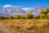
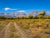
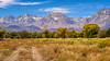

The above images may not be of the site on this page, but were taken nearby. They are loaded from Flickr so please click on them for image credits.
Click here to see more info for this site
Nearby sites
Click here to view sites on an interactive map of the areaKey: Red: member's photo, Blue: 3rd party photo, Yellow: other image, Green: no photo - please go there and take one, Grey: site destroyed
Download sites to:
KML (Google Earth)
GPX (GPS waypoints)
CSV (Garmin/Navman)
CSV (Excel)
To unlock full downloads you need to sign up as a Contributory Member. Otherwise downloads are limited to 50 sites.
Turn off the page maps and other distractions
Nearby sites listing. In the following links * = Image available
95.9km SSE 152° Swansea petroglyph site* Rock Art
150.3km S 191° Painted Rock at Tule River Rock Art
162.9km NNW 333° Pillars (Nevada)* Cairn
167.8km SSE 155° Coso Petroglyphs* Rock Art
197.7km NW 310° Miwok Salt Basins Ancient Mine, Quarry or other Industry
205.2km NE 39° Alta Toquima Wilderness* Ancient Mine, Quarry or other Industry
227.8km N 355° Grimes Point Arch. Area* Cave or Rock Shelter
231.9km NE 37° Gatecliff Rockshelter* Cave or Rock Shelter
246.2km S 178° Tomo Kahni* Rock Art
247.4km NE 34° Toquima Cave* Rock Art
264.0km SSE 155° Inscription Canyon* Rock Art
272.3km SSW 195° Wind Wolves Preserve* Rock Art
273.5km NNE 31° Hickison Petroglyphs* Rock Art
278.6km SSW 208° Painted Rock, Carrizo Plain* Rock Art
289.6km N 357° Lovelock Cave* Cave or Rock Shelter
289.9km W 264° Chitactac-Adams Heritage County Park* Ancient Village or Settlement
291.9km WNW 303° Maidu Indian Interpretive Center* Ancient Village or Settlement
298.6km ESE 116° Lost Creek* Rock Art
305.7km W 259° Moss Landing Shellmound* Artificial Mound
310.8km SW 226° Morro Creek* Ancient Village or Settlement
312.9km SW 224° Los Osos Back Bay* Ancient Village or Settlement
318.5km NNW 346° Winnemucca Lake Petroglyphs* Rock Art
320.5km S 178° Tataviam Pictograph Site* Rock Art
321.1km WSW 256° Monterey Indian Stone* Rock Art
321.6km W 265° Scotts Valley City Hall Artifact Display* Museum
View more nearby sites and additional images


 We would like to know more about this location. Please feel free to add a brief description and any relevant information in your own language.
 Wir möchten mehr über diese Stätte erfahren. Bitte zögern Sie nicht, eine kurze Beschreibung und relevante Informationen in Deutsch hinzuzufügen.
 Nous aimerions en savoir encore un peu sur les lieux. S'il vous plaît n'hesitez pas à ajouter une courte description et tous les renseignements pertinents dans votre propre langue.
 Quisieramos informarnos un poco más de las lugares. No dude en añadir una breve descripción y otros datos relevantes en su propio idioma.