


<< Other Photo Pages >> Swansea petroglyph site - Rock Art in United States in The West
Submitted by Harald_Platta on Monday, 14 June 2010 Page Views: 13476
Rock ArtSite Name: Swansea petroglyph site Alternative Name: INY272Country: United States Region: The West Type: Rock Art
Nearest Town: Swansea
Latitude: 36.600000N Longitude: 117.9W
Condition:
| 5 | Perfect |
| 4 | Almost Perfect |
| 3 | Reasonable but with some damage |
| 2 | Ruined but still recognisable as an ancient site |
| 1 | Pretty much destroyed, possibly visible as crop marks |
| 0 | No data. |
| -1 | Completely destroyed |
| 5 | Superb |
| 4 | Good |
| 3 | Ordinary |
| 2 | Not Good |
| 1 | Awful |
| 0 | No data. |
| 5 | Can be driven to, probably with disabled access |
| 4 | Short walk on a footpath |
| 3 | Requiring a bit more of a walk |
| 2 | A long walk |
| 1 | In the middle of nowhere, a nightmare to find |
| 0 | No data. |
| 5 | co-ordinates taken by GPS or official recorded co-ordinates |
| 4 | co-ordinates scaled from a detailed map |
| 3 | co-ordinates scaled from a bad map |
| 2 | co-ordinates of the nearest village |
| 1 | co-ordinates of the nearest town |
| 0 | no data |
Internal Links:
External Links:
I have visited· I would like to visit
ungust visited on 11th Feb 2015 - their rating: Cond: 4 Access: 4 We were up here for my Lady's Birthday. Places like this are special for us. The Park Rangers at the visitor center in Lone Pine will not give you the exact coordinates to the site. But, to use their favorite saying, " If you are in Keeler, you have gone too far". Swansea is about 9 miles east of Lone Pine. Only one building ( inhabited) across the highway from an old smelter. Look for the Cerro Gordo Rd. sign. Then look for the tire tracks, you are close, use your intuition and you should be rewarded.
The Rangers won't give you the exact coordinates, because they don't want vandals to find these sites easily. Let's help them out and keep these sites protected, for others to visit and for the future generations to remember.
Tread lightly, bring lots of water, take lots of photos.
ENJOY!
mfrincu couldn't find O looked for this place in our expedition to the Eastern Sierra petroglyph sites. However lack of markings and willingness from others to share the coordinates left us wondering.
")
The petroglyphs at site INY272 in eastern California comprise a solar calendrical observatory, with rayed circles, spirals, and other patterns evidently marking the times of at least the summer solstice, equinoxes, and possibly cross-quarter days, with distinctive patterns of light and shadow at sunset or sunrise. Some of these patterns are reminiscent of those reported at Chaco Canyon and elsewhere in the American Southwest.
Of primary interest here is one equinox marker, consisting of six vertical bars pecked into the rock, that predicts the actual time of equinox within a few hours.1 This is a remarkable degree of accuracy and precision for an apparently simple device. Although it is difficult to attribute motive and intent to the ancient people who created this petroglyph, it is possible to infer some ways the marker could have been designed, what minimum kit of tools and ideas was necessary to design it, and how closely its use matches theoretical performance limits. The purpose of this article is to investigate these questions.
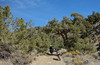
Site INY272... Petroglyph site INY272 is located at latitude 36.6°N and longitude 117.9°W and an elevation of 1130 m, just north of the town of Swansea. The western horizon is formed by the jagged crest of the Sierra Nevada, 30 km distant and rising 3 km above Swansea. There are several hundred petroglyphs at the site, most of which were pecked into white dolomitic marble boulders and bedrock that have been stained tan by weathering. The petroglyphs are concentrated on a wave-polished promontory that was, buried by beach gravels of Pleistocene Owens Lake at the end of the last glaciation, less than 15,000 years ago. The age of the lake high stand was estimated from radiocarbon dating of unaltered clam-shell fossils from the beach gravels themselves, and from tufa lower in the stratigraphic section. It is consistent with radiocarbon dates of organic matter from lake-sediment cores nearby. The lake level throughout the Holocene was lower and the promontory has been exposed above shoreline that whole time. The Holocene climate has been arid; modem rainfall is about 10 cm/yr.
More, with references at the Equinox Project. Photos of the site at Harry Helms' Blog.
Note: Summer solstice field trip to Swansea Petroglyph site, June 19-21, 2010 and article in PCAS newsletter March 2010, see comment
(Page text originally posted by Andy_B; pictures posted by Harald_Platta)
You may be viewing yesterday's version of this page. To see the most up to date information please register for a free account.
")
")
")
")
Do not use the above information on other web sites or publications without permission of the contributor.
Nearby Images from Flickr
The above images may not be of the site on this page, but were taken nearby. They are loaded from Flickr so please click on them for image credits.
Click here to see more info for this site
Nearby sites
Click here to view sites on an interactive map of the areaKey: Red: member's photo, Blue: 3rd party photo, Yellow: other image, Green: no photo - please go there and take one, Grey: site destroyed
Download sites to:
KML (Google Earth)
GPX (GPS waypoints)
CSV (Garmin/Navman)
CSV (Excel)
To unlock full downloads you need to sign up as a Contributory Member. Otherwise downloads are limited to 50 sites.
Turn off the page maps and other distractions
Nearby sites listing. In the following links * = Image available
72.1km SSE 159° Coso Petroglyphs* Rock Art
95.9km NNW 332° Bishop Eastern Sierra Petroglyphs* Rock Art
96.5km SW 229° Painted Rock at Tule River Rock Art
166.1km SSW 194° Tomo Kahni* Rock Art
168.4km SSE 158° Inscription Canyon* Rock Art
212.9km SSW 213° Wind Wolves Preserve* Rock Art
227.4km ESE 102° Lost Creek* Rock Art
238.7km S 189° Tataviam Pictograph Site* Rock Art
239.4km SW 228° Painted Rock, Carrizo Plain* Rock Art
239.5km SE 130° 17 Mile Point* Rock Art
258.1km NNE 19° Alta Toquima Wilderness* Ancient Mine, Quarry or other Industry
258.8km NNW 333° Pillars (Nevada)* Cairn
265.3km ESE 106° Sloan Petroglyph Site* Rock Art
271.7km E 98° Gypsum Cave Cave or Rock Shelter
284.6km SE 127° Hole-in-the-Wall* Rock Art
285.0km S 189° Levitated Mass* Modern Stone Circle etc
285.2km NNE 20° Gatecliff Rockshelter* Cave or Rock Shelter
288.9km SW 217° Chumash Painted Cave* Cave or Rock Shelter
289.0km SE 126° Tortoise Shell Mountain* Rock Art
289.1km NW 318° Miwok Salt Basins Ancient Mine, Quarry or other Industry
292.5km SW 214° Burton Mound* Artificial Mound
298.5km WSW 244° Morro Creek* Ancient Village or Settlement
298.6km WSW 243° Los Osos Back Bay* Ancient Village or Settlement
300.0km E 93° Valley of Fire - Atlatl Rock* Rock Art
302.9km E 92° Mouse's Tank Canyon* Natural Stone / Erratic / Other Natural Feature
View more nearby sites and additional images

 We would like to know more about this location. Please feel free to add a brief description and any relevant information in your own language.
 Wir möchten mehr über diese Stätte erfahren. Bitte zögern Sie nicht, eine kurze Beschreibung und relevante Informationen in Deutsch hinzuzufügen.
 Nous aimerions en savoir encore un peu sur les lieux. S'il vous plaît n'hesitez pas à ajouter une courte description et tous les renseignements pertinents dans votre propre langue.
 Quisieramos informarnos un poco más de las lugares. No dude en añadir una breve descripción y otros datos relevantes en su propio idioma.