


<< Other Photo Pages >> Cooper's Ferry Archaeological Site - Ancient Village or Settlement in United States in The Northwest Mountains
Submitted by AKFisher on Tuesday, 22 August 2023 Page Views: 225
Mesolithic, Palaeolithic and EarlierSite Name: Cooper's Ferry Archaeological Site Alternative Name: Cooper's Ferry Site, Cooper's FerryCountry: United States
NOTE: This site is 18.942 km away from the location you searched for.
Region: The Northwest Mountains Type: Ancient Village or Settlement
Nearest Town: Cottonwood, ID
Latitude: 45.905740N Longitude: 116.39652W
Condition:
| 5 | Perfect |
| 4 | Almost Perfect |
| 3 | Reasonable but with some damage |
| 2 | Ruined but still recognisable as an ancient site |
| 1 | Pretty much destroyed, possibly visible as crop marks |
| 0 | No data. |
| -1 | Completely destroyed |
| 5 | Superb |
| 4 | Good |
| 3 | Ordinary |
| 2 | Not Good |
| 1 | Awful |
| 0 | No data. |
| 5 | Can be driven to, probably with disabled access |
| 4 | Short walk on a footpath |
| 3 | Requiring a bit more of a walk |
| 2 | A long walk |
| 1 | In the middle of nowhere, a nightmare to find |
| 0 | No data. |
| 5 | co-ordinates taken by GPS or official recorded co-ordinates |
| 4 | co-ordinates scaled from a detailed map |
| 3 | co-ordinates scaled from a bad map |
| 2 | co-ordinates of the nearest village |
| 1 | co-ordinates of the nearest town |
| 0 | no data |
Internal Links:
External Links:
")
Excavations:
Initial excavation at the site was conducted by B. Robert Butler in 1961, 1962, and later in 1964. Stemmed projectile points were recovered in a stratified context; no chronometric dating occurred.[1] In 1997 Loren G. Davis conducted a text excavation finding four stemmed points, in the same horizontal position, and 9 other lithic tools (one large uniface, three blades, two lithic cores, two modified flake tools, and a hammerstone). The points were typical of those found in the Columbia Plateau and radiocarbon dated to 11,370 ± 40 years Before Present (about 13,200 calendar years ago). A bone containing a butchering cut mark was also found. Radiocarbon dating of the full excavation produced dates which ranged from Pleistocene to early Holocene ages as the excavation deepened.[2]
The most recent work at the Coopers Ferry site was a joint effort of Oregon State University and the Bureau of Land Management and led by Loren G. Davis. Excavation began in 2009 and ran until 2018. A hearth, pits, and animal bones including extinct horses were found. A number of spear points from the Western Stemmed (Point) Tradition (WSPT or WST) were found in a clearly defined pit.[3] These points have been found in various locations including British Columbia and Texas. Similar points were found in Japan from this period though the similarity has been challenged. Between 2012 and 2017, thirteen complete and incomplete projectile points were found. They ranged from 0.5 inches to 2.0 inches in length. The points had two ends, one sharpened and one stemmed, and were found in pits. Radiocarbon dating provided a date mapping to 15,700 years calendar years ago. This would be several thousand years before the Clovis fluted points.[4][5][6] It has been noted that the dearth of dendrochronological data for America in that period limits radiocarbon calibration. Several researchers have suggested a later date for the finds.[7][8] The excavators have suggested their finds support the idea that early Americans arrived via a coastal route followed by riverine travel.[9][10] An analysis of the data in 2022 supported the earlier dating though the issue is far from closed.[11][12]
References:
1. Butler, B. Robert (1969). "The Earlier Cultural Remains at Cooper's Ferry". Tebiwa. No. 12. pp. 35–50.
2. Davis, Loren G.; David A. Sisson (1998). "An Early Stemmed Point Cache From the Lower Salmon River Canyon of West-Central Idaho". Current Research in the Pleistocene (15): 12–14.
3. Paulson, Kirsten (March 20, 2023). Western Stemmed Tradition Technologies and Faunal Remains from a Terminal Pleistocene Pit Feature at the Cooper’s Ferry Site (Masters thesis).
4. Davis, Loren G.; et al. (2019). "Late upper paleolithic occupation at Cooper's Ferry, Idaho, USA, ~16,000 years ago". Science. 365 (6456): 891–897.
5. Wade, Lizzie (2019). "Ancient site in Idaho implies first Americans came by sea". Science. 365 (6456): 848–849.
6. Carroll, Amanda J. (2018). Perspectives on Pits of the Western Stemmed Tradition: An Analysis on the Contents of Feature 59 at the Cooper’s Ferry Site (Thesis).
7. Manning, Sturt W. (2020). "Comment on "Late Upper Paleolithic occupation at Cooper's Ferry, Idaho, USA, ~16,000 years ago". Science. 368 (6487).
8. Davis, L. G.; et al. (2020). "Response to Comment on "Late Upper Paleolithic occupation at Cooper's Ferry, Idaho, USA, ~16,000 years ago". Science. 368 (6487).
9. Fiedel, Stuart J.; et al. (2021). "Pioneers from Northern Japan in Idaho 16,000 Years Ago? A Critical Evaluation of the Evidence from Cooper's Ferry". PaleoAmerica. 7 (1): 28–42.
10. Scott, G. Richard; et al. (2021). "Peopling the Americas: not "out of Japan" (PDF). PaleoAmerica. 7 (4): 309–332.
11. Davis, Loren G.; et al. (2021). "Response to Review of "Late Upper Paleolithic occupation at Cooper's Ferry, Idaho, USA, ~16,000 years ago" by Fiedel et al". PaleoAmerica. 7 (1): 43–52.
12. Davis, Loren (2022). "Dating of a Large Tool Assemblage at the Cooper's Ferry Site (Idaho, USA) Dated ~15,785 cal yr B.P. Extends Age of Stemmed Points in the Americas". Science Advances. 8 (51). doi:10.1126/sciadv.ade1248. PMC 9788777.
Further reading and information:
- Clark, Jorie; et al. (2022). "The age of the opening of the Ice-Free Corridor and implications for the peopling of the Americas". 119 (14). Proceedings of the National Academy of Sciences.
- Davis, Loren G.; et al. (2014). "CONTEXT, PROVENANCE AND TECHNOLOGY OF A WESTERN STEMMED TRADITION ARTIFACT CACHE FROM THE COOPER'S FERRY SITE, IDAHO". American Antiquity. 79 (4): 596–615.
- Davis, Loren G.; Charles E. Schweger (2004). "Geoarchaeological Context of Late Pleistocene and Early Holocene Occupation at the Cooper's Ferry Site, Western Idaho, USA". Geoarchaeology. 19: 685–704.
- Davis, Loren G.; Daniel W. Bean; Alexander J. Nyers (2017). "Morphometric And Technological Attributes Of Western Stemmed Tradition Projectile Points Revealed In A Second Artifact Cache From The Coopers Ferry Site, Idaho". American Antiquity. 82 (3): 536–557.
- Davis, Loren G.; Shane J. Macfarlan; Celeste N. Henrickson (2011). "A PXRF-based Chemostratigraphy and Provenience System for the Cooper's Ferry site, Idaho". Journal of Archaeological Science. 39: 663–671.
- Gregory, Alex R. (2021). Comparing Random and Nonrandom Spatial Patterns of Artifacts within Lithostratigraphic Unit 3 at Cooper’s Ferry, Idaho (Thesis).
- Ponkratova, Irina Y.; et al. (2022). "Technological Similarities Between~ 13 ka Stemmed Points from Ushki V, Kamchatka, Russian Far East, and the Earliest Stemmed Points in North America". Maritime Prehistory of Northeast Asia. Singapore: Springer: 233–261.
- Skinner, Sarah M. (2018). A Geometric Morphometric Analysis of Projectile Point Maintenance using Experimental Resharpening Techniques: An Examination of PFP1 Curation, Cooper’s Ferry Site, Idaho (Thesis).
- Smith, Geoffrey M.; et al. (2020). "The Western stemmed tradition: problems and prospects in Paleoindian archaeology in the Intermountain West". PaleoAmerica. 6 (1): 23–42.
Source: Wikipedia
Directions: From Cottonwood, ID via Graves Creek Rd., 12 mi.
You may be viewing yesterday's version of this page. To see the most up to date information please register for a free account.
")
")
Do not use the above information on other web sites or publications without permission of the contributor.
Nearby Images from Flickr
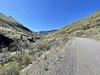
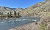
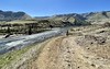
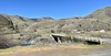
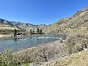
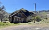
The above images may not be of the site on this page, but were taken nearby. They are loaded from Flickr so please click on them for image credits.
Click here to see more info for this site
Nearby sites
Click here to view sites on an interactive map of the areaKey: Red: member's photo, Blue: 3rd party photo, Yellow: other image, Green: no photo - please go there and take one, Grey: site destroyed
Download sites to:
KML (Google Earth)
GPX (GPS waypoints)
CSV (Garmin/Navman)
CSV (Excel)
To unlock full downloads you need to sign up as a Contributory Member. Otherwise downloads are limited to 50 sites.
Turn off the page maps and other distractions
Nearby sites listing. In the following links * = Image available
65.9km SSW 197° Snake River Archaeological Site* Rock Art
69.2km NW 314° Red Elk Rock Shelter* Rock Art
109.3km SSW 199° Hells Canyon Archeological District* Rock Art
216.4km W 280° Columbia Park* Ancient Village or Settlement
224.9km NNW 339° Indian Painted Rocks (Spokane) Rock Art
228.3km W 271° Matalam Ancient Village or Settlement
282.0km WNW 288° Whale Island Petroglyphs Rock Art
290.0km S 182° Celebration Park (Idaho)* Rock Art
298.4km N 353° Priest Lake Pictographs Rock Art
299.7km WNW 294° Vantage Petroglyphs* Rock Art
309.7km SSW 213° Stinkingwater Medicine Wheels* Stone Circle
339.8km NNE 19° Crystal Lakes Golf Course Stonehenge* Modern Stone Circle etc
342.6km W 268° Maryhill Stonehenge* Modern Stone Circle etc
343.0km NW 320° Balance Rock Omak* Natural Stone / Erratic / Other Natural Feature
345.4km SSE 151° Shoshone Ice Caves* Cave or Rock Shelter
349.4km ENE 77° Megaliths Of Helena* Natural Stone / Erratic / Other Natural Feature
352.3km SSE 153° Idaho's Mammoth Cave* Cave or Rock Shelter
366.3km W 267° Columbia Hills State Park* Rock Art
383.8km W 268° Lower Memaloose Island* Barrow Cemetery
388.0km SSE 153° Wilson Butte Cave Cave or Rock Shelter
410.6km ENE 63° First Peoples Buffalo Jump* Natural Stone / Erratic / Other Natural Feature
417.5km WSW 246° Redmond Lava Caves Cave or Rock Shelter
445.0km SSW 208° Catlow Cave Cave or Rock Shelter
451.9km SW 234° Cougar Mountain Cave Cave or Rock Shelter
452.7km SW 216° Petroglyph Lake Rock Art
View more nearby sites and additional images


 We would like to know more about this location. Please feel free to add a brief description and any relevant information in your own language.
 Wir möchten mehr über diese Stätte erfahren. Bitte zögern Sie nicht, eine kurze Beschreibung und relevante Informationen in Deutsch hinzuzufügen.
 Nous aimerions en savoir encore un peu sur les lieux. S'il vous plaît n'hesitez pas à ajouter une courte description et tous les renseignements pertinents dans votre propre langue.
 Quisieramos informarnos un poco más de las lugares. No dude en añadir una breve descripción y otros datos relevantes en su propio idioma.