

<< Text Pages >> Sacred Ridge - Ancient Village or Settlement in United States in The Southwest
Submitted by bat400 on Sunday, 12 December 2010 Page Views: 8974
Multi-periodSite Name: Sacred Ridge Alternative Name: 5lp245Country: United States
NOTE: This site is 29.353 km away from the location you searched for.
Region: The Southwest Type: Ancient Village or Settlement
Nearest Town: Durango, Co
Latitude: 37.224000N Longitude: 107.9407W
Condition:
| 5 | Perfect |
| 4 | Almost Perfect |
| 3 | Reasonable but with some damage |
| 2 | Ruined but still recognisable as an ancient site |
| 1 | Pretty much destroyed, possibly visible as crop marks |
| 0 | No data. |
| -1 | Completely destroyed |
| 5 | Superb |
| 4 | Good |
| 3 | Ordinary |
| 2 | Not Good |
| 1 | Awful |
| 0 | No data. |
| 5 | Can be driven to, probably with disabled access |
| 4 | Short walk on a footpath |
| 3 | Requiring a bit more of a walk |
| 2 | A long walk |
| 1 | In the middle of nowhere, a nightmare to find |
| 0 | No data. |
| 5 | co-ordinates taken by GPS or official recorded co-ordinates |
| 4 | co-ordinates scaled from a detailed map |
| 3 | co-ordinates scaled from a bad map |
| 2 | co-ordinates of the nearest village |
| 1 | co-ordinates of the nearest town |
| 0 | no data |
Be the first person to rate this site - see the 'Contribute!' box in the right hand menu.
Internal Links:
External Links:
Ancient Village in La Plata County.
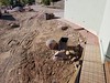
Situated overlooking what is now known as the Ridges Basin, this settlement had a least 22 pit houses and a stone building that may have been a tower of several stories. Around 800AD the settlement was wiped out in what appears to have been a single massed attack.
The site was excavated as part of the Animas-LaPlata water project. Once the water storage area has filled the Ridges Basin, Sacred Ridge will be left as an island. The location given is an assumption based on archaeological site description and FEMA floodplain graphics.
Note: “It was not an idyllic period where you hunt and kill a bunny, then sit around a campfire and sing ‘Kumbaya.’” See comment for article on the evidence for cannibalism as part of "ethnic cleansing".
You may be viewing yesterday's version of this page. To see the most up to date information please register for a free account.
Do not use the above information on other web sites or publications without permission of the contributor.
Nearby Images from Flickr
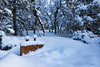
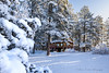
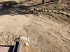
The above images may not be of the site on this page, but were taken nearby. They are loaded from Flickr so please click on them for image credits.
Click here to see more info for this site
Nearby sites
Click here to view sites on an interactive map of the areaKey: Red: member's photo, Blue: 3rd party photo, Yellow: other image, Green: no photo - please go there and take one, Grey: site destroyed
Download sites to:
KML (Google Earth)
GPX (GPS waypoints)
CSV (Garmin/Navman)
CSV (Excel)
To unlock full downloads you need to sign up as a Contributory Member. Otherwise downloads are limited to 50 sites.
Turn off the page maps and other distractions
Nearby sites listing. In the following links * = Image available
43.6km S 187° Aztec Ruins National Monument* Ancient Village or Settlement
46.0km W 261° Hemenway House Ancient Village or Settlement
46.9km W 262° Mesa Verde - Balcony House* Ancient Village or Settlement
47.6km W 262° Mesa Verde - Cliff Palace* Ancient Village or Settlement
47.8km W 261° House of Many Windows Ancient Village or Settlement
47.8km W 262° Mesa Verde - Sun Temple* Ancient Temple
48.0km W 262° Mesa Verde - Oak Tree House* Ancient Village or Settlement
48.1km W 262° Mesa Verde - Fire Temple* Ancient Village or Settlement
48.6km W 265° Mesa Verde - Spruce Tree House* Ancient Village or Settlement
48.6km W 264° Mesa Verde - Pithouses and Pueblos* Ancient Village or Settlement
49.1km W 264° Mesa Verde - Petroglyph Pt. Trail Cliff Dwelling * Ancient Village or Settlement
49.1km W 264° Mesa Verde - Petroglyph Point* Rock Art
49.2km W 265° Thomas House Ancient Village or Settlement
49.2km W 263° Mesa Verde - Square Tower House* Ancient Village or Settlement
49.8km W 274° Mesa Verde Ancient Village or Settlement
49.8km W 272° Mesa Verde - Pipe Shrine House* Ancient Village or Settlement
49.9km W 272° Mesa Verde - Far View House* Ancient Village or Settlement
49.9km W 272° Mesa Verde - Far View Tower* Ancient Temple
49.9km W 272° Mesa Verde - Megalithic House* Ancient Village or Settlement
50.0km W 272° Mesa Verde - Mummy Lake* Misc. Earthwork
50.1km W 264° Navajo Watchtower Promontory Fort / Cliff Castle
50.1km W 272° Mesa Verde - Coyote Village* Ancient Village or Settlement
51.1km SSE 151° Simon Canyon Ruins* Ancient Village or Settlement
52.5km W 265° Kodak House Ancient Village or Settlement
52.7km W 266° Badger House Community Ancient Village or Settlement
View more nearby sites and additional images


 We would like to know more about this location. Please feel free to add a brief description and any relevant information in your own language.
 Wir möchten mehr über diese Stätte erfahren. Bitte zögern Sie nicht, eine kurze Beschreibung und relevante Informationen in Deutsch hinzuzufügen.
 Nous aimerions en savoir encore un peu sur les lieux. S'il vous plaît n'hesitez pas à ajouter une courte description et tous les renseignements pertinents dans votre propre langue.
 Quisieramos informarnos un poco más de las lugares. No dude en añadir una breve descripción y otros datos relevantes en su propio idioma.