


<< Text Pages >> St Helen's Well (Stainland) - Holy Well or Sacred Spring in England in Yorkshire (West)
Submitted by Sunny100 on Monday, 05 September 2011 Page Views: 7772
Springs and Holy WellsSite Name: St Helen's Well (Stainland) Alternative Name: St Elyn's Well (Helen Hill Farm)Country: England
NOTE: This site is 3.175 km away from the location you searched for.
County: Yorkshire (West) Type: Holy Well or Sacred Spring
Nearest Town: Ripponden Nearest Village: Stainland
Map Ref: SE088188
Latitude: 53.665609N Longitude: 1.868295W
Condition:
| 5 | Perfect |
| 4 | Almost Perfect |
| 3 | Reasonable but with some damage |
| 2 | Ruined but still recognisable as an ancient site |
| 1 | Pretty much destroyed, possibly visible as crop marks |
| 0 | No data. |
| -1 | Completely destroyed |
| 5 | Superb |
| 4 | Good |
| 3 | Ordinary |
| 2 | Not Good |
| 1 | Awful |
| 0 | No data. |
| 5 | Can be driven to, probably with disabled access |
| 4 | Short walk on a footpath |
| 3 | Requiring a bit more of a walk |
| 2 | A long walk |
| 1 | In the middle of nowhere, a nightmare to find |
| 0 | No data. |
| 5 | co-ordinates taken by GPS or official recorded co-ordinates |
| 4 | co-ordinates scaled from a detailed map |
| 3 | co-ordinates scaled from a bad map |
| 2 | co-ordinates of the nearest village |
| 1 | co-ordinates of the nearest town |
| 0 | no data |
Internal Links:
External Links:
I have visited· I would like to visit
Northernchief would like to visit
The well is still there today. It is a rectangular stone structure with a large cistern containing three seperate compartments (basins) for the use of pilgrims. The water is still flowing into each basin with what has been described as "ever-flowing, copious amounts of cold and clear water as a curative for various ailments of the body" according to J.A.Heginbottom in his 'Transactions of the Halifax Antiquarian Society, 1989". The well was also mentioned in 'Source - The Holy Wells Journal (first series) issue no 3 by Tristan-Gray Hulse.
[Please note:- the well is on private land at Helen Hill Farm].
You may be viewing yesterday's version of this page. To see the most up to date information please register for a free account.
Do not use the above information on other web sites or publications without permission of the contributor.
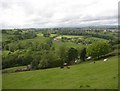
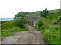
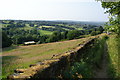
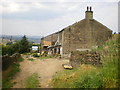
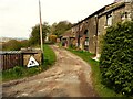
Nearby Images from Geograph Britain and Ireland:
©2006(licence)
©2006(licence)
©2013(licence)
©2009(licence)
©2022(licence)
The above images may not be of the site on this page, they are loaded from Geograph.
Please Submit an Image of this site or go out and take one for us!
Click here to see more info for this site
Nearby sites
Key: Red: member's photo, Blue: 3rd party photo, Yellow: other image, Green: no photo - please go there and take one, Grey: site destroyed
Download sites to:
KML (Google Earth)
GPX (GPS waypoints)
CSV (Garmin/Navman)
CSV (Excel)
To unlock full downloads you need to sign up as a Contributory Member. Otherwise downloads are limited to 50 sites.
Turn off the page maps and other distractions
Nearby sites listing. In the following links * = Image available
2.7km SSW 204° Whole Stone (Golcar) Natural Stone / Erratic / Other Natural Feature (SE077163)
2.8km SSW 206° Rocking Stone (Golcar) Natural Stone / Erratic / Other Natural Feature (SE076163)
4.0km WSW 251° Meg Dike Ancient Village or Settlement (SE04981749)
4.4km W 263° Ringstone Edge* Stone Circle (SE0443518251)
4.6km SE 134° Crosland Moor Holy Well* Holy Well or Sacred Spring (SE121156)
5.1km SSW 201° Slaithwaite Cross Ancient Cross (SE0714)
5.2km N 6° Shaw Hill (Skircoat) Cairn (SE09372401)
5.7km ENE 61° St Matthew (Rastrick)* Ancient Cross (SE1383121596)
6.8km N 0° Stannary (Halifax) Stone Circle (SE088256)
6.9km NNW 337° Warley Edge (Halifax)* Rock Art (SE061252)
8.0km NNW 335° Tower Hill (Warley) Cairn (SE05472604)
8.0km SE 126° Castle Hill (West Yorkshire)* Hillfort (SE153141)
8.2km SSW 207° Samuel Laycock's Monument (Marsden)* Carving (SE0512011485)
8.5km NW 312° Sowerby Lad (Mytholmroyd) Standing Stone (Menhir) (SE02442443)
8.7km WNW 281° Great Manshead Rock Art (SE0027420493)
8.7km S 180° Oldfield Hill (Meltham) Ancient Village or Settlement (SE0874510097)
8.7km NNE 30° Priestly Green Holy Well Holy Well or Sacred Spring (SE13202632)
8.9km NNW 336° Tower Hill Enclosure Misc. Earthwork (SE05192689)
9.2km W 260° Cat Stones* Round Barrow(s) (SD99741727)
9.3km SW 230° March Hill Mesolithic Camp Ancient Village or Settlement (SE0163612804)
9.5km WNW 294° Coffin stone, Cragg Vale* Marker Stone (SE001226)
9.5km S 189° Rocking Stone (Meltham Moor) Natural Stone / Erratic / Other Natural Feature (SE07280944)
9.6km WNW 292° Turley Holes* Standing Stones (SD99832236)
9.9km WNW 300° Upper Lumb Cup & Ring Stone Rock Art (SE002237)
10.0km WNW 292° Turley Holes Edge Standing Stones (SD99522261)
View more nearby sites and additional images


 We would like to know more about this location. Please feel free to add a brief description and any relevant information in your own language.
 Wir möchten mehr über diese Stätte erfahren. Bitte zögern Sie nicht, eine kurze Beschreibung und relevante Informationen in Deutsch hinzuzufügen.
 Nous aimerions en savoir encore un peu sur les lieux. S'il vous plaît n'hesitez pas à ajouter une courte description et tous les renseignements pertinents dans votre propre langue.
 Quisieramos informarnos un poco más de las lugares. No dude en añadir una breve descripción y otros datos relevantes en su propio idioma.