


<< Text Pages >> Kinder Scout II - Round Barrow(s) in England in Derbyshire
Submitted by boggart on Monday, 31 March 2014 Page Views: 2587
Neolithic and Bronze AgeSite Name: Kinder Scout IICountry: England
NOTE: This site is 0.189 km away from the location you searched for.
County: Derbyshire Type: Round Barrow(s)
Nearest Village: Hayfield
Map Ref: SK06728981
Latitude: 53.405068N Longitude: 1.900386W
Condition:
| 5 | Perfect |
| 4 | Almost Perfect |
| 3 | Reasonable but with some damage |
| 2 | Ruined but still recognisable as an ancient site |
| 1 | Pretty much destroyed, possibly visible as crop marks |
| 0 | No data. |
| -1 | Completely destroyed |
| 5 | Superb |
| 4 | Good |
| 3 | Ordinary |
| 2 | Not Good |
| 1 | Awful |
| 0 | No data. |
| 5 | Can be driven to, probably with disabled access |
| 4 | Short walk on a footpath |
| 3 | Requiring a bit more of a walk |
| 2 | A long walk |
| 1 | In the middle of nowhere, a nightmare to find |
| 0 | No data. |
| 5 | co-ordinates taken by GPS or official recorded co-ordinates |
| 4 | co-ordinates scaled from a detailed map |
| 3 | co-ordinates scaled from a bad map |
| 2 | co-ordinates of the nearest village |
| 1 | co-ordinates of the nearest town |
| 0 | no data |
Internal Links:
External Links:
Round Barrow in Derbyshire
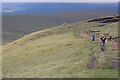
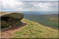
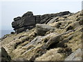
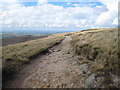
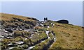
Situated on Kinder Scout close to Williams Clough and Mill Hill.
This is one of two burial mounds that is situated to the south east of Mill Hill, a prominent flat topped hill that forms part of Kinder Scout. The burial mound is on the western edge of the plateau and forms part of a complex of structures that includes the round barrows Kinder Scout I, Kinder Low End and the Druids Altar. It is probable that many more Neolithic and bronze structures exist on Kinder Scout that have been hidden by the accumulation of peat.
To my knowledge the barrow has not been excavated.
Mentioned in "The Burial Mounds of Derbyshire" by Barry M. Marsden
You may be viewing yesterday's version of this page. To see the most up to date information please register for a free account.
Do not use the above information on other web sites or publications without permission of the contributor.
Nearby Images from Geograph Britain and Ireland:
©2011(licence)
©2011(licence)
©2019(licence)
©2010(licence)
©2012(licence)
The above images may not be of the site on this page, they are loaded from Geograph.
Please Submit an Image of this site or go out and take one for us!
Click here to see more info for this site
Nearby sites
Key: Red: member's photo, Blue: 3rd party photo, Yellow: other image, Green: no photo - please go there and take one, Grey: site destroyed
Download sites to:
KML (Google Earth)
GPX (GPS waypoints)
CSV (Garmin/Navman)
CSV (Excel)
To unlock full downloads you need to sign up as a Contributory Member. Otherwise downloads are limited to 50 sites.
Turn off the page maps and other distractions
Nearby sites listing. In the following links * = Image available
211m S 186° Cairn on Kinder Scout Cairn (SK067896)
439m NW 319° Kinder Scout I Round Barrow(s) (SK06439014)
1.3km SSE 149° Mermaid's Pool* Holy Well or Sacred Spring (SK074887)
2.5km SSE 155° Cluther Rocks* Ancient Mine, Quarry or other Industry (SK078875)
2.9km SSW 207° Upper Dole Field Well* Holy Well or Sacred Spring (SK054872)
3.2km S 170° Kinderlow Bowl Barrow* Round Barrow(s) (SK073867)
3.2km SSW 202° Tunstead Clough* Ancient Village or Settlement (SK055868)
3.8km SSW 201° White Lady standing stone* Standing Stone (Menhir) (SK0534286250)
3.8km SSE 165° Edale Cross* Ancient Cross (SK0772586092)
3.9km SW 217° Whitworth Well* Holy Well or Sacred Spring (SK0437786691)
4.0km SSW 197° Fog Field Well* Holy Well or Sacred Spring (SK05578602)
4.1km SW 221° Watery Hey Well* Holy Well or Sacred Spring (SK0399986733)
4.2km SSW 197° Coldwell Clough Anglo Saxon cross Ancient Cross (SK055858)
4.5km NW 325° Carr House Lane standing stone Standing Stone (Menhir) (SK041935)
4.7km SE 124° Grindsbrook Clough, Edale* Rock Art (SK106872)
4.7km SSW 194° Mount Famine burial cist* Cist (SK056852)
5.1km WNW 294° Coombes Edge* Ring Cairn (SK0204591892)
5.9km W 276° Ringstones (new circle at Near Slack Farm)* Modern Stone Circle etc (SK0087290394)
6.1km W 280° Chisworth Cupmarked stone* Rock Art (SK007909)
6.1km W 268° Ringstones (Derbyshire)* Stone Circle (SK006896)
6.2km W 281° Robin Hood's Picking Rods* Ancient Cross (SK0060990941)
6.4km WNW 301° Hargate Hill* Standing Stone (Menhir) (SK01239315)
6.5km NNE 21° Kissing Stones* Natural Stone / Erratic / Other Natural Feature (SK091959)
6.9km NW 324° Mouselow Castle Hillfort (SK027954)
7.0km SSW 207° Chinley Churn Barrow Round Barrow(s) (SK035836)
View more nearby sites and additional images


 We would like to know more about this location. Please feel free to add a brief description and any relevant information in your own language.
 Wir möchten mehr über diese Stätte erfahren. Bitte zögern Sie nicht, eine kurze Beschreibung und relevante Informationen in Deutsch hinzuzufügen.
 Nous aimerions en savoir encore un peu sur les lieux. S'il vous plaît n'hesitez pas à ajouter une courte description et tous les renseignements pertinents dans votre propre langue.
 Quisieramos informarnos un poco más de las lugares. No dude en añadir una breve descripción y otros datos relevantes en su propio idioma.