


<< Text Pages >> Geretzine Fondo Cabaña - Ancient Village or Settlement in Spain in Navarra
Submitted by holger_rix on Sunday, 22 November 2015 Page Views: 905
Multi-periodSite Name: Geretzine Fondo CabañaCountry: Spain
NOTE: This site is 1.367 km away from the location you searched for.
Region: Navarra Type: Ancient Village or Settlement
Latitude: 43.189164N Longitude: 1.834293W
Condition:
| 5 | Perfect |
| 4 | Almost Perfect |
| 3 | Reasonable but with some damage |
| 2 | Ruined but still recognisable as an ancient site |
| 1 | Pretty much destroyed, possibly visible as crop marks |
| 0 | No data. |
| -1 | Completely destroyed |
| 5 | Superb |
| 4 | Good |
| 3 | Ordinary |
| 2 | Not Good |
| 1 | Awful |
| 0 | No data. |
| 5 | Can be driven to, probably with disabled access |
| 4 | Short walk on a footpath |
| 3 | Requiring a bit more of a walk |
| 2 | A long walk |
| 1 | In the middle of nowhere, a nightmare to find |
| 0 | No data. |
| 5 | co-ordinates taken by GPS or official recorded co-ordinates |
| 4 | co-ordinates scaled from a detailed map |
| 3 | co-ordinates scaled from a bad map |
| 2 | co-ordinates of the nearest village |
| 1 | co-ordinates of the nearest town |
| 0 | no data |
Be the first person to rate this site - see the 'Contribute!' box in the right hand menu.
Internal Links:
External Links:
Ancient Village or Settlement in Navarra
You may be viewing yesterday's version of this page. To see the most up to date information please register for a free account.
Do not use the above information on other web sites or publications without permission of the contributor.
Nearby Images from Flickr
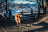
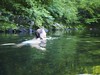
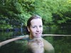
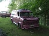
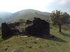
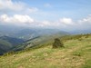
The above images may not be of the site on this page, but were taken nearby. They are loaded from Flickr so please click on them for image credits.
Click here to see more info for this site
Nearby sites
Click here to view sites on an interactive map of the areaKey: Red: member's photo, Blue: 3rd party photo, Yellow: other image, Green: no photo - please go there and take one, Grey: site destroyed
Download sites to:
KML (Google Earth)
GPX (GPS waypoints)
CSV (Garmin/Navman)
CSV (Excel)
To unlock full downloads you need to sign up as a Contributory Member. Otherwise downloads are limited to 50 sites.
Turn off the page maps and other distractions
Nearby sites listing. In the following links * = Image available
919m SSW 200° Espide Chromlech Stone Circle
1.4km N 4° Altuetako Lepoa (Aritzaundi) Túmulo Round Barrow(s)
1.4km N 4° Altuetako Lepoa Chromlech Stone Circle
1.5km NNE 30° Ueko Menhir Standing Stone (Menhir)
1.5km NNE 30° Ueko Cromlech Stone Circle
1.5km SSW 199° Gorosketattipi Cromlechs 1-4 Stone Circle
1.6km ENE 65° Satorborro Túmulo Round Barrow(s)
1.6km N 356° Deskantzuko Bizkarra Cromlechs 1-3 Stone Circle
1.6km ENE 65° Satorborro Chromlech Stone Circle
1.6km NNE 24° Altueta Cromlech Stone Circle
1.7km ENE 69° Meatzerta Chromlech Stone Circle
1.9km E 93° Lakueta Chromlechs 1+2 Stone Circle
1.9km SSE 161° Sorohaundi Cromlech Stone Circle
1.9km NNE 25° Unalbide Hego Chromlechs 1+2 Stone Circle
2.0km N 353° Gaztahotz Cromlech Stone Circle
2.0km ESE 107° Urrizti Cromlech Stone Circle
2.1km ESE 117° Arriurdineta Cromlechs 1-6 Stone Circle
2.1km ESE 117° Arriurdineta Túmulo Round Barrow(s)
2.1km NNE 25° Unalbide Erdi Cromlechs 1-5 Stone Circle
2.1km N 357° Unalbide Cromlech Stone Circle
2.2km SSE 158° Kapelogorri Fondo Cabaña Ancient Village or Settlement
2.2km NNE 25° Unalbide Ipar Cromlech Stone Circle
2.2km SSE 159° Kapelogorri Borda Fondo Cabaña Ancient Village or Settlement
2.3km NNW 345° Gaztarrozko Bizkarra Chromlechs 1-3 Stone Circle
2.4km NNE 17° Baltsa Túmulo Round Barrow(s)
View more nearby sites and additional images


 We would like to know more about this location. Please feel free to add a brief description and any relevant information in your own language.
 Wir möchten mehr über diese Stätte erfahren. Bitte zögern Sie nicht, eine kurze Beschreibung und relevante Informationen in Deutsch hinzuzufügen.
 Nous aimerions en savoir encore un peu sur les lieux. S'il vous plaît n'hesitez pas à ajouter une courte description et tous les renseignements pertinents dans votre propre langue.
 Quisieramos informarnos un poco más de las lugares. No dude en añadir una breve descripción y otros datos relevantes en su propio idioma.