


<< Our Photo Pages >> St Catherine's Hill (Christchurch) - Barrow Cemetery in England in Dorset
Submitted by Andy B on Saturday, 03 September 2011 Page Views: 10212
Neolithic and Bronze AgeSite Name: St Catherine's Hill (Christchurch)Country: England
NOTE: This site is 0.245 km away from the location you searched for.
County: Dorset Type: Barrow Cemetery
Nearest Town: Christchurch
Map Ref: SZ143955
Latitude: 50.758921N Longitude: 1.798628W
Condition:
| 5 | Perfect |
| 4 | Almost Perfect |
| 3 | Reasonable but with some damage |
| 2 | Ruined but still recognisable as an ancient site |
| 1 | Pretty much destroyed, possibly visible as crop marks |
| 0 | No data. |
| -1 | Completely destroyed |
| 5 | Superb |
| 4 | Good |
| 3 | Ordinary |
| 2 | Not Good |
| 1 | Awful |
| 0 | No data. |
| 5 | Can be driven to, probably with disabled access |
| 4 | Short walk on a footpath |
| 3 | Requiring a bit more of a walk |
| 2 | A long walk |
| 1 | In the middle of nowhere, a nightmare to find |
| 0 | No data. |
| 5 | co-ordinates taken by GPS or official recorded co-ordinates |
| 4 | co-ordinates scaled from a detailed map |
| 3 | co-ordinates scaled from a bad map |
| 2 | co-ordinates of the nearest village |
| 1 | co-ordinates of the nearest town |
| 0 | no data |
Internal Links:
External Links:
 (PID:81232)")
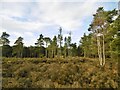
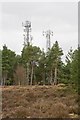
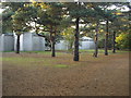
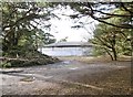
It is located to the north of Christchurch and is bordered by Town Common Nature Reserve and the Wessex Way (A338). The Hill is home to a large number of important wildlife species and is highly designated.
The site forms part of a larger area of sensitive heathland that is jointly managed for nature conservation by Christchurch Countryside Service, RSPB, Dorset Wildlife Trust and The Amphibian and Reptile Conservation Trust (ARC). Other parties involved include the Urban Heaths Partnership who provide supplementary wardens for the site. At 163ft (53 metres) above sea level.
Source: Dorset for you
Note: Walkaround St Catherine's Hill, Saturday 10th September and a fascinating tale of folklore and dragons: The Mystery Of St Catherine's Hill
You may be viewing yesterday's version of this page. To see the most up to date information please register for a free account.
Do not use the above information on other web sites or publications without permission of the contributor.
Nearby Images from Geograph Britain and Ireland:
©2015(licence)
©2008(licence)
©2013(licence)
©2006(licence)
©2015(licence)
The above images may not be of the site on this page, they are loaded from Geograph.
Please Submit an Image of this site or go out and take one for us!
Click here to see more info for this site
Nearby sites
Key: Red: member's photo, Blue: 3rd party photo, Yellow: other image, Green: no photo - please go there and take one, Grey: site destroyed
Download sites to:
KML (Google Earth)
GPX (GPS waypoints)
CSV (Garmin/Navman)
CSV (Excel)
To unlock full downloads you need to sign up as a Contributory Member. Otherwise downloads are limited to 50 sites.
Turn off the page maps and other distractions
Nearby sites listing. In the following links * = Image available
1.8km NW 322° Ramsdown Plantation / Sopley Common* Round Barrow(s) (SZ132969)
2.0km NE 47° St Michael's Well (Sopley)* Holy Well or Sacred Spring (SZ1573596865)
2.0km NNW 327° Sopley Common Tumulus* Round Barrow(s) (SZ132972)
2.8km WSW 252° Holdenhurst Long Barrow* Long Barrow (SZ116946)
3.3km SSE 152° The Red House Museum* Museum (SZ1588292577)
4.3km NNW 332° Hurn Forest Barrow* Round Barrow(s) (SZ123993)
5.0km SSE 153° Double Dykes Bowl Barrow* Round Barrow(s) (SZ16609102)
5.5km SSE 151° Warren Hill Round Barrow 2* Round Barrow(s) (SZ1704090688)
5.5km ESE 119° Friars Cliff Tumulus* Round Barrow(s) (SZ1917492825)
5.6km SSE 149° Warren Hill Bowl Barrow Round Barrow(s) (SZ17199069)
5.6km SSE 149° Warren Hill Round Barrow 1 Round Barrow(s) (SZ17269069)
5.9km SSE 146° Hengistbury Head* Promontory Fort / Cliff Castle (SZ176906)
6.6km WNW 300° Ralph's Barrow* Round Barrow(s) (SZ086988)
6.7km NNW 346° Barnsfield Heath (North)* Round Barrow(s) (SU127020)
6.8km NE 52° All Saints Well* Holy Well or Sacred Spring (SZ197997)
7.0km WSW 245° Robin Hood's Barrow (Bournemouth) Round Barrow(s) (SZ07939256)
7.0km WNW 290° Dudsbury Camp* Hillfort (SZ077979)
7.1km NW 318° Trickett's Cross Barrow* Round Barrow(s) (SU095007)
7.1km NE 41° Lugden Barrow* Round Barrow(s) (SU18920091)
7.1km WNW 296° Parley Barrow* Round Barrow(s) (SZ07909865)
7.7km W 273° Two Barrow Heath Barrow Cemetery (SZ0663495924)
7.7km WNW 293° Dudsbury Hill Tumuli* Round Barrow(s) (SZ072985)
7.9km WSW 249° Fern Barrow* Round Barrow(s) (SZ069926)
8.5km WNW 297° Ferndown Town Common* Round Barrow(s) (SZ067993)
8.6km W 263° Poole Timber Circle Timber Circle (SZ057944)
View more nearby sites and additional images


 We would like to know more about this location. Please feel free to add a brief description and any relevant information in your own language.
 Wir möchten mehr über diese Stätte erfahren. Bitte zögern Sie nicht, eine kurze Beschreibung und relevante Informationen in Deutsch hinzuzufügen.
 Nous aimerions en savoir encore un peu sur les lieux. S'il vous plaît n'hesitez pas à ajouter une courte description et tous les renseignements pertinents dans votre propre langue.
 Quisieramos informarnos un poco más de las lugares. No dude en añadir una breve descripción y otros datos relevantes en su propio idioma.