


<< Other Photo Pages >> The Red House Museum - Museum in England in Hampshire
Submitted by Andy B on Thursday, 22 May 2008 Page Views: 5473
MuseumsSite Name: The Red House MuseumCountry: England
NOTE: This site is 0.719 km away from the location you searched for.
County: Hampshire Type: Museum
Nearest Town: Christchurch
Map Ref: SZ1588292577
Latitude: 50.732595N Longitude: 1.776325W
Condition:
| 5 | Perfect |
| 4 | Almost Perfect |
| 3 | Reasonable but with some damage |
| 2 | Ruined but still recognisable as an ancient site |
| 1 | Pretty much destroyed, possibly visible as crop marks |
| 0 | No data. |
| -1 | Completely destroyed |
| 5 | Superb |
| 4 | Good |
| 3 | Ordinary |
| 2 | Not Good |
| 1 | Awful |
| 0 | No data. |
| 5 | Can be driven to, probably with disabled access |
| 4 | Short walk on a footpath |
| 3 | Requiring a bit more of a walk |
| 2 | A long walk |
| 1 | In the middle of nowhere, a nightmare to find |
| 0 | No data. |
| 5 | co-ordinates taken by GPS or official recorded co-ordinates |
| 4 | co-ordinates scaled from a detailed map |
| 3 | co-ordinates scaled from a bad map |
| 2 | co-ordinates of the nearest village |
| 1 | co-ordinates of the nearest town |
| 0 | no data |
Internal Links:
External Links:
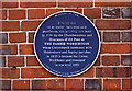
Museum in Hampshire. A Georgian building, built as a workhouse in 1764, now filled with a rich variety of displays and objects which reflect the social and natural history of the area, its geology and archaeology.
Address: Quay Road, Christchurch
Dorset BH23 1BU
Tel: 0845 603 5635
Opening Times: Tuesday to Friday 10am - 5pm; Saturday 10am - 4pm
Admission: Free
You may be viewing yesterday's version of this page. To see the most up to date information please register for a free account.
Do not use the above information on other web sites or publications without permission of the contributor.
davidmorgan has found this location on Google Street View:
Nearby Images from Geograph Britain and Ireland:
©2017(licence)
©2014(licence)
©2009(licence)
©2017(licence)
©2014(licence)
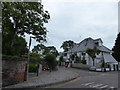
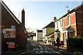
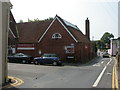
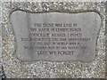
The above images may not be of the site on this page, they are loaded from Geograph.
Please Submit an Image of this site or go out and take one for us!
Click here to see more info for this site
Nearby sites
Key: Red: member's photo, Blue: 3rd party photo, Yellow: other image, Green: no photo - please go there and take one, Grey: site destroyed
Download sites to:
KML (Google Earth)
GPX (GPS waypoints)
CSV (Garmin/Navman)
CSV (Excel)
To unlock full downloads you need to sign up as a Contributory Member. Otherwise downloads are limited to 50 sites.
Turn off the page maps and other distractions
Nearby sites listing. In the following links * = Image available
1.7km SSE 155° Double Dykes Bowl Barrow* Round Barrow(s) (SZ16609102)
2.2km SSE 149° Warren Hill Round Barrow 2* Round Barrow(s) (SZ1704090688)
2.3km SE 146° Warren Hill Bowl Barrow Round Barrow(s) (SZ17199069)
2.3km SE 144° Warren Hill Round Barrow 1 Round Barrow(s) (SZ17269069)
2.6km SE 139° Hengistbury Head* Promontory Fort / Cliff Castle (SZ176906)
3.3km E 86° Friars Cliff Tumulus* Round Barrow(s) (SZ1917492825)
3.3km NNW 332° St Catherine's Hill (Christchurch)* Barrow Cemetery (SZ143955)
4.3km N 358° St Michael's Well (Sopley)* Holy Well or Sacred Spring (SZ1573596865)
4.7km WNW 296° Holdenhurst Long Barrow* Long Barrow (SZ116946)
5.1km NNW 328° Ramsdown Plantation / Sopley Common* Round Barrow(s) (SZ132969)
5.3km NNW 330° Sopley Common Tumulus* Round Barrow(s) (SZ132972)
7.6km NNW 332° Hurn Forest Barrow* Round Barrow(s) (SZ123993)
7.9km W 270° Robin Hood's Barrow (Bournemouth) Round Barrow(s) (SZ07939256)
8.1km NNE 28° All Saints Well* Holy Well or Sacred Spring (SZ197997)
8.9km NNE 20° Lugden Barrow* Round Barrow(s) (SU18920091)
9.0km W 270° Fern Barrow* Round Barrow(s) (SZ069926)
9.6km NW 311° Ralph's Barrow* Round Barrow(s) (SZ086988)
9.7km WNW 303° Dudsbury Camp* Hillfort (SZ077979)
9.8km WNW 290° Two Barrow Heath Barrow Cemetery (SZ0663495924)
9.9km NNW 342° Barnsfield Heath (North)* Round Barrow(s) (SU127020)
10.0km NW 308° Parley Barrow* Round Barrow(s) (SZ07909865)
10.3km W 280° Poole Timber Circle Timber Circle (SZ057944)
10.3km NW 322° Trickett's Cross Barrow* Round Barrow(s) (SU095007)
10.5km NW 305° Dudsbury Hill Tumuli* Round Barrow(s) (SZ072985)
10.9km W 268° Parkstone Standing Stone (Menhir) (SZ050922)
View more nearby sites and additional images


 We would like to know more about this location. Please feel free to add a brief description and any relevant information in your own language.
 Wir möchten mehr über diese Stätte erfahren. Bitte zögern Sie nicht, eine kurze Beschreibung und relevante Informationen in Deutsch hinzuzufügen.
 Nous aimerions en savoir encore un peu sur les lieux. S'il vous plaît n'hesitez pas à ajouter une courte description et tous les renseignements pertinents dans votre propre langue.
 Quisieramos informarnos un poco más de las lugares. No dude en añadir una breve descripción y otros datos relevantes en su propio idioma.