


<< Our Photo Pages >> Friars Cliff Tumulus - Round Barrow(s) in England in Dorset
Submitted by MarkEdwards on Thursday, 07 April 2022 Page Views: 546
Neolithic and Bronze AgeSite Name: Friars Cliff TumulusCountry: England
NOTE: This site is 1.196 km away from the location you searched for.
County: Dorset Type: Round Barrow(s)
Nearest Town: Christchurch Nearest Village: Friars Cliff
Map Ref: SZ1917492825
Latitude: 50.734726N Longitude: 1.729667W
Condition:
| 5 | Perfect |
| 4 | Almost Perfect |
| 3 | Reasonable but with some damage |
| 2 | Ruined but still recognisable as an ancient site |
| 1 | Pretty much destroyed, possibly visible as crop marks |
| 0 | No data. |
| -1 | Completely destroyed |
| 5 | Superb |
| 4 | Good |
| 3 | Ordinary |
| 2 | Not Good |
| 1 | Awful |
| 0 | No data. |
| 5 | Can be driven to, probably with disabled access |
| 4 | Short walk on a footpath |
| 3 | Requiring a bit more of a walk |
| 2 | A long walk |
| 1 | In the middle of nowhere, a nightmare to find |
| 0 | No data. |
| 5 | co-ordinates taken by GPS or official recorded co-ordinates |
| 4 | co-ordinates scaled from a detailed map |
| 3 | co-ordinates scaled from a bad map |
| 2 | co-ordinates of the nearest village |
| 1 | co-ordinates of the nearest town |
| 0 | no data |
Internal Links:
External Links:
")
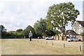
This unexcavated tumulus is approximately 15 metres diameter, and stands with a maximum height of 60cm. The height is obviously extremely denuded, and is presently covered with low lying shrubbery, and a few trees.
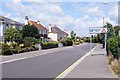
Access is very easy, and parking is available right next to the site.
This is one of the most exclusive locations in the country, and so, it is fortunate that the tumulus has survived at all, because the land it sits on must be worth a small fortune. Many "rich and famous" live close by.
The surrounding land is flat, and the tumulus is located around 100 metres from the coast of The English Channel. Without the surounding building, the sea would be observable from the tumulus.
There is an important Saxon settlement 2km to the west at Christchurch. And also 2km SSW at Hengistbury Head. Both being important Saxon sea ports. There is also the sacred Saxon site of St Catherines Hill 5km to the NW.
However, there is also a lot of evidence for Bronze and Iron Age activity in the area. There have been no finds associated with the tumulus that would suggest how old the site is.
There is also no nearby settlements identified that suggests association to the tumulus.
The site sits on public land, so is accessible for a good immersive experience.
You may be viewing yesterday's version of this page. To see the most up to date information please register for a free account.
")
")
Do not use the above information on other web sites or publications without permission of the contributor.
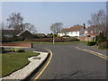
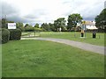
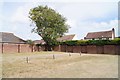
Nearby Images from Geograph Britain and Ireland:
©2009(licence)
©2007(licence)
©2015(licence)
©2015(licence)
©2015(licence)
The above images may not be of the site on this page, they are loaded from Geograph.
Please Submit an Image of this site or go out and take one for us!
Click here to see more info for this site
Nearby sites
Key: Red: member's photo, Blue: 3rd party photo, Yellow: other image, Green: no photo - please go there and take one, Grey: site destroyed
Download sites to:
KML (Google Earth)
GPX (GPS waypoints)
CSV (Garmin/Navman)
CSV (Excel)
To unlock full downloads you need to sign up as a Contributory Member. Otherwise downloads are limited to 50 sites.
Turn off the page maps and other distractions
Nearby sites listing. In the following links * = Image available
2.7km SW 215° Hengistbury Head* Promontory Fort / Cliff Castle (SZ176906)
2.9km SW 222° Warren Hill Round Barrow 1 Round Barrow(s) (SZ17269069)
2.9km SW 223° Warren Hill Bowl Barrow Round Barrow(s) (SZ17199069)
3.0km SW 225° Warren Hill Round Barrow 2* Round Barrow(s) (SZ1704090688)
3.1km SW 235° Double Dykes Bowl Barrow* Round Barrow(s) (SZ16609102)
3.3km W 266° The Red House Museum* Museum (SZ1588292577)
5.3km NW 320° St Michael's Well (Sopley)* Holy Well or Sacred Spring (SZ1573596865)
5.5km WNW 299° St Catherine's Hill (Christchurch)* Barrow Cemetery (SZ143955)
6.9km N 5° All Saints Well* Holy Well or Sacred Spring (SZ197997)
7.2km NW 305° Ramsdown Plantation / Sopley Common* Round Barrow(s) (SZ132969)
7.4km NW 306° Sopley Common Tumulus* Round Barrow(s) (SZ132972)
7.8km WNW 283° Holdenhurst Long Barrow* Long Barrow (SZ116946)
8.1km N 358° Lugden Barrow* Round Barrow(s) (SU18920091)
9.4km NW 314° Hurn Forest Barrow* Round Barrow(s) (SZ123993)
10.8km NNE 24° Clay Hill tumuli* Round Barrow(s) (SU235027)
10.9km N 359° Strodgemoor Barrow* Round Barrow(s) (SU18910371)
11.1km NE 51° Longslade View tumulus* Round Barrow(s) (SZ278998)
11.1km N 4° Castle Hill (Hampshire)* Hillfort (SU199039)
11.2km N 356° Knaves Ash barrow* Round Barrow(s) (SU18430396)
11.2km W 269° Robin Hood's Barrow (Bournemouth) Round Barrow(s) (SZ07939256)
11.2km NW 325° Barnsfield Heath (North)* Round Barrow(s) (SU127020)
11.4km N 7° St Mary's Well (Hampshire)* Holy Well or Sacred Spring (SU2056304175)
11.8km ENE 61° Shirley Holms* Round Barrow(s) (SZ295985)
12.0km N 11° Collins Grave Round Barrow(s) (SU21350461)
12.1km WNW 300° Ralph's Barrow* Round Barrow(s) (SZ086988)
View more nearby sites and additional images


 We would like to know more about this location. Please feel free to add a brief description and any relevant information in your own language.
 Wir möchten mehr über diese Stätte erfahren. Bitte zögern Sie nicht, eine kurze Beschreibung und relevante Informationen in Deutsch hinzuzufügen.
 Nous aimerions en savoir encore un peu sur les lieux. S'il vous plaît n'hesitez pas à ajouter une courte description et tous les renseignements pertinents dans votre propre langue.
 Quisieramos informarnos un poco más de las lugares. No dude en añadir una breve descripción y otros datos relevantes en su propio idioma.