


<< Our Photo Pages >> Summerhill Cists - Cist in England in Tyne and Wear
Submitted by durhamnature on Thursday, 02 August 2012 Page Views: 11250
Neolithic and Bronze AgeSite Name: Summerhill Cists Alternative Name: Image Hill, Summerhouse HillCountry: England
NOTE: This site is 1.37 km away from the location you searched for.
County: Tyne and Wear Type: Cist
Nearest Town: Blaydon Nearest Village: Pathhead
Map Ref: NZ176634
Latitude: 54.964921N Longitude: 1.726644W
Condition:
| 5 | Perfect |
| 4 | Almost Perfect |
| 3 | Reasonable but with some damage |
| 2 | Ruined but still recognisable as an ancient site |
| 1 | Pretty much destroyed, possibly visible as crop marks |
| 0 | No data. |
| -1 | Completely destroyed |
| 5 | Superb |
| 4 | Good |
| 3 | Ordinary |
| 2 | Not Good |
| 1 | Awful |
| 0 | No data. |
| 5 | Can be driven to, probably with disabled access |
| 4 | Short walk on a footpath |
| 3 | Requiring a bit more of a walk |
| 2 | A long walk |
| 1 | In the middle of nowhere, a nightmare to find |
| 0 | No data. |
| 5 | co-ordinates taken by GPS or official recorded co-ordinates |
| 4 | co-ordinates scaled from a detailed map |
| 3 | co-ordinates scaled from a bad map |
| 2 | co-ordinates of the nearest village |
| 1 | co-ordinates of the nearest town |
| 0 | no data |
Internal Links:
External Links:
I have visited· I would like to visit
Modern-Neolithic visited - their rating: Cond: 4 Amb: 3 Access: 5
")
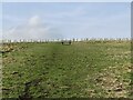
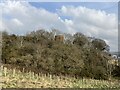
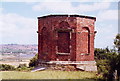
It has continued to be an attractive viewpoint in more recent times. As part of the Stella Hall estate, it gained an alternative name of Image Hill because of statues of Apollo and Aesculapius being (formerly) placed here. A nineteenth century folly, The Summerhouse, has recently been renovated by Gateshead Council. A statue of Giuseppe Garibaldi was destroyed by politically motivated vandals around 1900, but its head has been preserved in Blaydon library. The Summerhill is now a popular place for a walk or picnic.
The six cists are a close group of five and an outlier. The sites of numbers 2, 3 and 4 have probably been disrupted or destroyed by the modern A695 road. The whereabouts of only a few of the cist stones, grave goods and human remains are known.
Cist 1
The first was found by some boys in May 1930, at the top of the Summerhill. It contained the remains of a man and a woman, with a beaker and a knife. These are on display in the Great North Museum, formerly the Hancock Museum. (see photo)
Cist 2
On 5th of August 1937, the second cist was found at NZ17506339, in a sand pit a few metres south of the hill top. It was excavated by G W Temperley of the Hancock Museum, with Miss G M Scott of the Hancock, and Mr W Bulmer of Corbridge Museum. They dated it at 1500 BC. It was found 50 cms below ground, and constructed of four 75mm thick sandstone slabs to form a cavity 90 cms x 65 cms x 53 cms deep. The cover stone (or stones) was badly broken. It contained a single skeleton in a contracted position with the head at the northern end. Behind the skull of a skeleton, there was a flint knife of dark blue-grey flint some 50 mm long by 25 mm wide. The knife may now be in the Sunderland Museum.
Cist 3
On 11th November 1938 the third cist was found very close by at NZ17486340. It was excavated by T R Goddard of the Hancock Museum. It was constructed of four sandstone slabs which formed a rectangular space 60 cms x 100 cms x 67 cms deep, floored by thin irregular sand stone slabs and topped by a broken cover stone. There were the remains of one person, with fragments of charcoal and burnt bone. A broken food vessel, light buff with a dark grey core, was 150 mm high, 166 mm diameter at the rim, and 68 mm diameter at the base, and had a whipcord rim, alternating groups of horizontal and vertical lines of whipcord on the neck and shoulder, and vertical lines below this.
Cist 4
Shortly afterwards, the fourth cist was found at NZ17476340. It was a similar burial close to cist numbers 2 and 3. This well-constructed cist had internal dimensions of 105 cms x 60 cms x 45cms deep, with particularly large and thick side stones and a cover stone 165 cms x 90 cms x 10 cms thick. The joints between the stones were packed with small stones or clay, and the floor of the cist consisted of 3 slabs of sandstone, 25 mm thick, carefully fitted together. The cist contained a contracted skeleton and a pottery vessel upon sand and pebbles, plus some fragments of charcoal and burnt bone. The pottery vessel was a beaker measuring 184 mm in height with a rim diameter of 153 mm. The neck was decorated with five notched-wheel horizontal grooves, and the rest of the body, below a zigzag line, had comb-impressed horizontal bands, chevrons, cross-hatching, herringbone and zigzag. It was probably placed in the Museum of Antiquities and later moved to the Great North Museum.
Cist 5
On 13th November 1939 the fifth cist was found at NZ175634. It was recorded as being empty by a local historian, Mr Cocks, and moved to his garden, at Lilac Cottage, Barmoor, Ryton. The location of this find, though poorly recorded, may have been just north of the line of the modern A 695 road.
Cist 6
Found only two days after cist 5, but at an outlying location 500 metres to the south west. The site is now under the premises of the Newcastle Oil Company. It was excavated by G W Temperley of the Hancock Museum, and contained a single burial, a pottery vessel and a flint flake. The underside of its capstone bore an incised U-shaped groove about 50 mm wide and set about 75mm from the edge of the stone.
The cist was displayed in the grounds of the Ryton Urban District Council offices, and possibly moved to the Museum of Antiquities, Newcastle, on the 5th June 1972.
The food vessel was described as in pink buff fabric, 210 mm high, and with the diameter of the rim 180 mm, base 90 mm. It had a bulbous body with a carination and concave neck but no collar. The neck and body were decorated with scored cross-hatching, the rim with whipped cord. Its present location is unknown.
This account is compiled from a variety of sources.
You may be viewing yesterday's version of this page. To see the most up to date information please register for a free account.
Do not use the above information on other web sites or publications without permission of the contributor.
Nearby Images from Geograph Britain and Ireland:
©2024(licence)
©2012(licence)
©2024(licence)
©2012(licence)
©2005(licence)
The above images may not be of the site on this page, they are loaded from Geograph.
Please Submit an Image of this site or go out and take one for us!
Click here to see more info for this site
Nearby sites
Key: Red: member's photo, Blue: 3rd party photo, Yellow: other image, Green: no photo - please go there and take one, Grey: site destroyed
Download sites to:
KML (Google Earth)
GPX (GPS waypoints)
CSV (Garmin/Navman)
CSV (Excel)
To unlock full downloads you need to sign up as a Contributory Member. Otherwise downloads are limited to 50 sites.
Turn off the page maps and other distractions
Nearby sites listing. In the following links * = Image available
892m WNW 297° Stella enclosure Ancient Village or Settlement (NZ168638)
2.2km SE 134° Axwell Park Barrow* Round Barrow(s) (NZ19196188)
2.8km SE 145° Dam Head enclosure Ancient Village or Settlement (NZ192611)
2.8km WNW 301° Ryton Motte or Tumulus* Artificial Mound (NZ15176483)
2.8km W 272° The Ryton Stone Rock Art (NZ1475063500)
2.9km WNW 286° Ryton 1 Rock Art (NZ1480064170)
2.9km SSE 163° Copers Wood earthwork, Winlaton Mill* Ancient Village or Settlement (NZ18456061)
3.1km W 272° Ryton 2 Rock Art (NZ1450063500)
3.2km WSW 238° Holy Well, Greenside* Holy Well or Sacred Spring (NZ14936170)
3.6km SSE 162° Hollinside Farm 1 Rock Art (NZ1875260003)
3.6km WNW 291° Ryton 3 Rock Art (NZ1420064700)
4.3km NW 320° Throckley Bank Portable Rock Art (NZ1482066670)
4.3km NW 320° Throckley Bank Top Rock Art (NZ1482866677)
4.4km S 181° Lady Well, Gibside* Holy Well or Sacred Spring (NZ17575895)
4.6km S 181° Gibside Mound* Artificial Mound (NZ17515877)
4.7km WSW 256° White Well, Greenside* Holy Well or Sacred Spring (NZ13036222)
4.7km WNW 285° Simmery Hill Cist, Clara Vale* Cist (NZ13026462)
4.9km NNW 341° Dewley Burn Artificial Mound (NZ1601868016)
4.9km SE 131° Marshall Lands enclosure Ancient Village or Settlement (NZ213602)
4.9km E 84° Elswick Road Cist Cist (NZ225639)
5.1km W 268° Bradley Hall Dene Barrow Round Barrow(s) (NZ12536317)
5.3km NW 312° Hadrian's Wall (Heddon on the Wall)* Misc. Earthwork (NZ13616693)
5.4km W 269° Bradley Hall Ice House Barrow Round Barrow(s) (NZ12236333)
5.5km NW 310° St Andrew's Church (Heddon on the Wall)* Ancient Cross (NZ1338666892)
5.6km NNW 345° Callerton Lane End cropmark Ancient Village or Settlement (NZ16106875)
View more nearby sites and additional images


 We would like to know more about this location. Please feel free to add a brief description and any relevant information in your own language.
 Wir möchten mehr über diese Stätte erfahren. Bitte zögern Sie nicht, eine kurze Beschreibung und relevante Informationen in Deutsch hinzuzufügen.
 Nous aimerions en savoir encore un peu sur les lieux. S'il vous plaît n'hesitez pas à ajouter une courte description et tous les renseignements pertinents dans votre propre langue.
 Quisieramos informarnos un poco más de las lugares. No dude en añadir una breve descripción y otros datos relevantes en su propio idioma.