

<< Our Photo Pages >> Meon Hill - Hillfort in England in Warwickshire
Submitted by vicky on Thursday, 26 February 2004 Page Views: 26448
Iron Age and Later PrehistorySite Name: Meon HillCountry: England
NOTE: This site is 4.135 km away from the location you searched for.
County: Warwickshire Type: Hillfort
Map Ref: SP177454 Landranger Map Number: 151
Latitude: 52.106651N Longitude: 1.74298W
Condition:
| 5 | Perfect |
| 4 | Almost Perfect |
| 3 | Reasonable but with some damage |
| 2 | Ruined but still recognisable as an ancient site |
| 1 | Pretty much destroyed, possibly visible as crop marks |
| 0 | No data. |
| -1 | Completely destroyed |
| 5 | Superb |
| 4 | Good |
| 3 | Ordinary |
| 2 | Not Good |
| 1 | Awful |
| 0 | No data. |
| 5 | Can be driven to, probably with disabled access |
| 4 | Short walk on a footpath |
| 3 | Requiring a bit more of a walk |
| 2 | A long walk |
| 1 | In the middle of nowhere, a nightmare to find |
| 0 | No data. |
| 5 | co-ordinates taken by GPS or official recorded co-ordinates |
| 4 | co-ordinates scaled from a detailed map |
| 3 | co-ordinates scaled from a bad map |
| 2 | co-ordinates of the nearest village |
| 1 | co-ordinates of the nearest town |
| 0 | no data |
Internal Links:
External Links:
I have visited· I would like to visit
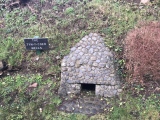
poho visited on 29th Jan 2023 - their rating: Cond: 2 Amb: 4 Access: 2 A climb up a very steep hill to the top is rewarded with suberb views, and the atmosphere was very spooky. Maybe I should have paid less attention to the stories of ghosts, murders and the devil that I read before setting off on this walk! Note that there is no official public access so go lightly and leave only footprints.
")
Have you visited this site? Please add a comment below.
You may be viewing yesterday's version of this page. To see the most up to date information please register for a free account.
")
")
")
")
")
")
")
")
Do not use the above information on other web sites or publications without permission of the contributor.
Click here to see more info for this site
Nearby sites
Key: Red: member's photo, Blue: 3rd party photo, Yellow: other image, Green: no photo - please go there and take one, Grey: site destroyed
Download sites to:
KML (Google Earth)
GPX (GPS waypoints)
CSV (Garmin/Navman)
CSV (Excel)
To unlock full downloads you need to sign up as a Contributory Member. Otherwise downloads are limited to 50 sites.
Turn off the page maps and other distractions
Nearby sites listing. In the following links * = Image available
7.7km SSW 213° Kiftsgate Stone* Holed Stone (SP13503898)
9.2km SW 220° Willersey* Chambered Tomb (SP118383)
10.6km SW 214° The Harford Member* Natural Stone / Erratic / Other Natural Feature (SP118366)
11.1km ENE 65° Ettington Cursus Cursus (SP277502)
11.2km ENE 64° Ettington Cursus Cursus (SP277504)
12.5km W 281° Norton and Lenchwick Cursus* Cursus (SP054477)
12.7km SSE 168° Batsford Camp* Ancient Village or Settlement (SP2038932974)
12.8km N 354° Mary Arden's Well* Holy Well or Sacred Spring (SP164581)
13.0km S 184° Bourton on the Hill* Chambered Tomb (SP168324)
13.5km NNE 34° Hampton Lucy B Timber Circle (SP252567)
13.6km NNE 33° Hampton Lucy A Timber Circle (SP251568)
14.2km NE 40° Charlecote B Cursus Cursus (SP268563)
14.3km NE 39° Charlecote B Cursus Cursus (SP268565)
14.8km SW 215° Snowshill* Round Barrow(s) (SP09153335)
15.4km SW 219° Shenberrow Hillfort* Hillfort (SP08043344)
15.5km NE 36° Charlecote A Cursus Cursus (SP26895795)
15.8km NE 34° Wasperton Timber Circle (SP265585)
16.5km S 181° Ganborough* Chambered Tomb (SP174289)
17.0km SSW 195° Oak Piece Chambered Tomb (SP134289)
17.2km S 188° Condicote henge* Henge (SP15392837)
17.2km SSW 209° Cutsdean Henge (SP09263038)
17.3km S 189° Cross Well (Condicote)* Holy Well or Sacred Spring (SP15122827)
17.6km W 269° St Michael (Cropthorne)* Ancient Cross (SP00014512)
17.7km E 92° Red Horse of Tysoe Hill Figure or Geoglyph (SP3539844833)
18.1km SW 215° Stanway Bowl Barrows* Round Barrow(s) (SP07413044)
View more nearby sites and additional images


 We would like to know more about this location. Please feel free to add a brief description and any relevant information in your own language.
 Wir möchten mehr über diese Stätte erfahren. Bitte zögern Sie nicht, eine kurze Beschreibung und relevante Informationen in Deutsch hinzuzufügen.
 Nous aimerions en savoir encore un peu sur les lieux. S'il vous plaît n'hesitez pas à ajouter une courte description et tous les renseignements pertinents dans votre propre langue.
 Quisieramos informarnos un poco más de las lugares. No dude en añadir una breve descripción y otros datos relevantes en su propio idioma.