


<< Text Pages >> Rocher de Boulic - Rock Art in France in Bretagne:Ille-et-Vilaine (35)
Submitted by holger_rix on Wednesday, 06 April 2016 Page Views: 993
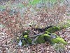
Rock ArtSite Name: Rocher de BoulicCountry: France
NOTE: This site is 5.248 km away from the location you searched for.
Département: Bretagne:Ille-et-Vilaine (35) Type: Rock Art
Nearest Town: Dol-de-Bretagne Nearest Village: Trans-la-Forêt
Latitude: 48.484796N Longitude: 1.581002W
Condition:
| 5 | Perfect |
| 4 | Almost Perfect |
| 3 | Reasonable but with some damage |
| 2 | Ruined but still recognisable as an ancient site |
| 1 | Pretty much destroyed, possibly visible as crop marks |
| 0 | No data. |
| -1 | Completely destroyed |
| 5 | Superb |
| 4 | Good |
| 3 | Ordinary |
| 2 | Not Good |
| 1 | Awful |
| 0 | No data. |
| 5 | Can be driven to, probably with disabled access |
| 4 | Short walk on a footpath |
| 3 | Requiring a bit more of a walk |
| 2 | A long walk |
| 1 | In the middle of nowhere, a nightmare to find |
| 0 | No data. |
| 5 | co-ordinates taken by GPS or official recorded co-ordinates |
| 4 | co-ordinates scaled from a detailed map |
| 3 | co-ordinates scaled from a bad map |
| 2 | co-ordinates of the nearest village |
| 1 | co-ordinates of the nearest town |
| 0 | no data |
Be the first person to rate this site - see the 'Contribute!' box in the right hand menu.
Internal Links:
External Links:
Rock Art in Bretagne:Ille-et-Vilaine (35)
Trans-la-Forêt, Dol-de-Bretagne, Ille-et-Vilaine, Brittany
Source: T4T35.fr
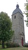
Picture:
topic-topos.com
You may be viewing yesterday's version of this page. To see the most up to date information please register for a free account.
Do not use the above information on other web sites or publications without permission of the contributor.
Nearby Images from Flickr

The above images may not be of the site on this page, but were taken nearby. They are loaded from Flickr so please click on them for image credits.
Click here to see more info for this site
Nearby sites
Click here to view sites on an interactive map of the areaKey: Red: member's photo, Blue: 3rd party photo, Yellow: other image, Green: no photo - please go there and take one, Grey: site destroyed
Download sites to:
KML (Google Earth)
GPX (GPS waypoints)
CSV (Garmin/Navman)
CSV (Excel)
To unlock full downloads you need to sign up as a Contributory Member. Otherwise downloads are limited to 50 sites.
Turn off the page maps and other distractions
Nearby sites listing. In the following links * = Image available
781m N 4° Allée Couverte de Pont-Perrin* Passage Grave
2.1km ENE 69° Maucrais menhir Standing Stone (Menhir)
3.1km ENE 64° Menhir de la Pierre Fichée (La Pinelais)* Standing Stone (Menhir)
3.3km ESE 103° La Barre Canto Standing Stone (Menhir)
5.2km ENE 65° Menhir La Roche du Diable (Sougéal)* Standing Stone (Menhir)
6.6km SSW 195° Pierre Longue (Noyal-sous-Bazouges)* Standing Stone (Menhir)
7.0km NE 35° Roche Buquet* Standing Stone (Menhir)
9.8km SW 223° Pierre Longue de Saint-Jouan* Standing Stone (Menhir)
10.4km WSW 243° Menhir des Douères* Standing Stone (Menhir)
11.0km NNW 342° Menhir du Perron Standing Stone (Menhir)
11.9km NNW 343° La Roche Longue (St-Marcan)* Standing Stone (Menhir)
12.6km NW 322° Outre Tombes* Stone Circle
12.7km SW 228° Allée Couverte de Chevrot Passage Grave
12.9km WNW 296° Champ Dolent Menhir* Standing Stone (Menhir)
13.7km E 94° Cromlech de Blanche Lande Stone Circle
16.6km WSW 259° Bourgneuf menhir Standing Stone (Menhir)
16.8km NW 305° Mont-Dol* Ancient Temple
17.4km W 279° Menhir dit la Pierre du Domaine* Standing Stone (Menhir)
17.6km NNE 17° Mont St Michel* Ancient Village or Settlement
20.0km WSW 247° Menhir du Grand-Herbage Standing Stone (Menhir)
20.1km ENE 74° St-Benoit polissoir* Polissoir
21.8km W 270° La Maison des Feins* Passage Grave
23.2km SSE 166° Alignement dit L'Escalier du Juge Standing Stones
24.0km SSE 163° Les Roches Piquées* Standing Stones
24.6km SSE 160° Menhir de la Forêt de Haute-Sève 1* Standing Stone (Menhir)
View more nearby sites and additional images


 We would like to know more about this location. Please feel free to add a brief description and any relevant information in your own language.
 Wir möchten mehr über diese Stätte erfahren. Bitte zögern Sie nicht, eine kurze Beschreibung und relevante Informationen in Deutsch hinzuzufügen.
 Nous aimerions en savoir encore un peu sur les lieux. S'il vous plaît n'hesitez pas à ajouter une courte description et tous les renseignements pertinents dans votre propre langue.
 Quisieramos informarnos un poco más de las lugares. No dude en añadir una breve descripción y otros datos relevantes en su propio idioma.