 with our Megalithic Portal iPhone app")

<< Text Pages >> Hazlerigg cropmark (North) - Ancient Village or Settlement in England in Tyne and Wear
Submitted by durhamnature on Wednesday, 12 September 2012 Page Views: 2404
Multi-periodSite Name: Hazlerigg cropmark (North) Alternative Name: Hazlerigg Number 1Country: England County: Tyne and Wear Type: Ancient Village or Settlement
Nearest Town: Newcastle
Map Ref: NZ23467172
Latitude: 55.039444N Longitude: 1.634442W
Condition:
| 5 | Perfect |
| 4 | Almost Perfect |
| 3 | Reasonable but with some damage |
| 2 | Ruined but still recognisable as an ancient site |
| 1 | Pretty much destroyed, possibly visible as crop marks |
| 0 | No data. |
| -1 | Completely destroyed |
| 5 | Superb |
| 4 | Good |
| 3 | Ordinary |
| 2 | Not Good |
| 1 | Awful |
| 0 | No data. |
| 5 | Can be driven to, probably with disabled access |
| 4 | Short walk on a footpath |
| 3 | Requiring a bit more of a walk |
| 2 | A long walk |
| 1 | In the middle of nowhere, a nightmare to find |
| 0 | No data. |
| 5 | co-ordinates taken by GPS or official recorded co-ordinates |
| 4 | co-ordinates scaled from a detailed map |
| 3 | co-ordinates scaled from a bad map |
| 2 | co-ordinates of the nearest village |
| 1 | co-ordinates of the nearest town |
| 0 | no data |
Internal Links:
External Links:
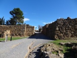
Ancient Village or Settlement in Tyne and Wear
Tyne and Wear HER 174, Scheduled Monument. Photo in Miket, page 121.
Late Iron Age or Romano-British settlement.
A rectilinear double-ditched enclosure visible on aerial photographs, 75 m square with the inner ditch 10 metres inside this. There are circular features, possibly hut circles or perhaps modern traces of coal mining. A single entrance is visible in the crop mark. Further settlement remains including hut circles, lie outside the enclosure. The site has been investigated by geophysical survey and anomalies interpreted as the remains of two hut circles lie in close proximity to the enclosure. The first, immediately to the north of the northern side of the enclosure, measures 16 metres in diameter. The second, 30 m to the south east of the south-eastern corner of the enclosure, measures 14 m in diameter.
You may be viewing yesterday's version of this page. To see the most up to date information please register for a free account.
Do not use the above information on other web sites or publications without permission of the contributor.
Nearby Images from Geograph Britain and Ireland:
©2020(licence)
©2017(licence)
©2017(licence)
©2017(licence)

©2020(licence)
The above images may not be of the site on this page, they are loaded from Geograph.
Please Submit an Image of this site or go out and take one for us!
Click here to see more info for this site
Nearby sites
Key: Red: member's photo, Blue: 3rd party photo, Yellow: other image, Green: no photo - please go there and take one, Grey: site destroyed
Download sites to:
KML (Google Earth)
GPX (GPS waypoints)
CSV (Garmin/Navman)
CSV (Excel)
To unlock full downloads you need to sign up as a Contributory Member. Otherwise downloads are limited to 50 sites.
Turn off the page maps and other distractions
Nearby sites listing. In the following links * = Image available
349m SSW 204° Hazlerigg cropmark (South) Ancient Village or Settlement (NZ23327140)
3.5km NW 315° Gardener's house crop mark, Dinnington Ancient Village or Settlement (NZ20977420)
5.5km N 4° Northumberlandia* Modern Stone Circle etc (NZ2384777182)
5.7km SSE 156° St. Mary's Well (Jesmond)* Holy Well or Sacred Spring (NZ2584366508)
6.2km SSE 168° Exhibition Park Circle* Modern Stone Circle etc (NZ2476265651)
6.6km SSE 158° Villa Reale cist, Jesmond* Cist (NZ26006562)
6.7km SSE 169° The Ponteland Boulder* Rock Art (NZ24816518)
6.7km SSE 168° Great North Museum* Museum (NZ2485565168)
6.7km SSE 168° Great North Museum (Rock Art)* Museum (NZ2485365162)
6.7km SSE 168° Great North Museum (Anglo Saxon Stones)* Museum (NZ2485065160)
6.7km S 171° The Museum of Antiquities* Museum (NZ246651)
6.7km E 99° Holy Stone (North Tyneside)* Ancient Cross (NZ30137066)
7.0km W 281° St Mary The Virgin (Ponteland)* Ancient Cross (NZ1658872956)
7.4km S 172° St Andrew's Church (Gallowgate)* Early Christian Sculptured Stone (NZ2453564409)
7.5km S 172° White Cross (Newcastle)* Ancient Cross (NZ24586426)
7.9km S 169° St Nicholas's Cathedral (Newcastle)* Ancient Cross (NZ2498664008)
7.9km S 187° Elswick Road Cist Cist (NZ225639)
7.9km WSW 248° Callerton Lane End cropmark Ancient Village or Settlement (NZ16106875)
8.0km SSE 168° Cale Cross (Newcastle)* Ancient Cross (NZ25206392)
8.2km S 170° White Friar Tower Cist Cist (NZ24876368)
8.3km WSW 244° Dewley Burn Artificial Mound (NZ1601868016)
10.0km WSW 240° Throckley Bank Top Rock Art (NZ1482866677)
10.0km WSW 240° Throckley Bank Portable Rock Art (NZ1482066670)
10.2km SW 215° Summerhill Cists* Cist (NZ176634)
10.3km SW 220° Stella enclosure Ancient Village or Settlement (NZ168638)
View more nearby sites and additional images


 We would like to know more about this location. Please feel free to add a brief description and any relevant information in your own language.
 Wir möchten mehr über diese Stätte erfahren. Bitte zögern Sie nicht, eine kurze Beschreibung und relevante Informationen in Deutsch hinzuzufügen.
 Nous aimerions en savoir encore un peu sur les lieux. S'il vous plaît n'hesitez pas à ajouter une courte description et tous les renseignements pertinents dans votre propre langue.
 Quisieramos informarnos un poco más de las lugares. No dude en añadir una breve descripción y otros datos relevantes en su propio idioma.