


<< Text Pages >> Great Chilton - Ancient Village or Settlement in England in County Durham
Submitted by FARMERDODDS on Wednesday, 02 August 2023 Page Views: 174
Multi-periodSite Name: Great ChiltonCountry: England
NOTE: This site is 2.599 km away from the location you searched for.
County: County Durham Type: Ancient Village or Settlement
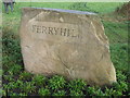
Nearest Town: Ferryhill Nearest Village: Chilton Lane
Map Ref: NZ2995430684
Latitude: 54.670344N Longitude: 1.537069W
Condition:
| 5 | Perfect |
| 4 | Almost Perfect |
| 3 | Reasonable but with some damage |
| 2 | Ruined but still recognisable as an ancient site |
| 1 | Pretty much destroyed, possibly visible as crop marks |
| 0 | No data. |
| -1 | Completely destroyed |
| 5 | Superb |
| 4 | Good |
| 3 | Ordinary |
| 2 | Not Good |
| 1 | Awful |
| 0 | No data. |
| 5 | Can be driven to, probably with disabled access |
| 4 | Short walk on a footpath |
| 3 | Requiring a bit more of a walk |
| 2 | A long walk |
| 1 | In the middle of nowhere, a nightmare to find |
| 0 | No data. |
| 5 | co-ordinates taken by GPS or official recorded co-ordinates |
| 4 | co-ordinates scaled from a detailed map |
| 3 | co-ordinates scaled from a bad map |
| 2 | co-ordinates of the nearest village |
| 1 | co-ordinates of the nearest town |
| 0 | no data |
Internal Links:
External Links:
Ancient Settlement in County Durham
Monument Number 1448066
A multi-phased site, dating to the Iron Age/ Roman period and consisting of a series of ditched enclosures, visible as a cropmark on air photographs. The largest enclosure, measures 104m x 88m, and contained within it are two circular enclosures measuring 15m and 10m in diameter, possibly representing domestic round houses. This large enclosure abuts a smaller rectilinear enclosure measuring 52m x 54m. The boundary ditches of the latter appear to have been re-cut at least three times and on each occasion along a slightly different alignment. Within the enclosure is a circular pit with a 2m diameter. Cutting through the rectilinear enclosure is a 32m x 23m curvilinear enclosure, although it is not clear if this feature pre or post-dates it. Finally, a boundary ditch is visible to the north and may represent further enclosures or field boundaries. The site is situated on a knoll of higher ground.
You may be viewing yesterday's version of this page. To see the most up to date information please register for a free account.
Do not use the above information on other web sites or publications without permission of the contributor.
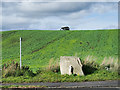
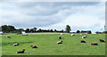
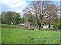
Nearby Images from Geograph Britain and Ireland:
©2018(licence)
©2009(licence)
©2018(licence)
©2007(licence)
©2007(licence)
The above images may not be of the site on this page, they are loaded from Geograph.
Please Submit an Image of this site or go out and take one for us!
Click here to see more info for this site
Nearby sites
Key: Red: member's photo, Blue: 3rd party photo, Yellow: other image, Green: no photo - please go there and take one, Grey: site destroyed
Download sites to:
KML (Google Earth)
GPX (GPS waypoints)
CSV (Garmin/Navman)
CSV (Excel)
To unlock full downloads you need to sign up as a Contributory Member. Otherwise downloads are limited to 50 sites.
Turn off the page maps and other distractions
Nearby sites listing. In the following links * = Image available
3.5km ENE 67° Bishop Middleham Cave Cave or Rock Shelter (NZ33223209)
6.8km WSW 239° Eldon Hill Stone Circle* Stone Circle (NZ2416627139)
7.2km WSW 249° Eldon Fort* Hillfort (NZ23202804)
7.6km W 270° Coundon Burn Barrow Long Barrow (NZ223307)
8.5km WSW 255° Auckland St Andrew Ancient Cross* Ancient Cross (NZ21752846)
8.7km SSW 191° St Andrew's Church (Aycliffe)* Ancient Cross (NZ2830622162)
10.2km SW 224° Shackleton Beacon* Hillfort (NZ22952331)
10.2km NW 314° St Brandon’s Church, Brancepeth* Carving (NZ22473769)
10.4km ESE 119° Thorpe Thewles cropmark Ancient Village or Settlement (NZ391257)
10.6km NE 51° Old Wingate Long Barrow* Long Barrow (NZ38143745)
10.7km NE 50° Old Wingate Round Barrow* Round Barrow(s) (NZ3815937568)
11.0km W 268° Escomb Cross* Ancient Cross (NZ1892830139)
11.1km N 352° Maiden Castle (Durham)* Promontory Fort / Cliff Castle (NZ283417)
11.5km NNW 348° St. Oswald's Well* Holy Well or Sacred Spring (NZ27524190)
11.5km SE 146° St Peter's Church (Bishopton)* Ancient Cross (NZ3649721242)
11.5km ESE 123° Thorpe Thewles settlement Ancient Village or Settlement (NZ39672445)
11.6km NNW 346° St Mary's Well, Durham City* Holy Well or Sacred Spring (NZ27074191)
11.6km NNW 347° Old Fulling Mill Museum of Archaeology* Museum (NZ272420)
11.8km NNW 347° Galilee Well* Holy Well or Sacred Spring (NZ27274215)
11.8km NNW 347° St Cuthbert's Well (County Durham)* Holy Well or Sacred Spring (NZ2727642218)
11.9km SE 146° Castle Hill (Bishopton)* Misc. Earthwork (NZ3667020898)
12.0km W 259° Eldon (Durham)* Rock Art (NZ1816528358)
12.3km SW 229° Legg's Cross* Ancient Cross (NZ20712249)
12.5km NNW 344° Maiden's Bower (County Durham)* Round Cairn (NZ26434271)
13.1km NW 316° Brandon Hill Cist* Cist (NZ207400)
View more nearby sites and additional images


 We would like to know more about this location. Please feel free to add a brief description and any relevant information in your own language.
 Wir möchten mehr über diese Stätte erfahren. Bitte zögern Sie nicht, eine kurze Beschreibung und relevante Informationen in Deutsch hinzuzufügen.
 Nous aimerions en savoir encore un peu sur les lieux. S'il vous plaît n'hesitez pas à ajouter une courte description et tous les renseignements pertinents dans votre propre langue.
 Quisieramos informarnos un poco más de las lugares. No dude en añadir una breve descripción y otros datos relevantes en su propio idioma.