


<< Text Pages >> Hampstead Marshall Mottes - Artificial Mound in England in Berkshire
Submitted by Andy B on Friday, 24 January 2014 Page Views: 2610
Multi-periodSite Name: Hampstead Marshall MottesCountry: England
NOTE: This site is 0.452 km away from the location you searched for.
County: Berkshire Type: Artificial Mound
Nearest Village: Hampstead Marshall
Map Ref: SU42156685
Latitude: 51.399124N Longitude: 1.395503W
Condition:
| 5 | Perfect |
| 4 | Almost Perfect |
| 3 | Reasonable but with some damage |
| 2 | Ruined but still recognisable as an ancient site |
| 1 | Pretty much destroyed, possibly visible as crop marks |
| 0 | No data. |
| -1 | Completely destroyed |
| 5 | Superb |
| 4 | Good |
| 3 | Ordinary |
| 2 | Not Good |
| 1 | Awful |
| 0 | No data. |
| 5 | Can be driven to, probably with disabled access |
| 4 | Short walk on a footpath |
| 3 | Requiring a bit more of a walk |
| 2 | A long walk |
| 1 | In the middle of nowhere, a nightmare to find |
| 0 | No data. |
| 5 | co-ordinates taken by GPS or official recorded co-ordinates |
| 4 | co-ordinates scaled from a detailed map |
| 3 | co-ordinates scaled from a bad map |
| 2 | co-ordinates of the nearest village |
| 1 | co-ordinates of the nearest town |
| 0 | no data |
Internal Links:
External Links:
The monument includes two motte and bailey castles, fishponds, the remains of the deserted medieval village of Hamstead Marshall and a possible manor site. The two castles lie in close proximity, their centres only 115m apart, below and to the northeast of the church and the remains of the former village.
[Why would you have two castles so close together - the suspicion is that one of them could be a prehistoric mound similar to Silbury Hill and the Marlborough Mound.]
Both occupy low spurs which overlook the valley of the River Kennet. The most south-easterly and smaller of the two castles has a diameter of 50m and stands to a height of 4.7m. It is surrounded by a ditch up to 2m deep and has a roughly square bailey adjoining the ditch to the north-east. The bailey is orientated north-east to south-west; it has internal dimensions of 48m by 52m and is defined in extent by a bank with prominent outer scarp.
Site included due to the suspicion that one may have prehistoric origins, however the Round Mounds Project have radiocarbon dated “Castle 3” Hamstead Marshall to Late 12th to mid-13th century AD. “Castle 2”, Hamstead Marshall has yet to be dated.
More at English Heritage.
See also the 'suspicious' motte at Sherrington.
You may be viewing yesterday's version of this page. To see the most up to date information please register for a free account.
Do not use the above information on other web sites or publications without permission of the contributor.
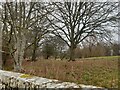
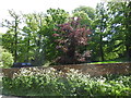
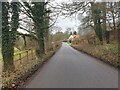
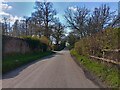
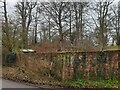
Nearby Images from Geograph Britain and Ireland:
©2023(licence)
©2015(licence)
©2023(licence)
©2023(licence)
©2023(licence)
The above images may not be of the site on this page, they are loaded from Geograph.
Please Submit an Image of this site or go out and take one for us!
Click here to see more info for this site
Nearby sites
Key: Red: member's photo, Blue: 3rd party photo, Yellow: other image, Green: no photo - please go there and take one, Grey: site destroyed
Download sites to:
KML (Google Earth)
GPX (GPS waypoints)
CSV (Garmin/Navman)
CSV (Excel)
To unlock full downloads you need to sign up as a Contributory Member. Otherwise downloads are limited to 50 sites.
Turn off the page maps and other distractions
Nearby sites listing. In the following links * = Image available
3.2km WNW 298° Kintbury Cursus Cursus (SU39296835)
3.4km ENE 73° The Ladywell* Holy Well or Sacred Spring (SU454679)
3.8km ESE 122° Wash Common* Barrow Cemetery (SU45446484)
5.0km E 88° West Berkshire Museum Museum (SU472671)
5.9km NNE 19° Borough Hill (Boxford)* Hillfort (SU4401372417)
5.9km W 271° Inglewood Barrow Cemetery (SU3622366924)
7.0km SW 223° Walbury Camp* Hillfort (SU374617)
7.2km SW 232° Inkpen Long Barrow* Long Barrow (SU365623)
7.4km NE 39° Bussock Camp* Hillfort (SU468726)
8.0km N 7° Hangman's Stone - Leckhampstead* Marker Stone (SU431748)
8.6km WSW 237° Inkpen Hill Barrows* Barrow Cemetery (SU34966203)
8.7km NNE 16° Leckhampstead Bowl Barrow Round Barrow(s) (SU44507518)
9.0km WNW 286° Charnham Lane Timber Circle (SU334692)
9.4km NNW 334° Great Shefford Churchyard Cross* Ancient Cross (SU380753)
9.7km W 268° Standon Manor Puddingstone Natural Stone / Erratic / Other Natural Feature (SU324664)
9.8km SSE 160° Beacon Hill Cross Dyke Misc. Earthwork (SU45565764)
9.8km SSE 160° Beacon Hill Barrow North Spur Round Barrow(s) (SU45595762)
10.2km E 83° Dunston Park Ancient Village or Settlement (SU523681)
10.2km SSE 160° Beacon Hill (Burghclere)* Hillfort (SU45785727)
10.5km SSE 160° Beacon Hill Barrow South Spur Round Barrow(s) (SU45865698)
10.5km ENE 59° Grimsbury Castle* Hillfort (SU512723)
10.7km ENE 76° Ramsbury Corner* Hillfort (SU525696)
11.0km NE 42° Oareborough Hill* Hillfort (SU49407515)
11.5km SSE 151° Ladle Hill* Hillfort (SU47885683)
12.0km SSE 165° Lower Woodcott Down* Misc. Earthwork (SU453553)
View more nearby sites and additional images


 We would like to know more about this location. Please feel free to add a brief description and any relevant information in your own language.
 Wir möchten mehr über diese Stätte erfahren. Bitte zögern Sie nicht, eine kurze Beschreibung und relevante Informationen in Deutsch hinzuzufügen.
 Nous aimerions en savoir encore un peu sur les lieux. S'il vous plaît n'hesitez pas à ajouter une courte description et tous les renseignements pertinents dans votre propre langue.
 Quisieramos informarnos un poco más de las lugares. No dude en añadir una breve descripción y otros datos relevantes en su propio idioma.