 with our Megalithic Portal iPhone app")


<< Text Pages >> Holy well (Tuxford) - Holy Well or Sacred Spring in England in Nottinghamshire
Submitted by HOLYWELL on Sunday, 06 February 2011 Page Views: 4171
Springs and Holy WellsSite Name: Holy well (Tuxford)Country: England
NOTE: This site is 5.051 km away from the location you searched for.
County: Nottinghamshire Type: Holy Well or Sacred Spring
Nearest Town: Newark Nearest Village: Tuxford
Map Ref: SK745714
Latitude: 53.234418N Longitude: 0.885305W
Condition:
| 5 | Perfect |
| 4 | Almost Perfect |
| 3 | Reasonable but with some damage |
| 2 | Ruined but still recognisable as an ancient site |
| 1 | Pretty much destroyed, possibly visible as crop marks |
| 0 | No data. |
| -1 | Completely destroyed |
| 5 | Superb |
| 4 | Good |
| 3 | Ordinary |
| 2 | Not Good |
| 1 | Awful |
| 0 | No data. |
| 5 | Can be driven to, probably with disabled access |
| 4 | Short walk on a footpath |
| 3 | Requiring a bit more of a walk |
| 2 | A long walk |
| 1 | In the middle of nowhere, a nightmare to find |
| 0 | No data. |
| 5 | co-ordinates taken by GPS or official recorded co-ordinates |
| 4 | co-ordinates scaled from a detailed map |
| 3 | co-ordinates scaled from a bad map |
| 2 | co-ordinates of the nearest village |
| 1 | co-ordinates of the nearest town |
| 0 | no data |
Internal Links:
External Links:
Holy Well or Sacred Spring in Nottinghamshire
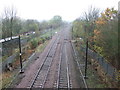
Tuxford’s Holy Well waters were said to be good for rheumatics and scurvy The well was said last to be in use in 1922 but is now lost, there is just some water arising roughly where old maps show it but it fills to be filled in. Its water was said to fill a Roman bath house but this theory is not supported by any archaeology. Indeed, there was a victorian bath house is marked on the 1887 map not far from the footpath beside the railway. The area where the bath house was located is still enclosed but overgrown. The well's water was also taken to the Fountain, but there is no evidence there.
You may be viewing yesterday's version of this page. To see the most up to date information please register for a free account.
Do not use the above information on other web sites or publications without permission of the contributor.
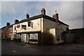
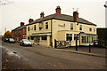
Nearby Images from Geograph Britain and Ireland:
©2011(licence)

©2011(licence)

©2021(licence)
©2012(licence)
©2011(licence)
The above images may not be of the site on this page, they are loaded from Geograph.
Please Submit an Image of this site or go out and take one for us!
Click here to see more info for this site
Nearby sites
Key: Red: member's photo, Blue: 3rd party photo, Yellow: other image, Green: no photo - please go there and take one, Grey: site destroyed
Download sites to:
KML (Google Earth)
GPX (GPS waypoints)
CSV (Garmin/Navman)
CSV (Excel)
To unlock full downloads you need to sign up as a Contributory Member. Otherwise downloads are limited to 50 sites.
Turn off the page maps and other distractions
Nearby sites listing. In the following links * = Image available
2.0km SW 228° Holy well ( Tuxford ) Holy Well or Sacred Spring (SK7370)
2.9km NE 44° Kingshaugh* Hillfort (SK765735)
5.1km SSW 205° The Duck's Mouth* Holy Well or Sacred Spring (SK724667)
6.6km N 4° Lady well (Headon)* Holy Well or Sacred Spring (SK7483877954)
9.2km N 358° Castle Hill (Nottinghamshire) Hillfort (SK741806)
10.8km SE 133° Besthorpe Ancient Village or Settlement (SK825641)
11.6km N 351° St John's Well (Welham) Holy Well or Sacred Spring (SK72558280)
12.3km W 268° Budby Barrow* Round Barrow(s) (SK62187087)
14.8km W 259° Thynghowe* Artificial Mound (SK59936834)
15.7km SSE 147° Langford, Brough and Glebe Farm sites on the A46* Ancient Village or Settlement (SK833584)
15.9km ENE 71° South Ingleby Tumulus Misc. Earthwork (SK8946576860)
18.1km SSW 195° Southwell Minster* Early Christian Sculptured Stone (SK70165378)
18.9km S 182° Holy Trinity (Rolleston)* Ancient Cross (SK7418552503)
18.9km S 182° Rolleston Cross* Ancient Cross (SK7418052489)
19.1km SSW 199° St Catherine's Well (Westthorpe)* Holy Well or Sacred Spring (SK68565327)
19.2km SSE 166° Farndon Fields* Natural Stone / Erratic / Other Natural Feature (SK794528)
19.8km SW 216° Combs Camp Hillfort (SK63145512)
19.8km SSW 212° Hart's Well* Holy Well or Sacred Spring (SK6415254451)
21.0km W 279° Mother Grundy’s Parlour Cave or Rock Shelter (SK536743)
21.1km W 279° Creswell Crags* Cave or Rock Shelter (SK535743)
21.1km WSW 256° Sookholme Bath* Holy Well or Sacred Spring (SK5466)
21.2km W 278° Robin Hood’s Cave* Cave or Rock Shelter (SK534742)
21.2km SSW 212° Oldox Camp* Hillfort (SK635532)
21.3km W 278° Pin Hole Cave Cave or Rock Shelter (SK533741)
21.3km W 278° Ossiferous Fissure Cave or Rock Shelter (SK533741)
View more nearby sites and additional images


 We would like to know more about this location. Please feel free to add a brief description and any relevant information in your own language.
 Wir möchten mehr über diese Stätte erfahren. Bitte zögern Sie nicht, eine kurze Beschreibung und relevante Informationen in Deutsch hinzuzufügen.
 Nous aimerions en savoir encore un peu sur les lieux. S'il vous plaît n'hesitez pas à ajouter une courte description et tous les renseignements pertinents dans votre propre langue.
 Quisieramos informarnos un poco más de las lugares. No dude en añadir una breve descripción y otros datos relevantes en su propio idioma.