


<< Our Photo Pages >> Linch Down - Round Barrow(s) in England in West Sussex
Submitted by paulcall on Friday, 03 October 2008 Page Views: 3860
Neolithic and Bronze AgeSite Name: Linch DownCountry: England
NOTE: This site is 1.424 km away from the location you searched for.
County: West Sussex Type: Round Barrow(s)
Nearest Town: Midhurst Nearest Village: Cocking
Map Ref: SU8464517407
Latitude: 50.949893N Longitude: 0.796395W
Condition:
| 5 | Perfect |
| 4 | Almost Perfect |
| 3 | Reasonable but with some damage |
| 2 | Ruined but still recognisable as an ancient site |
| 1 | Pretty much destroyed, possibly visible as crop marks |
| 0 | No data. |
| -1 | Completely destroyed |
| 5 | Superb |
| 4 | Good |
| 3 | Ordinary |
| 2 | Not Good |
| 1 | Awful |
| 0 | No data. |
| 5 | Can be driven to, probably with disabled access |
| 4 | Short walk on a footpath |
| 3 | Requiring a bit more of a walk |
| 2 | A long walk |
| 1 | In the middle of nowhere, a nightmare to find |
| 0 | No data. |
| 5 | co-ordinates taken by GPS or official recorded co-ordinates |
| 4 | co-ordinates scaled from a detailed map |
| 3 | co-ordinates scaled from a bad map |
| 2 | co-ordinates of the nearest village |
| 1 | co-ordinates of the nearest town |
| 0 | no data |
Internal Links:
External Links:
I have visited· I would like to visit
paulcall has visited here
")
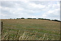
It lies on a ridge running west from Linchball Hill (where there is a possible barrow cemetary), and there are excellent views to the west towards Harting Beacon.
You may be viewing yesterday's version of this page. To see the most up to date information please register for a free account.
")
Do not use the above information on other web sites or publications without permission of the contributor.
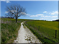
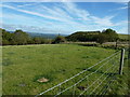
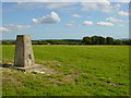
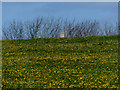
Nearby Images from Geograph Britain and Ireland:
©2014(licence)
©2012(licence)
©2005(licence)
©2014(licence)
©2013(licence)
The above images may not be of the site on this page, they are loaded from Geograph.
Please Submit an Image of this site or go out and take one for us!
Click here to see more info for this site
Nearby sites
Key: Red: member's photo, Blue: 3rd party photo, Yellow: other image, Green: no photo - please go there and take one, Grey: site destroyed
Download sites to:
KML (Google Earth)
GPX (GPS waypoints)
CSV (Garmin/Navman)
CSV (Excel)
To unlock full downloads you need to sign up as a Contributory Member. Otherwise downloads are limited to 50 sites.
Turn off the page maps and other distractions
Nearby sites listing. In the following links * = Image available
212m ESE 107° Linchball Hill* Barrow Cemetery (SU84851735)
607m ESE 119° Newfarm Plantation Cross Dyke Misc. Earthwork (SU8518117120)
947m S 175° West Dean Woods Barrow Round Barrow(s) (SU8473916465)
954m ESE 118° Bepton Down Bowl Barrow* Round Barrow(s) (SU8549716973)
1.0km ESE 119° Bepton Down Platform barrow* Round Barrow(s) (SU8554516928)
1.7km ESE 110° Cocking Down* Round Barrow(s) (SU8629216825)
2.1km W 268° Devil's Jumps* Barrow Cemetery (SU825173)
3.9km N 8° Minsted Round Barrows* Barrow Cemetery (SU85152125)
4.2km WNW 285° Harting Beacon* Hillfort (SU806184)
4.2km N 4° Fitzhall Heath 1* Barrow Cemetery (SU849216)
4.3km N 351° Goldrings Warren* Round Barrow(s) (SU8392821677)
4.4km N 357° Fitzhall Heath 3* Round Barrow(s) (SU84332180)
4.4km N 7° Fitzhall Heath 2* Barrow Cemetery (SU8513721803)
4.5km N 358° Fitzhall Heath 4* Barrow Cemetery (SU8441621923)
4.7km N 2° Fitzhall Heath 5* Barrow Cemetery (SU8473122134)
5.1km SSW 200° Goosehill Camp* Hillfort (SU830126)
5.1km WSW 257° Handle Down Central* Round Barrow(s) (SU79691619)
5.1km W 260° Handle Down North* Round Barrow(s) (SU7963616421)
5.2km WSW 253° Handle Down South Round Barrow(s) (SU7967815765)
5.7km N 357° St Mary's Church (Chithurst) Artificial Mound (SU84252310)
5.8km SSW 204° Stoughton Down Tumulus Round Barrow(s) (SU824121)
5.8km SSW 205° Stoughton Long Barrows* Long Barrow (SU823121)
6.1km E 100° Heyshott Down Cross Dyke* Misc. Earthwork (SU9070416492)
6.2km WSW 253° Bevis Thumb* Long Barrow (SU7875415513)
6.3km SE 127° Court Hill Causewayed Enclosure (SU897137)
View more nearby sites and additional images


 We would like to know more about this location. Please feel free to add a brief description and any relevant information in your own language.
 Wir möchten mehr über diese Stätte erfahren. Bitte zögern Sie nicht, eine kurze Beschreibung und relevante Informationen in Deutsch hinzuzufügen.
 Nous aimerions en savoir encore un peu sur les lieux. S'il vous plaît n'hesitez pas à ajouter une courte description et tous les renseignements pertinents dans votre propre langue.
 Quisieramos informarnos un poco más de las lugares. No dude en añadir una breve descripción y otros datos relevantes en su propio idioma.