


<< Our Photo Pages >> Dolmen de la Pierre Qui Saute - Burial Chamber or Dolmen in France in Poitou:Charente-Maritime (17)
Submitted by Rubis on Saturday, 22 January 2011 Page Views: 3089
Neolithic and Bronze AgeSite Name: Dolmen de la Pierre Qui SauteCountry: France
NOTE: This site is 11.381 km away from the location you searched for.
Département: Poitou:Charente-Maritime (17) Type: Burial Chamber or Dolmen
Nearest Town: Saintes Nearest Village: Chermignac
Latitude: 45.692222N Longitude: 0.656389W
Condition:
| 5 | Perfect |
| 4 | Almost Perfect |
| 3 | Reasonable but with some damage |
| 2 | Ruined but still recognisable as an ancient site |
| 1 | Pretty much destroyed, possibly visible as crop marks |
| 0 | No data. |
| -1 | Completely destroyed |
| 5 | Superb |
| 4 | Good |
| 3 | Ordinary |
| 2 | Not Good |
| 1 | Awful |
| 0 | No data. |
| 5 | Can be driven to, probably with disabled access |
| 4 | Short walk on a footpath |
| 3 | Requiring a bit more of a walk |
| 2 | A long walk |
| 1 | In the middle of nowhere, a nightmare to find |
| 0 | No data. |
| 5 | co-ordinates taken by GPS or official recorded co-ordinates |
| 4 | co-ordinates scaled from a detailed map |
| 3 | co-ordinates scaled from a bad map |
| 2 | co-ordinates of the nearest village |
| 1 | co-ordinates of the nearest town |
| 0 | no data |
Internal Links:
External Links:
")
Legend says, that each year on the night of December the 25th, the capstone of this dolmen "jumps".
The locality kept the name of La Pierre qui saute and the ground is really stony.
An inhabitant of Chermignac told me that in the twenties, yet her grandfather ploughed the ground and there was nothing anymore.
For a long time the dolmen served a boundary stone between the two villages Chermignac and Thénac.
You may be viewing yesterday's version of this page. To see the most up to date information please register for a free account.
")
")
Do not use the above information on other web sites or publications without permission of the contributor.
Nearby Images from Flickr
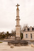
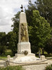

The above images may not be of the site on this page, but were taken nearby. They are loaded from Flickr so please click on them for image credits.
Click here to see more info for this site
Nearby sites
Click here to view sites on an interactive map of the areaKey: Red: member's photo, Blue: 3rd party photo, Yellow: other image, Green: no photo - please go there and take one, Grey: site destroyed
Download sites to:
KML (Google Earth)
GPX (GPS waypoints)
CSV (Garmin/Navman)
CSV (Excel)
To unlock full downloads you need to sign up as a Contributory Member. Otherwise downloads are limited to 50 sites.
Turn off the page maps and other distractions
Nearby sites listing. In the following links * = Image available
6.3km NNE 14° Saintes Polissoir Polissoir
6.6km NNE 25° Musée de Préhistoire (Saintes)* Museum
7.0km E 82° Terrier de la Fade Chambered Tomb
11.4km NNW 345° Terrier des Coutiers Chambered Tomb
13.4km ENE 62° Paléosite* Museum
13.4km ENE 59° Abri de la Roche-a-Pierrot Cave or Rock Shelter
14.0km N 356° Le Peu Chambered Tomb
19.4km W 273° La Pierre Levée (Sablonceaux)* Burial Chamber or Dolmen
20.0km WNW 296° Dolmen dit le Terrier de Sainte-Catherine Chambered Tomb
20.4km SW 233° Dolmen du Moulin Rompu Burial Chamber or Dolmen
21.7km SSE 164° Menhir de Bribaudon* Standing Stone (Menhir)
21.7km NNW 337° Dolmens de Civrac* Burial Chamber or Dolmen
21.8km WSW 240° Tumulus de la Motte Ronde* Chambered Tomb
22.7km NE 35° La Roche tumulus Chambered Tomb
23.4km NNE 19° Menhir des Richards* Standing Stone (Menhir)
23.5km SSE 152° Menhirs de Ménac Standing Stones
23.9km NW 320° Dolmen du Bois de la Grosse Pierre (Sainte-Radegonde) Burial Chamber or Dolmen
24.1km SE 134° Tumulus du Planti d'Audouin Round Barrow(s)
24.6km W 272° La Graube 2 Burial Chamber or Dolmen
24.7km WSW 240° Beloire Dolmen* Burial Chamber or Dolmen
25.0km NE 50° Enceinte néolithique chemin Saint Jean Causewayed Enclosure
25.5km E 94° Pierre Levée (Châteaubernard)* Burial Chamber or Dolmen
26.3km NW 326° Dolmen de la Pierre Levée (La Vallée)* Burial Chamber or Dolmen
26.9km E 90° Sechebec Dolmen* Burial Chamber or Dolmen
28.3km NW 318° Buffletizion Dolmen* Burial Chamber or Dolmen
View more nearby sites and additional images


 We would like to know more about this location. Please feel free to add a brief description and any relevant information in your own language.
 Wir möchten mehr über diese Stätte erfahren. Bitte zögern Sie nicht, eine kurze Beschreibung und relevante Informationen in Deutsch hinzuzufügen.
 Nous aimerions en savoir encore un peu sur les lieux. S'il vous plaît n'hesitez pas à ajouter une courte description et tous les renseignements pertinents dans votre propre langue.
 Quisieramos informarnos un poco más de las lugares. No dude en añadir una breve descripción y otros datos relevantes en su propio idioma.