 with our Megalithic Portal iPhone app")

<< Text Pages >> Burgh Banks - Hillfort in England in Lincolnshire
Submitted by vicky on Thursday, 25 March 2004 Page Views: 5149
Iron Age and Later PrehistorySite Name: Burgh BanksCountry: England
NOTE: This site is 4.942 km away from the location you searched for.
County: Lincolnshire Type: Hillfort
Nearest Town: Grantham Nearest Village: Old Somerby
Map Ref: SK955330 Landranger Map Number: 130
Latitude: 52.885988N Longitude: 0.582154W
Condition:
| 5 | Perfect |
| 4 | Almost Perfect |
| 3 | Reasonable but with some damage |
| 2 | Ruined but still recognisable as an ancient site |
| 1 | Pretty much destroyed, possibly visible as crop marks |
| 0 | No data. |
| -1 | Completely destroyed |
| 5 | Superb |
| 4 | Good |
| 3 | Ordinary |
| 2 | Not Good |
| 1 | Awful |
| 0 | No data. |
| 5 | Can be driven to, probably with disabled access |
| 4 | Short walk on a footpath |
| 3 | Requiring a bit more of a walk |
| 2 | A long walk |
| 1 | In the middle of nowhere, a nightmare to find |
| 0 | No data. |
| 5 | co-ordinates taken by GPS or official recorded co-ordinates |
| 4 | co-ordinates scaled from a detailed map |
| 3 | co-ordinates scaled from a bad map |
| 2 | co-ordinates of the nearest village |
| 1 | co-ordinates of the nearest town |
| 0 | no data |
Internal Links:
External Links:
Hillfort in Lincolnshire
Have you visited this site? Please add a comment below.
You may be viewing yesterday's version of this page. To see the most up to date information please register for a free account.
Do not use the above information on other web sites or publications without permission of the contributor.
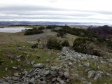
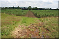
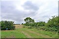
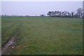
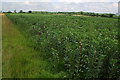
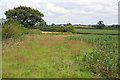
Nearby Images from Geograph Britain and Ireland:
©2007(licence)
©2021(licence)
©2007(licence)
©2007(licence)
©2007(licence)
The above images may not be of the site on this page, they are loaded from Geograph.
Please Submit an Image of this site or go out and take one for us!
Click here to see more info for this site
Nearby sites
Key: Red: member's photo, Blue: 3rd party photo, Yellow: other image, Green: no photo - please go there and take one, Grey: site destroyed
Download sites to:
KML (Google Earth)
GPX (GPS waypoints)
CSV (Garmin/Navman)
CSV (Excel)
To unlock full downloads you need to sign up as a Contributory Member. Otherwise downloads are limited to 50 sites.
Turn off the page maps and other distractions
Nearby sites listing. In the following links * = Image available
4.3km ESE 122° Round Hills Fort* Hillfort (SK992308)
9.3km SW 220° Fish Well* Holy Well or Sacred Spring (SK89602578)
9.4km N 1° Honington Camp* Hillfort (SK954424)
10.1km WSW 241° King Lud’s Intrenchments Misc. Earthwork (SK867279)
10.7km NNE 17° Lady Well (Ancaster)* Holy Well or Sacred Spring (SK98404332)
11.7km W 265° St Michael and All Angels (Harston)* Ancient Cross (SK8384031774)
12.5km NW 307° Salt Well* Holy Well or Sacred Spring (SK853403)
12.7km SW 232° St Bartholomew (Sproxton)* Ancient Cross (SK8566624904)
14.0km NE 46° Folk Moot* Round Barrow(s) (TF0536742981)
14.1km NE 46° Butt Mound* Round Barrow(s) (TF055430)
15.1km E 92° Holy Well (Sempringham)* Holy Well or Sacred Spring (TF10673282)
15.9km W 280° St Peter's Church (Redmile)* Early Christian Sculptured Stone (SK7971335528)
16.0km WNW 293° Bottesford Cross* Ancient Cross (SK8061638944)
16.2km E 87° Billingborough Wells* Holy Well or Sacred Spring (TF11703420)
16.4km E 83° Horbling Spring Well* Holy Well or Sacred Spring (TF11813528)
17.6km SSE 166° Holy Well (Careby and Aunby) Holy Well or Sacred Spring (TF00031598)
18.6km S 191° Greetham* Holy Well or Sacred Spring (SK924146)
19.3km SSE 155° Careby Camp* Hillfort (TF040157)
20.9km SSW 204° Ashwell Wishing Well* Holy Well or Sacred Spring (SK874137)
22.1km SSE 166° Walk Farm Enclosure Ancient Village or Settlement (TF012116)
22.8km WSW 251° Hazeltongue Lodge Henge (SK74092509)
23.1km NW 317° Hawton Cursus Cursus (SK79294949)
23.7km NE 43° Anwick Drake Stones* Natural Stone / Erratic / Other Natural Feature (TF114506)
23.9km WSW 257° Long Clawson Stone* Standing Stone (Menhir) (SK722272)
24.1km NW 307° Willow Rundle Spring* Holy Well or Sacred Spring (SK7602047230)
View more nearby sites and additional images


 We would like to know more about this location. Please feel free to add a brief description and any relevant information in your own language.
 Wir möchten mehr über diese Stätte erfahren. Bitte zögern Sie nicht, eine kurze Beschreibung und relevante Informationen in Deutsch hinzuzufügen.
 Nous aimerions en savoir encore un peu sur les lieux. S'il vous plaît n'hesitez pas à ajouter une courte description et tous les renseignements pertinents dans votre propre langue.
 Quisieramos informarnos un poco más de las lugares. No dude en añadir una breve descripción y otros datos relevantes en su propio idioma.