 with our Megalithic Portal iPhone app")
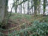

<< Text Pages >> Grand Malveau - Chambered Tomb in France in Poitou:Charente-Maritime (17)
Submitted by TheCaptain on Saturday, 16 April 2005 Page Views: 3305
Neolithic and Bronze AgeSite Name: Grand MalveauCountry: France
NOTE: This site is 2.392 km away from the location you searched for.
Département: Poitou:Charente-Maritime (17) Type: Chambered Tomb
Nearest Town: Niort Nearest Village: Bernay-Saint-Martin
Latitude: 46.055093N Longitude: 0.593096W
Condition:
| 5 | Perfect |
| 4 | Almost Perfect |
| 3 | Reasonable but with some damage |
| 2 | Ruined but still recognisable as an ancient site |
| 1 | Pretty much destroyed, possibly visible as crop marks |
| 0 | No data. |
| -1 | Completely destroyed |
| 5 | Superb |
| 4 | Good |
| 3 | Ordinary |
| 2 | Not Good |
| 1 | Awful |
| 0 | No data. |
| 5 | Can be driven to, probably with disabled access |
| 4 | Short walk on a footpath |
| 3 | Requiring a bit more of a walk |
| 2 | A long walk |
| 1 | In the middle of nowhere, a nightmare to find |
| 0 | No data. |
| 5 | co-ordinates taken by GPS or official recorded co-ordinates |
| 4 | co-ordinates scaled from a detailed map |
| 3 | co-ordinates scaled from a bad map |
| 2 | co-ordinates of the nearest village |
| 1 | co-ordinates of the nearest town |
| 0 | no data |
Be the first person to rate this site - see the 'Contribute!' box in the right hand menu.
Internal Links:
External Links:
Tumulus in Charente-Maritime
You may be viewing yesterday's version of this page. To see the most up to date information please register for a free account.
Do not use the above information on other web sites or publications without permission of the contributor.
Nearby Images from Flickr
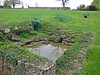
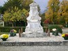
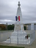
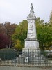

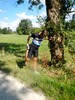
The above images may not be of the site on this page, but were taken nearby. They are loaded from Flickr so please click on them for image credits.
Click here to see more info for this site
Nearby sites
Click here to view sites on an interactive map of the areaKey: Red: member's photo, Blue: 3rd party photo, Yellow: other image, Green: no photo - please go there and take one, Grey: site destroyed
Download sites to:
KML (Google Earth)
GPX (GPS waypoints)
CSV (Garmin/Navman)
CSV (Excel)
To unlock full downloads you need to sign up as a Contributory Member. Otherwise downloads are limited to 50 sites.
Turn off the page maps and other distractions
Nearby sites listing. In the following links * = Image available
7.2km N 0° Dolmen de Marsais* Burial Chamber or Dolmen
9.3km SSW 204° Pierre de la Mort* Rock Art
10.6km E 81° La Fromagère Chambered Tomb
11.5km NNE 25° Tumulus du Péré* Chambered Tomb
12.8km SE 124° La Grosse Pierre (Antezant)* Burial Chamber or Dolmen
15.1km E 95° La Longue Pierre and the little menhirs Standing Stones
18.4km S 172° Menhir des Richards* Standing Stone (Menhir)
21.0km E 88° La Pierre l'Abbé Modern Stone Circle etc
22.2km W 270° La Pierre Levée (Ardillières)* Burial Chamber or Dolmen
22.6km NW 322° Tumulus La Pointe (Benon)* Artificial Mound
22.8km W 269° Dolmen dit la Pierre Fouquerée* Burial Chamber or Dolmen
23.1km SSE 160° La Roche tumulus Chambered Tomb
23.2km N 354° Amuré Allée couverte* Passage Grave
24.4km SSW 213° Dolmens de Civrac* Burial Chamber or Dolmen
24.8km SE 144° Pierre du Terrier de Babelot Polissoir
25.1km WSW 246° Dolmen de Châteauroux Burial Chamber or Dolmen
26.3km NW 320° Nécropole de Champ-Chalon* Barrow Cemetery
27.0km SW 227° Dolmen de la Pierre Levée (La Vallée)* Burial Chamber or Dolmen
27.0km SSW 193° Le Peu Chambered Tomb
28.2km SSE 149° Enceinte néolithique chemin Saint Jean Causewayed Enclosure
30.0km SW 223° Dolmen du Bois de la Grosse Pierre (Sainte-Radegonde) Burial Chamber or Dolmen
30.3km NW 312° La Butte des Moindreaux* Chambered Tomb
30.4km SSW 195° Terrier des Coutiers Chambered Tomb
30.6km SW 231° Buffletizion Dolmen* Burial Chamber or Dolmen
31.8km WSW 245° Musée Archéologique (Rochefort)* Museum
View more nearby sites and additional images


 We would like to know more about this location. Please feel free to add a brief description and any relevant information in your own language.
 Wir möchten mehr über diese Stätte erfahren. Bitte zögern Sie nicht, eine kurze Beschreibung und relevante Informationen in Deutsch hinzuzufügen.
 Nous aimerions en savoir encore un peu sur les lieux. S'il vous plaît n'hesitez pas à ajouter une courte description et tous les renseignements pertinents dans votre propre langue.
 Quisieramos informarnos un poco más de las lugares. No dude en añadir una breve descripción y otros datos relevantes en su propio idioma.