

<< Our Photo Pages >> Menhir de la Belle Roche - Standing Stone (Menhir) in France in Normandie:Calvados (14)
Submitted by TheCaptain on Sunday, 19 December 2004 Page Views: 3392
Neolithic and Bronze AgeSite Name: Menhir de la Belle Roche Alternative Name: Pierre à la Demoiselle, Menhir CuleyCountry: France
NOTE: This site is 3.007 km away from the location you searched for.
Département: Normandie:Calvados (14) Type: Standing Stone (Menhir)
Nearest Town: Caen Nearest Village: Culey-le-Patry
Latitude: 48.949700N Longitude: 0.5514W
Condition:
| 5 | Perfect |
| 4 | Almost Perfect |
| 3 | Reasonable but with some damage |
| 2 | Ruined but still recognisable as an ancient site |
| 1 | Pretty much destroyed, possibly visible as crop marks |
| 0 | No data. |
| -1 | Completely destroyed |
| 5 | Superb |
| 4 | Good |
| 3 | Ordinary |
| 2 | Not Good |
| 1 | Awful |
| 0 | No data. |
| 5 | Can be driven to, probably with disabled access |
| 4 | Short walk on a footpath |
| 3 | Requiring a bit more of a walk |
| 2 | A long walk |
| 1 | In the middle of nowhere, a nightmare to find |
| 0 | No data. |
| 5 | co-ordinates taken by GPS or official recorded co-ordinates |
| 4 | co-ordinates scaled from a detailed map |
| 3 | co-ordinates scaled from a bad map |
| 2 | co-ordinates of the nearest village |
| 1 | co-ordinates of the nearest town |
| 0 | no data |
Be the first person to rate this site - see the 'Contribute!' box in the right hand menu.
Internal Links:
External Links:
")
You may be viewing yesterday's version of this page. To see the most up to date information please register for a free account.
Do not use the above information on other web sites or publications without permission of the contributor.
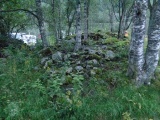
Nearby Images from Flickr

The above images may not be of the site on this page, but were taken nearby. They are loaded from Flickr so please click on them for image credits.
Click here to see more info for this site
Nearby sites
Click here to view sites on an interactive map of the areaKey: Red: member's photo, Blue: 3rd party photo, Yellow: other image, Green: no photo - please go there and take one, Grey: site destroyed
Download sites to:
KML (Google Earth)
GPX (GPS waypoints)
CSV (Garmin/Navman)
CSV (Excel)
To unlock full downloads you need to sign up as a Contributory Member. Otherwise downloads are limited to 50 sites.
Turn off the page maps and other distractions
Nearby sites listing. In the following links * = Image available
4.3km SW 227° Pierres Druidiques de Becquerel Rock Art
9.0km ESE 105° Mégalithe du Pré-du-Vivret* Burial Chamber or Dolmen
9.9km WSW 247° Menhir de la Pierre Grise (Lassy) Standing Stone (Menhir)
11.3km W 264° Montchauvet Alignements* Standing Stones
11.3km W 264° Pierre du Hu* Standing Stone (Menhir)
14.7km WNW 292° Pierre Dialan* Burial Chamber or Dolmen
16.1km SE 144° La Demoiselle de Roufit Standing Stone (Menhir)
17.4km NNE 12° Nécropole mérovingienne à Évrecy* Ancient Village or Settlement
17.6km ENE 73° La Roche Piquée (St-Germain-le-Vasson)* Standing Stone (Menhir)
18.1km E 96° Menhir dit Pierre de la Hoberie* Standing Stone (Menhir)
18.2km NE 49° Pierre Tournante (Fresnay-le-Puceux)* Standing Stone (Menhir)
18.6km ENE 63° Pierre Tourneresse (Gouvix)* Standing Stone (Menhir)
18.7km NNW 336° Pierrelaye menhir* Standing Stone (Menhir)
19.4km E 90° Pierre du Pôt* Standing Stone (Menhir)
20.4km E 95° Menhir de la Grurie* Standing Stone (Menhir)
21.3km NE 40° La Hogue* Chambered Tomb
21.7km NE 41° La Hoguette* Chambered Tomb
22.0km SE 132° Val d'Orne menhir Standing Stone (Menhir)
22.0km SE 132° Pierre de la Roussellière* Standing Stone (Menhir)
22.1km SSE 165° Menhir de la Croix Carrée (Landigou)* Standing Stone (Menhir)
22.3km SSE 168° Landigou Menhir Standing Stone (Menhir)
23.0km ENE 68° Bretteville-le-Rabet* Ancient Mine, Quarry or other Industry
23.1km SSE 150° Dolmen du Bois de la Mousse Burial Chamber or Dolmen
24.1km SE 145° Menhir dit la Droite Pierre (Chênedouit)* Standing Stone (Menhir)
24.1km E 85° Bons Tassilly polissoirs* Polissoir
View more nearby sites and additional images


 We would like to know more about this location. Please feel free to add a brief description and any relevant information in your own language.
 Wir möchten mehr über diese Stätte erfahren. Bitte zögern Sie nicht, eine kurze Beschreibung und relevante Informationen in Deutsch hinzuzufügen.
 Nous aimerions en savoir encore un peu sur les lieux. S'il vous plaît n'hesitez pas à ajouter une courte description et tous les renseignements pertinents dans votre propre langue.
 Quisieramos informarnos un poco más de las lugares. No dude en añadir una breve descripción y otros datos relevantes en su propio idioma.