


<< Our Photo Pages >> St Austin's Stone (High Hunsley) - Natural Stone / Erratic / Other Natural Feature in England in Yorkshire (East)
Submitted by Anne T on Monday, 08 January 2018 Page Views: 3581
Natural PlacesSite Name: St Austin's Stone (High Hunsley) Alternative Name: St Augustine's Stone; St Austin's RockCountry: England
NOTE: This site is 0.529 km away from the location you searched for.
County: Yorkshire (East) Type: Natural Stone / Erratic / Other Natural Feature
Nearest Town: Beverley Nearest Village: High Hunsley / South Cave
Map Ref: SE9336034443
Latitude: 53.797926N Longitude: 0.584069W
Condition:
| 5 | Perfect |
| 4 | Almost Perfect |
| 3 | Reasonable but with some damage |
| 2 | Ruined but still recognisable as an ancient site |
| 1 | Pretty much destroyed, possibly visible as crop marks |
| 0 | No data. |
| -1 | Completely destroyed |
| 5 | Superb |
| 4 | Good |
| 3 | Ordinary |
| 2 | Not Good |
| 1 | Awful |
| 0 | No data. |
| 5 | Can be driven to, probably with disabled access |
| 4 | Short walk on a footpath |
| 3 | Requiring a bit more of a walk |
| 2 | A long walk |
| 1 | In the middle of nowhere, a nightmare to find |
| 0 | No data. |
| 5 | co-ordinates taken by GPS or official recorded co-ordinates |
| 4 | co-ordinates scaled from a detailed map |
| 3 | co-ordinates scaled from a bad map |
| 2 | co-ordinates of the nearest village |
| 1 | co-ordinates of the nearest town |
| 0 | no data |
Internal Links:
External Links:
 (PID:185448)")
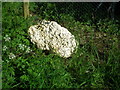
This site features on The Northern Antiquarian (TNA) - see their entry for St Austin’s Stone, High Hunsley, East Yorkshire. The TNA page includes images of the 1855 and 1890 OS maps showing the location of this legendary rock, together with local folklore. TNA adds: "The site was also surmounted by a cross at some time in its recent history, but this has gone. The earth mystery writer Philip Heselton (1986) told that the nearby Well was indeed a place connected to St. Austin’s Stone."
Pastscape Monument No. 64178, which says: "St. Austin's Stone, a mass of rock projecting from the side of a hill, stands in the vale about 1/2 mile N.E. of Drewton. It is supposed to have received its name from the visit of St. Augustine to the East Riding. A natural rock outcrop."
You may be viewing yesterday's version of this page. To see the most up to date information please register for a free account.
Do not use the above information on other web sites or publications without permission of the contributor.
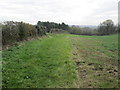
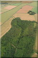
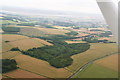
Nearby Images from Geograph Britain and Ireland:
©2014(licence)
©2014(licence)
©2014(licence)
©2014(licence)
©2006(licence)
The above images may not be of the site on this page, they are loaded from Geograph.
Please Submit an Image of this site or go out and take one for us!
Click here to see more info for this site
Nearby sites
Key: Red: member's photo, Blue: 3rd party photo, Yellow: other image, Green: no photo - please go there and take one, Grey: site destroyed
Download sites to:
KML (Google Earth)
GPX (GPS waypoints)
CSV (Garmin/Navman)
CSV (Excel)
To unlock full downloads you need to sign up as a Contributory Member. Otherwise downloads are limited to 50 sites.
Turn off the page maps and other distractions
Nearby sites listing. In the following links * = Image available
3.4km ENE 68° Ling Howe Long Barrow Long Barrow (SE96503580)
3.5km NE 51° Ella Hill* Round Barrow(s) (SE9606036730)
3.9km SSW 207° St Helen's Well (South Cave)* Holy Well or Sacred Spring (SE91693096)
4.2km NNE 33° Littlewood Lodge Round Barrow(s) (SE95563801)
4.4km WSW 246° St. Helen's Well (North Cave)* Holy Well or Sacred Spring (SE894326)
5.6km ENE 62° Middle Howe Round Barrow(s) (SE98283713)
6.9km N 358° Arras Barrow Cemetery* Barrow Cemetery (SE930413)
9.1km NNW 332° St Helen's Well (Goodmanham)* Holy Well or Sacred Spring (SE890424)
9.7km NNW 333° Lady Well (Goodmanham)* Holy Well or Sacred Spring (SE887430)
11.4km ENE 66° Beverley Minster Early Christian Sculptured Stone (TA03773925)
12.7km NNW 330° All Saints (Londesborough)* Ancient Cross (SE86864538)
13.7km SSW 204° Julian's Bower* Turf Maze (SE880218)
13.9km SSW 204° Countess Close* Ancient Village or Settlement (SE879216)
15.0km SSW 205° Kell Well (Walcot)* Holy Well or Sacred Spring (SE873207)
15.9km NNW 328° St James Church (Nunburnholme)* Ancient Cross (SE84774779)
16.0km WNW 293° Lady Well (Seaton Ross) Holy Well or Sacred Spring (SE784403)
16.1km NNE 25° Cleves Top (High Bradley) Rock Art (SE99934916)
16.7km S 178° Holy Well (Winterton) Holy Well or Sacred Spring (SE944178)
17.7km ESE 110° Hull and East Riding Museum* Museum (TA101286)
18.0km NNW 329° Kilnwick Percy Hill - Barrow* Barrow Cemetery (SE8365149674)
18.8km NNW 332° Newcote Round Barrow* Barrow Cemetery (SE84225085)
19.2km NNW 342° Dearsden Hill Hillfort (SE872526)
19.5km WSW 253° Ringstone Wood (Howden) Stone Circle (SE748282)
20.4km S 189° Dragonby* Natural Stone / Erratic / Other Natural Feature (SE905142)
20.7km NNE 17° Southburn Archaeological Museum Museum (SE98965435)
View more nearby sites and additional images


 We would like to know more about this location. Please feel free to add a brief description and any relevant information in your own language.
 Wir möchten mehr über diese Stätte erfahren. Bitte zögern Sie nicht, eine kurze Beschreibung und relevante Informationen in Deutsch hinzuzufügen.
 Nous aimerions en savoir encore un peu sur les lieux. S'il vous plaît n'hesitez pas à ajouter une courte description et tous les renseignements pertinents dans votre propre langue.
 Quisieramos informarnos un poco más de las lugares. No dude en añadir una breve descripción y otros datos relevantes en su propio idioma.