 with our Megalithic Portal iPhone app")


<< Our Photo Pages >> Great Gaddesden Puddingstone - Natural Stone / Erratic / Other Natural Feature in England in Hertfordshire
Submitted by ocifant on Monday, 29 August 2005 Page Views: 6851
Natural PlacesSite Name: Great Gaddesden PuddingstoneCountry: England
NOTE: This site is 2.662 km away from the location you searched for.
County: Hertfordshire Type: Natural Stone / Erratic / Other Natural Feature
Nearest Town: Hemel Hempstead Nearest Village: Great Gaddesden
Map Ref: TL029112
Latitude: 51.790001N Longitude: 0.509483W
Condition:
| 5 | Perfect |
| 4 | Almost Perfect |
| 3 | Reasonable but with some damage |
| 2 | Ruined but still recognisable as an ancient site |
| 1 | Pretty much destroyed, possibly visible as crop marks |
| 0 | No data. |
| -1 | Completely destroyed |
| 5 | Superb |
| 4 | Good |
| 3 | Ordinary |
| 2 | Not Good |
| 1 | Awful |
| 0 | No data. |
| 5 | Can be driven to, probably with disabled access |
| 4 | Short walk on a footpath |
| 3 | Requiring a bit more of a walk |
| 2 | A long walk |
| 1 | In the middle of nowhere, a nightmare to find |
| 0 | No data. |
| 5 | co-ordinates taken by GPS or official recorded co-ordinates |
| 4 | co-ordinates scaled from a detailed map |
| 3 | co-ordinates scaled from a bad map |
| 2 | co-ordinates of the nearest village |
| 1 | co-ordinates of the nearest town |
| 0 | no data |
Internal Links:
External Links:
I have visited· I would like to visit
ocifant has visited here
")
The stone lies within 100 yards or so of the River Gade which runs nearby - possibly indicating a safe river crossing place? The river certainly widens here which slows the flow...
This stone, unlike others I have seen, shows signs of having been polished, as the upper surface is smooth, showing the make-up of the puddingstone to good effect.
You may be viewing yesterday's version of this page. To see the most up to date information please register for a free account.
Do not use the above information on other web sites or publications without permission of the contributor.
Nearby Images from Geograph Britain and Ireland:
©2023(licence)
©2018(licence)
©2016(licence)

©2016(licence)

©2016(licence)
The above images may not be of the site on this page, they are loaded from Geograph.
Please Submit an Image of this site or go out and take one for us!
Click here to see more info for this site
Nearby sites
Key: Red: member's photo, Blue: 3rd party photo, Yellow: other image, Green: no photo - please go there and take one, Grey: site destroyed
Download sites to:
KML (Google Earth)
GPX (GPS waypoints)
CSV (Garmin/Navman)
CSV (Excel)
To unlock full downloads you need to sign up as a Contributory Member. Otherwise downloads are limited to 50 sites.
Turn off the page maps and other distractions
Nearby sites listing. In the following links * = Image available
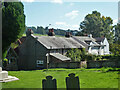
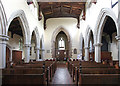
76m NNW 338° Great Gaddesden church puddingstones* Natural Stone / Erratic / Other Natural Feature (TL02871127)
6.2km WNW 289° Moneybury Hill Round Barrow(s) (SP97031309)
6.3km WNW 294° Moneybury Hill Bell Barrow* Round Barrow(s) (SP97111361)
6.6km E 90° The Aubreys* Hillfort (TL095113)
7.2km SSE 161° Kings Langley Cursus Cursus (TL0535804425)
7.4km NW 309° Mead's Plantation Ancient Village or Settlement (SP97021576)
7.9km SSW 205° Whelpley Hill* Hillfort (SP99680397)
8.1km WNW 286° Aldbury Nowers Round Barrow(s) (SP95071324)
8.4km NW 316° Ivinghoe Beacon Barrow* Round Barrow(s) (SP96931709)
8.5km WNW 292° Pitstone Hill Causewayed Enclosure (SP949142)
8.6km NW 308° Ivinghoe Beacon Hill Barrows* Barrow Cemetery (SP95961638)
8.8km SE 140° Bedmond Puddingstone Natural Stone / Erratic / Other Natural Feature (TL087045)
8.9km S 176° Towerhill (Herts) Puddingstone* Natural Stone / Erratic / Other Natural Feature (TL0363802375)
8.9km NW 311° Ivinghoe Beacon* Hillfort (SP960169)
9.0km WNW 291° Northfield Settlement Ancient Village or Settlement (SP944143)
9.2km W 260° Grim’s Ditch (Hertfordshire) Misc. Earthwork (SP93850938)
9.8km NW 324° Edlesborough* Artificial Mound (SP970190)
9.8km ESE 108° Devil's Ditch (Hertfordshire) Ancient Village or Settlement (TL123084)
10.0km SSW 208° Botley Puddingstones Natural Stone / Erratic / Other Natural Feature (SP983023)
10.1km S 171° Chipperfield Common Round Barrows* Round Barrow(s) (TL04620126)
10.1km NNW 348° Five Knolls* Barrow Cemetery (TL00632103)
10.5km SE 126° Potterscrouch Puddingstones Natural Stone / Erratic / Other Natural Feature (TL116052)
10.7km WSW 249° Cholesbury Camp* Hillfort (SP930072)
11.1km ESE 111° Verulamium Puddingstone Natural Stone / Erratic / Other Natural Feature (TL134074)
11.6km ESE 110° St Albans Puddingstones* Natural Stone / Erratic / Other Natural Feature (TL139075)
View more nearby sites and additional images


 We would like to know more about this location. Please feel free to add a brief description and any relevant information in your own language.
 Wir möchten mehr über diese Stätte erfahren. Bitte zögern Sie nicht, eine kurze Beschreibung und relevante Informationen in Deutsch hinzuzufügen.
 Nous aimerions en savoir encore un peu sur les lieux. S'il vous plaît n'hesitez pas à ajouter une courte description et tous les renseignements pertinents dans votre propre langue.
 Quisieramos informarnos un poco más de las lugares. No dude en añadir una breve descripción y otros datos relevantes en su propio idioma.