


<< Our Photo Pages >> Holy Well (St. Albans) - Holy Well or Sacred Spring in England in Hertfordshire
Submitted by DavidCWoods on Sunday, 21 August 2005 Page Views: 19647
Springs and Holy WellsSite Name: Holy Well (St. Albans) Alternative Name: St Alban's Well (St Albans)Country: England County: Hertfordshire Type: Holy Well or Sacred Spring
Nearest Town: St. Albans
Map Ref: TL14640670
Latitude: 51.747279N Longitude: 0.340824W
Condition:
| 5 | Perfect |
| 4 | Almost Perfect |
| 3 | Reasonable but with some damage |
| 2 | Ruined but still recognisable as an ancient site |
| 1 | Pretty much destroyed, possibly visible as crop marks |
| 0 | No data. |
| -1 | Completely destroyed |
| 5 | Superb |
| 4 | Good |
| 3 | Ordinary |
| 2 | Not Good |
| 1 | Awful |
| 0 | No data. |
| 5 | Can be driven to, probably with disabled access |
| 4 | Short walk on a footpath |
| 3 | Requiring a bit more of a walk |
| 2 | A long walk |
| 1 | In the middle of nowhere, a nightmare to find |
| 0 | No data. |
| 5 | co-ordinates taken by GPS or official recorded co-ordinates |
| 4 | co-ordinates scaled from a detailed map |
| 3 | co-ordinates scaled from a bad map |
| 2 | co-ordinates of the nearest village |
| 1 | co-ordinates of the nearest town |
| 0 | no data |
Internal Links:
External Links:
 (PID:16307)")
I visited the site in August 2005, expecting from my records to find at most a manhole cover and was delighted to find a preserved well. Turning left heading down Holywell Hill I parked in Belmont Hill and took the footpath on the right heading downhill into the estate. A hundred yards or so down the path, on the left was a square containing a hedged and fenced enclosure. Each of the four sides had a small staircase leading down to a central recess. This contained a square well housing, slightly offset from the direction of the sides of the square.
For more information see: Pastscape Monument No. 361910 which tells us: "Hope (1893) recounts the legend of the martyrdom of St Alban in AD 303 and relates how a spring of water sprang up under his feet when he prayed for water to quench his thirst."
The Northern Antiquarian (TNA) also features a page for this holy well - see their entry for St. Alban’s Well, St. Albans, Hertfordshire, which quotes from several 19th and 20th century references, which includes local folklore.
You may be viewing yesterday's version of this page. To see the most up to date information please register for a free account.
Do not use the above information on other web sites or publications without permission of the contributor.
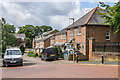
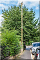
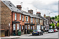
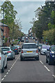
Nearby Images from Geograph Britain and Ireland:
©2020(licence)
©2020(licence)
©2020(licence)
©2019(licence)
©2021(licence)
The above images may not be of the site on this page, they are loaded from Geograph.
Please Submit an Image of this site or go out and take one for us!
Click here to see more info for this site
Nearby sites
Key: Red: member's photo, Blue: 3rd party photo, Yellow: other image, Green: no photo - please go there and take one, Grey: site destroyed
Download sites to:
KML (Google Earth)
GPX (GPS waypoints)
CSV (Garmin/Navman)
CSV (Excel)
To unlock full downloads you need to sign up as a Contributory Member. Otherwise downloads are limited to 50 sites.
Turn off the page maps and other distractions
Nearby sites listing. In the following links * = Image available
1.1km NW 319° St Albans Puddingstones* Natural Stone / Erratic / Other Natural Feature (TL139075)
1.4km WNW 301° Verulamium Puddingstone Natural Stone / Erratic / Other Natural Feature (TL134074)
2.7km NNE 20° Beech Bottom Dyke* Ancient Village or Settlement (TL155093)
2.9km NW 307° Devil's Ditch (Hertfordshire) Ancient Village or Settlement (TL123084)
3.4km WSW 245° Potterscrouch Puddingstones Natural Stone / Erratic / Other Natural Feature (TL116052)
4.3km E 101° Tyttenhanger Puddingstones Natural Stone / Erratic / Other Natural Feature (TL189060)
6.3km WSW 251° Bedmond Puddingstone Natural Stone / Erratic / Other Natural Feature (TL087045)
6.9km NW 313° The Aubreys* Hillfort (TL095113)
7.7km NNE 32° Devil's Dyke (Hertfordshire)* Ancient Village or Settlement (TL186133)
9.5km WSW 257° Kings Langley Cursus Cursus (TL0535804425)
9.8km ENE 73° Mill Green Museum Museum (TL240097)
10.9km SSW 210° Cassiobury Park barrow* Round Barrow(s) (TQ094971)
11.4km WSW 243° Chipperfield Common Round Barrows* Round Barrow(s) (TL04620126)
11.6km ESE 119° Potters Bar Museum Museum (TL2494101262)
11.6km E 91° Wildhill Puddingstone Natural Stone / Erratic / Other Natural Feature (TL263067)
11.8km WSW 250° Towerhill (Herts) Puddingstone* Natural Stone / Erratic / Other Natural Feature (TL0363802375)
12.5km WNW 292° Great Gaddesden Puddingstone* Natural Stone / Erratic / Other Natural Feature (TL029112)
12.6km WNW 293° Great Gaddesden church puddingstones* Natural Stone / Erratic / Other Natural Feature (TL02871127)
12.7km NE 43° Welwyn Puddingstone* Natural Stone / Erratic / Other Natural Feature (TL231162)
12.8km NE 45° Welwyn Roman Baths* Ancient Village or Settlement (TL23451602)
12.9km S 176° Stanmore common barrows Misc. Earthwork (TQ15869381)
13.0km ESE 107° Griffin's Hole* Holy Well or Sacred Spring (TL2720403249)
13.6km SW 234° Church Hill puddingstones Natural Stone / Erratic / Other Natural Feature (TQ03899840)
14.4km S 186° Grim's Ditch (Greater London) Ancient Village or Settlement (TQ134923)
15.2km W 261° Whelpley Hill* Hillfort (SP99680397)
View more nearby sites and additional images


 We would like to know more about this location. Please feel free to add a brief description and any relevant information in your own language.
 Wir möchten mehr über diese Stätte erfahren. Bitte zögern Sie nicht, eine kurze Beschreibung und relevante Informationen in Deutsch hinzuzufügen.
 Nous aimerions en savoir encore un peu sur les lieux. S'il vous plaît n'hesitez pas à ajouter une courte description et tous les renseignements pertinents dans votre propre langue.
 Quisieramos informarnos un poco más de las lugares. No dude en añadir una breve descripción y otros datos relevantes en su propio idioma.