


<< Text Pages >> Our Lady's Well (Lancing) - Holy Well or Sacred Spring in England in West Sussex
Submitted by DavidCWoods on Saturday, 08 January 2005 Page Views: 12041
Springs and Holy WellsSite Name: Our Lady's Well (Lancing) Alternative Name: Ladywell SpringCountry: England
NOTE: This site is 1.036 km away from the location you searched for.
County: West Sussex Type: Holy Well or Sacred Spring
Nearest Town: Brighton Nearest Village: Lancing
Map Ref: TQ193067
Latitude: 50.847530N Longitude: 0.30675W
Condition:
| 5 | Perfect |
| 4 | Almost Perfect |
| 3 | Reasonable but with some damage |
| 2 | Ruined but still recognisable as an ancient site |
| 1 | Pretty much destroyed, possibly visible as crop marks |
| 0 | No data. |
| -1 | Completely destroyed |
| 5 | Superb |
| 4 | Good |
| 3 | Ordinary |
| 2 | Not Good |
| 1 | Awful |
| 0 | No data. |
| 5 | Can be driven to, probably with disabled access |
| 4 | Short walk on a footpath |
| 3 | Requiring a bit more of a walk |
| 2 | A long walk |
| 1 | In the middle of nowhere, a nightmare to find |
| 0 | No data. |
| 5 | co-ordinates taken by GPS or official recorded co-ordinates |
| 4 | co-ordinates scaled from a detailed map |
| 3 | co-ordinates scaled from a bad map |
| 2 | co-ordinates of the nearest village |
| 1 | co-ordinates of the nearest town |
| 0 | no data |
Be the first person to rate this site - see the 'Contribute!' box in the right hand menu.
Internal Links:
External Links:
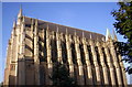
Holy Well in West Sussex. Situated on private land within the grounds of Lancing College.
The Chaplain of the College has told me that the natural spring supplies a stream flowing into the River Adur, and that it has pre-Christian significance.
I have not yet been able to visit or photograph this site.
You may be viewing yesterday's version of this page. To see the most up to date information please register for a free account.
Do not use the above information on other web sites or publications without permission of the contributor.
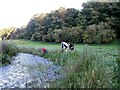
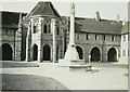
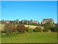
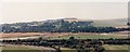
Nearby Images from Geograph Britain and Ireland:
©2017(licence)
©2012(licence)
©2008(licence)
©2005(licence)
©2006(licence)
The above images may not be of the site on this page, they are loaded from Geograph.
Please Submit an Image of this site or go out and take one for us!
Click here to see more info for this site
Nearby sites
Key: Red: member's photo, Blue: 3rd party photo, Yellow: other image, Green: no photo - please go there and take one, Grey: site destroyed
Download sites to:
KML (Google Earth)
GPX (GPS waypoints)
CSV (Garmin/Navman)
CSV (Excel)
To unlock full downloads you need to sign up as a Contributory Member. Otherwise downloads are limited to 50 sites.
Turn off the page maps and other distractions
Nearby sites listing. In the following links * = Image available
2.0km W 276° Titch Hill Farm Cross Dyke Misc. Earthwork (TQ17310687)
3.9km ENE 70° Thunders Barrow Field System Misc. Earthwork (TQ229081)
3.9km ENE 67° Thundersbarrow Hill Hillfort (TQ229083)
4.0km ENE 69° Thunders Barrow Misc. Earthwork (TQ230082)
4.5km NW 324° Steyning Round Hill Cross Dyke Misc. Earthwork (TQ16581031)
4.6km E 88° Rest And Be Thankful Marker Stone (TQ239070)
4.9km NNW 345° Carved stone in Steyning Church Early Christian Sculptured Stone (TQ1791211392)
5.0km ENE 64° Tenant Hill Tumulus Round Barrow(s) (TQ238090)
5.5km WNW 285° Cissbury Ring* Hillfort (TQ13910803)
5.9km ENE 63° Tenant Hill Fields System Misc. Earthwork (TQ245095)
5.9km NE 45° Edburton Hill Tumulus* Round Barrow(s) (TQ23381100)
6.0km SW 231° Worthing Museum Museum (TQ147028)
6.2km NE 47° Edburton Hill Motte and Bailey* Artificial Mound (TQ23771102)
6.2km E 95° Church Hill Standing Stones Natural Stone / Erratic / Other Natural Feature (TQ2554506318)
6.4km ENE 59° Fulking Hill Tumulus 2 Round Barrow(s) (TQ24771011)
6.7km ENE 62° Adder Bottom Tumulus Round Barrow(s) (TQ252100)
6.8km NE 55° Fulking Hill Tumulus 1* Round Barrow(s) (TQ248108)
7.1km NW 316° Chanctonbury Hill Bowl Barrow 6* Round Barrow(s) (TQ14231174)
7.2km NW 316° Chanctonbury Hill Bowl Barrow 5* Round Barrow(s) (TQ14211180)
7.4km ESE 103° St. Leonards Church Sarsens Natural Stone / Erratic / Other Natural Feature (TQ26560524)
7.5km NW 317° Chanctonbury Hill Saucer Barrows 2-4* Barrow Cemetery (TQ14031200)
7.6km NW 316° Chanctonbury Ring* Hillfort (TQ139121)
7.7km NW 315° Chanctonbury Hill Bowl Barrow 1* Round Barrow(s) (TQ13731202)
7.9km NW 314° Chanctonbury Hill Cross Dyke* Misc. Earthwork (TQ13491205)
8.0km ENE 58° Devil's Dyke (West Sussex)* Hillfort (TQ2597311088)
View more nearby sites and additional images


 We would like to know more about this location. Please feel free to add a brief description and any relevant information in your own language.
 Wir möchten mehr über diese Stätte erfahren. Bitte zögern Sie nicht, eine kurze Beschreibung und relevante Informationen in Deutsch hinzuzufügen.
 Nous aimerions en savoir encore un peu sur les lieux. S'il vous plaît n'hesitez pas à ajouter une courte description et tous les renseignements pertinents dans votre propre langue.
 Quisieramos informarnos un poco más de las lugares. No dude en añadir una breve descripción y otros datos relevantes en su propio idioma.