

<< Text Pages >> Bush Hill - Hillfort in England in Greater London
Submitted by vicky on Thursday, 25 March 2004 Page Views: 7615
Iron Age and Later PrehistorySite Name: Bush Hill Alternative Name: Earthworks at Old ParkCountry: England
NOTE: This site is 5.584 km away from the location you searched for.
County: Greater London Type: Hillfort
Nearest Town: Enfield Nearest Village: Winchmore Hill
Map Ref: TQ321956 Landranger Map Number: 166
Latitude: 51.643692N Longitude: 0.092254W
Condition:
| 5 | Perfect |
| 4 | Almost Perfect |
| 3 | Reasonable but with some damage |
| 2 | Ruined but still recognisable as an ancient site |
| 1 | Pretty much destroyed, possibly visible as crop marks |
| 0 | No data. |
| -1 | Completely destroyed |
| 5 | Superb |
| 4 | Good |
| 3 | Ordinary |
| 2 | Not Good |
| 1 | Awful |
| 0 | No data. |
| 5 | Can be driven to, probably with disabled access |
| 4 | Short walk on a footpath |
| 3 | Requiring a bit more of a walk |
| 2 | A long walk |
| 1 | In the middle of nowhere, a nightmare to find |
| 0 | No data. |
| 5 | co-ordinates taken by GPS or official recorded co-ordinates |
| 4 | co-ordinates scaled from a detailed map |
| 3 | co-ordinates scaled from a bad map |
| 2 | co-ordinates of the nearest village |
| 1 | co-ordinates of the nearest town |
| 0 | no data |
Internal Links:
External Links:
I have visited· I would like to visit
eilidhns would like to visit
Slight univallate hillfort, 410m NNE of Grange Park Methodist Church. Despite having been part-mutilated and levelled, this is a rare example of its type, which survives comparatively well with much of the western rampart remaining. Ref: Historic England
Have you visited this site? Please add a comment below.
You may be viewing yesterday's version of this page. To see the most up to date information please register for a free account.
Do not use the above information on other web sites or publications without permission of the contributor.
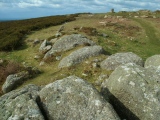
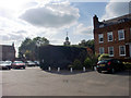
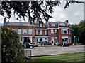
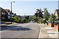
Nearby Images from Geograph Britain and Ireland:
©2011(licence)
©2010(licence)
©2014(licence)
©2011(licence)
©2015(licence)
The above images may not be of the site on this page, they are loaded from Geograph.
Please Submit an Image of this site or go out and take one for us!
Click here to see more info for this site
Nearby sites
Key: Red: member's photo, Blue: 3rd party photo, Yellow: other image, Green: no photo - please go there and take one, Grey: site destroyed
Download sites to:
KML (Google Earth)
GPX (GPS waypoints)
CSV (Garmin/Navman)
CSV (Excel)
To unlock full downloads you need to sign up as a Contributory Member. Otherwise downloads are limited to 50 sites.
Turn off the page maps and other distractions
Nearby sites listing. In the following links * = Image available
5.8km SSW 210° St. Dunstan's Well Holy Well or Sacred Spring (TQ293905)
6.2km E 98° Pole Hill* Modern Stone Circle etc (TQ383949)
6.3km SSE 166° St. Eloy's Well* Holy Well or Sacred Spring (TQ338895)
6.5km SSW 212° Mus Well (Muswell Hill) Holy Well or Sacred Spring (TQ28869001)
8.1km S 183° Finsbury Park earthworks* Artificial Mound (TQ3186087537)
8.3km NNE 19° Flamstead Puddingstone Marker Stone (TL346035)
8.5km SE 125° Gipsy Smith* Modern Stone Circle etc (TQ392909)
9.1km NNW 329° Griffin's Hole* Holy Well or Sacred Spring (TL2720403249)
9.1km NW 310° Potters Bar Museum Museum (TL2494101262)
9.3km ENE 73° High Beach* Artificial Mound (TQ410985)
9.6km NE 42° Monkham Puddingstone Marker Stone (TL384029)
9.9km E 80° Loughton Camp* Hillfort (TQ418975)
9.9km NE 43° Holyfield Puddingstone* Marker Stone (TL38670303)
10.2km SSW 209° Hampstead Heath Barrow* Round Barrow(s) (TQ2738286518)
10.9km SSW 211° Chalybeate Well* Holy Well or Sacred Spring (TQ2671986055)
11.4km NE 45° Galley Hill Puddingstone Marker Stone (TL400038)
11.9km ENE 61° Upshire Stone* Natural Stone / Erratic / Other Natural Feature (TL424016)
12.5km NNW 334° Wildhill Puddingstone Natural Stone / Erratic / Other Natural Feature (TL263067)
12.6km ENE 69° Ambresbury Banks* Hillfort (TL438004)
13.2km NE 53° Parvills Puddingstone* Marker Stone (TL424039)
13.4km S 185° Skinner's Well (Finsbury) Holy Well or Sacred Spring (TQ313822)
13.5km S 184° Clerk's Well (Farringdon Lane) Holy Well or Sacred Spring (TQ3145282134)
13.6km SSW 192° Petrie Museum of Egyptian Archaeology* Museum (TQ2962882172)
13.8km S 183° Cow Cross (Finsbury) Ancient Cross (TQ31788181)
14.0km WSW 239° Kingsbury erratic* Natural Stone / Erratic / Other Natural Feature (TQ2025488084)
View more nearby sites and additional images


 We would like to know more about this location. Please feel free to add a brief description and any relevant information in your own language.
 Wir möchten mehr über diese Stätte erfahren. Bitte zögern Sie nicht, eine kurze Beschreibung und relevante Informationen in Deutsch hinzuzufügen.
 Nous aimerions en savoir encore un peu sur les lieux. S'il vous plaît n'hesitez pas à ajouter une courte description et tous les renseignements pertinents dans votre propre langue.
 Quisieramos informarnos un poco más de las lugares. No dude en añadir una breve descripción y otros datos relevantes en su propio idioma.