


<< Our Photo Pages >> Griffin's Hole - Holy Well or Sacred Spring in England in Hertfordshire
Submitted by HOLYWELL on Monday, 24 January 2011 Page Views: 8141
Springs and Holy WellsSite Name: Griffin's Hole Alternative Name: Hermit's Well, John's Hole, St. Claridge's WellCountry: England County: Hertfordshire Type: Holy Well or Sacred Spring
Nearest Town: Stevenage Nearest Village: Northaw
Map Ref: TL2720403249
Latitude: 51.713558N Longitude: 0.160189W
Condition:
| 5 | Perfect |
| 4 | Almost Perfect |
| 3 | Reasonable but with some damage |
| 2 | Ruined but still recognisable as an ancient site |
| 1 | Pretty much destroyed, possibly visible as crop marks |
| 0 | No data. |
| -1 | Completely destroyed |
| 5 | Superb |
| 4 | Good |
| 3 | Ordinary |
| 2 | Not Good |
| 1 | Awful |
| 0 | No data. |
| 5 | Can be driven to, probably with disabled access |
| 4 | Short walk on a footpath |
| 3 | Requiring a bit more of a walk |
| 2 | A long walk |
| 1 | In the middle of nowhere, a nightmare to find |
| 0 | No data. |
| 5 | co-ordinates taken by GPS or official recorded co-ordinates |
| 4 | co-ordinates scaled from a detailed map |
| 3 | co-ordinates scaled from a bad map |
| 2 | co-ordinates of the nearest village |
| 1 | co-ordinates of the nearest town |
| 0 | no data |
Internal Links:
External Links:
")
I have copied the following from Holy Wells and Healing Springs of Hertfordshire (2009) which notes that:
Griffin’s Hole lays in Well Wood, a small private part of the Great Wood. A footpath from Well Road leads directly to the well and nowhere else, which suggests a great past importance for the site being the main supply for the village. This path appeared to have been recently re-opened, and the well itself has been repaired. The site consists of a roughly square pool of muddy water with an edging of old red bricks, possibly Tudor. A fence of rhododendrons has been erected around the site to prevent people falling in, but it does not deflect from the mysteriousness of the site: which is very odd and eerie. Unfortunately I have been unable to find out why the site is called the Griffin’s Hole but it would appear to be the same site as the Hermit’s Well, John’s Hole and possibly a St. Claridge’s Well. Of which it is recorded that saint would entertain angels and hermits for the blessing of the water, who sat of mossy stones called Claridge Covers. St. Claridge may have been another name for Sigur, who was a hermit who lived in Northaw Woods. Fox-Wilson (1927) records that the hermit built a cell near a well of pure water in the woods. This is recorded in Gesta Abbotum Mon Sci Albani 1 105 (1119-1149), dating it around the 12th Century. There is accordingly, a tomb in St. Alban’s Abbey which reads:“Vir Domini verus jacet hic hermeita Regerus et sub eo clarus meritus hermita Sigarus."
Writer Charles Lamb in 1828 in a letter to Charles Cowden Clark may help locate it as he appears to have encountered the well on a four hour walk to “the willow and lavender plantations to the south-east of Northaw Church.” However, this is confusing as it would appear to suggest that the well is to the south-east but that depends on where he was travelling from! He is known to visited in Buntingford. He refers to Claridge’s covers “Clumps of the finest moss rising hillock fashion, I counted to the number of two hundred and sixty...not a sweeter spot is in ten counties around”. Fox Wilson states that this site was called John’s Hole, and that in the 1920s requests were still made to the landowner for the water as it cured rheumatism. Which suggests that again it was this site as I was told that people still came to take the Griffin's hole water. Harte (2008) states that the name St. Claridge is a joke but does not explain why.
You may be viewing yesterday's version of this page. To see the most up to date information please register for a free account.
")
Do not use the above information on other web sites or publications without permission of the contributor.
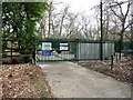
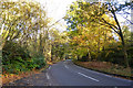
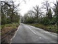
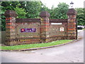
Nearby Images from Geograph Britain and Ireland:
©2015(licence)
©2017(licence)
©2015(licence)
©2012(licence)
©2015(licence)
The above images may not be of the site on this page, they are loaded from Geograph.
Please Submit an Image of this site or go out and take one for us!
Click here to see more info for this site
Nearby sites
Key: Red: member's photo, Blue: 3rd party photo, Yellow: other image, Green: no photo - please go there and take one, Grey: site destroyed
Download sites to:
KML (Google Earth)
GPX (GPS waypoints)
CSV (Garmin/Navman)
CSV (Excel)
To unlock full downloads you need to sign up as a Contributory Member. Otherwise downloads are limited to 50 sites.
Turn off the page maps and other distractions
Nearby sites listing. In the following links * = Image available
3.0km SW 230° Potters Bar Museum Museum (TL2494101262)
3.6km NNW 347° Wildhill Puddingstone Natural Stone / Erratic / Other Natural Feature (TL263067)
7.2km NNW 335° Mill Green Museum Museum (TL240097)
7.4km E 89° Flamstead Puddingstone Marker Stone (TL346035)
8.7km WNW 290° Tyttenhanger Puddingstones Natural Stone / Erratic / Other Natural Feature (TL189060)
9.1km SSE 149° Bush Hill Hillfort (TQ321956)
11.2km E 93° Monkham Puddingstone Marker Stone (TL384029)
11.4km E 93° Holyfield Puddingstone* Marker Stone (TL38670303)
12.8km E 89° Galley Hill Puddingstone Marker Stone (TL400038)
12.9km NE 38° Chadwell Spring* Holy Well or Sacred Spring (TL349136)
12.9km S 172° St. Dunstan's Well Holy Well or Sacred Spring (TQ293905)
13.0km WNW 287° Holy Well (St. Albans)* Holy Well or Sacred Spring (TL14640670)
13.1km WNW 299° Beech Bottom Dyke* Ancient Village or Settlement (TL155093)
13.2km NW 321° Devil's Dyke (Hertfordshire)* Ancient Village or Settlement (TL186133)
13.3km NNW 345° Welwyn Roman Baths* Ancient Village or Settlement (TL23451602)
13.3km S 174° Mus Well (Muswell Hill) Holy Well or Sacred Spring (TQ28869001)
13.6km NNW 344° Welwyn Puddingstone* Natural Stone / Erratic / Other Natural Feature (TL231162)
13.6km NE 49° Emma's Well* Holy Well or Sacred Spring (TL372125)
13.8km N 356° Perry's Grove Boundary Ditch* Misc. Earthwork (TL25851700)
13.9km SE 128° Pole Hill* Modern Stone Circle etc (TQ383949)
13.9km WNW 289° St Albans Puddingstones* Natural Stone / Erratic / Other Natural Feature (TL139075)
14.4km WNW 288° Verulamium Puddingstone Natural Stone / Erratic / Other Natural Feature (TL134074)
14.6km ESE 110° High Beach* Artificial Mound (TQ410985)
14.7km SW 232° Stanmore common barrows Misc. Earthwork (TQ15869381)
15.2km E 89° Parvills Puddingstone* Marker Stone (TL424039)
View more nearby sites and additional images


 We would like to know more about this location. Please feel free to add a brief description and any relevant information in your own language.
 Wir möchten mehr über diese Stätte erfahren. Bitte zögern Sie nicht, eine kurze Beschreibung und relevante Informationen in Deutsch hinzuzufügen.
 Nous aimerions en savoir encore un peu sur les lieux. S'il vous plaît n'hesitez pas à ajouter une courte description et tous les renseignements pertinents dans votre propre langue.
 Quisieramos informarnos un poco más de las lugares. No dude en añadir una breve descripción y otros datos relevantes en su propio idioma.