


<< Text Pages >> Camp des Romains - Ancient Village or Settlement in France in Pays de la Loire:Maine-et-Loire 49
Submitted by TheCaptain on Saturday, 16 April 2005 Page Views: 2401
Multi-periodSite Name: Camp des RomainsCountry: France
NOTE: This site is 9.016 km away from the location you searched for.
Département: Pays de la Loire:Maine-et-Loire 49 Type: Ancient Village or Settlement
Nearest Town: Saumur Nearest Village: Chênehutte-Trèves-Cu
Latitude: 47.305000N Longitude: 0.155W
Condition:
| 5 | Perfect |
| 4 | Almost Perfect |
| 3 | Reasonable but with some damage |
| 2 | Ruined but still recognisable as an ancient site |
| 1 | Pretty much destroyed, possibly visible as crop marks |
| 0 | No data. |
| -1 | Completely destroyed |
| 5 | Superb |
| 4 | Good |
| 3 | Ordinary |
| 2 | Not Good |
| 1 | Awful |
| 0 | No data. |
| 5 | Can be driven to, probably with disabled access |
| 4 | Short walk on a footpath |
| 3 | Requiring a bit more of a walk |
| 2 | A long walk |
| 1 | In the middle of nowhere, a nightmare to find |
| 0 | No data. |
| 5 | co-ordinates taken by GPS or official recorded co-ordinates |
| 4 | co-ordinates scaled from a detailed map |
| 3 | co-ordinates scaled from a bad map |
| 2 | co-ordinates of the nearest village |
| 1 | co-ordinates of the nearest town |
| 0 | no data |
Be the first person to rate this site - see the 'Contribute!' box in the right hand menu.
Internal Links:
External Links:
Oppidum in Maine-et-Loire
IMPORTANT NOTE: Positional co-ordinates scaled from a detailed map source
You may be viewing yesterday's version of this page. To see the most up to date information please register for a free account.
Do not use the above information on other web sites or publications without permission of the contributor.
Nearby Images from Flickr
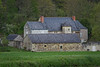
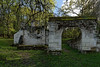
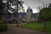
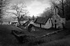
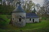
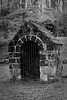
The above images may not be of the site on this page, but were taken nearby. They are loaded from Flickr so please click on them for image credits.
Click here to see more info for this site
Nearby sites
Click here to view sites on an interactive map of the areaKey: Red: member's photo, Blue: 3rd party photo, Yellow: other image, Green: no photo - please go there and take one, Grey: site destroyed
Download sites to:
KML (Google Earth)
GPX (GPS waypoints)
CSV (Garmin/Navman)
CSV (Excel)
To unlock full downloads you need to sign up as a Contributory Member. Otherwise downloads are limited to 50 sites.
Turn off the page maps and other distractions
Nearby sites listing. In the following links * = Image available
2.9km SW 222° Dolmen du Bouchet Burial Chamber or Dolmen
3.2km WSW 241° Dolmen du Ruisseau d'Enfer Burial Chamber or Dolmen
3.8km SE 144° Rue Des Morts Dolmen 2* Burial Chamber or Dolmen
3.8km SE 144° Rue Des Morts Dolmen 1* Burial Chamber or Dolmen
4.8km SSE 151° Dolmen du Bois du Feu* Burial Chamber or Dolmen
5.7km SSW 198° Polissoir du Champ de Courses Polissoir
5.9km SSW 194° Crypte sous Dalle du Champ de Courses Burial Chamber or Dolmen
6.0km SSE 150° La Pierre St Julien Stone Circle
6.4km SE 140° Dolmen du Bois-Briand Burial Chamber or Dolmen
6.7km WNW 296° Dolmen de la Madeleine (Gennes)* Burial Chamber or Dolmen
6.8km SE 142° Crypte sous Dalle du Bois Brard Burial Chamber or Dolmen
7.1km SSE 163° Dolmen dit de la Butte à Matto Burial Chamber or Dolmen
7.1km S 174° Les Pierres Longues Standing Stones
7.1km WNW 296° Tombe du Pavillon d'Achon Burial Chamber or Dolmen
7.1km WNW 298° Amphithéâtre Gallo-Romain (Gennes)* Ancient Village or Settlement
7.2km WNW 297° Les Pierres Levées de l'Amphitheatre Standing Stones
7.2km S 177° Dolmen dit la Pierre Couverte du Clos-Moreau Burial Chamber or Dolmen
7.3km S 182° Dolmen dit la Pierre Couverte du Clos Badier* Burial Chamber or Dolmen
7.4km S 184° Pierre Couverte de la Rigaudiere Burial Chamber or Dolmen
7.5km WSW 237° Pierre qui Vire de Virolais Standing Stone (Menhir)
7.7km W 278° Tertre Tumulaires du Plateau d'Avort Barrow Cemetery
7.8km S 181° Pierre Couverte de Rou Burial Chamber or Dolmen
7.8km SSE 149° Dolmen de chemin de Bournant Burial Chamber or Dolmen
7.9km SSE 147° Le Petit Dolmen de Bagneux* Passage Grave
8.2km SSE 166° Dolmens du Bois de la Chenaise* Burial Chamber or Dolmen
View more nearby sites and additional images


 We would like to know more about this location. Please feel free to add a brief description and any relevant information in your own language.
 Wir möchten mehr über diese Stätte erfahren. Bitte zögern Sie nicht, eine kurze Beschreibung und relevante Informationen in Deutsch hinzuzufügen.
 Nous aimerions en savoir encore un peu sur les lieux. S'il vous plaît n'hesitez pas à ajouter une courte description et tous les renseignements pertinents dans votre propre langue.
 Quisieramos informarnos un poco más de las lugares. No dude en añadir una breve descripción y otros datos relevantes en su propio idioma.