

<< Our Photo Pages >> Camp Celtique de Bière - Ancient Village or Settlement in France in Normandie:Orne (61)
Submitted by TheCaptain on Saturday, 16 April 2005 Page Views: 7246
Multi-periodSite Name: Camp Celtique de BièreCountry: France
NOTE: This site is 4.002 km away from the location you searched for.
Département: Normandie:Orne (61) Type: Ancient Village or Settlement
Nearest Town: Argentan Nearest Village: Merri
Latitude: 48.833400N Longitude: 0.0537W
Condition:
| 5 | Perfect |
| 4 | Almost Perfect |
| 3 | Reasonable but with some damage |
| 2 | Ruined but still recognisable as an ancient site |
| 1 | Pretty much destroyed, possibly visible as crop marks |
| 0 | No data. |
| -1 | Completely destroyed |
| 5 | Superb |
| 4 | Good |
| 3 | Ordinary |
| 2 | Not Good |
| 1 | Awful |
| 0 | No data. |
| 5 | Can be driven to, probably with disabled access |
| 4 | Short walk on a footpath |
| 3 | Requiring a bit more of a walk |
| 2 | A long walk |
| 1 | In the middle of nowhere, a nightmare to find |
| 0 | No data. |
| 5 | co-ordinates taken by GPS or official recorded co-ordinates |
| 4 | co-ordinates scaled from a detailed map |
| 3 | co-ordinates scaled from a bad map |
| 2 | co-ordinates of the nearest village |
| 1 | co-ordinates of the nearest town |
| 0 | no data |
Internal Links:
External Links:
I have visited· I would like to visit
TheCaptain visited on 2nd May 2005 - their rating: Cond: 4 Amb: 5 Access: 4 This is a massive fortified encampment which has been dated back to 4000 BC but with traces of habitation from long before that. The site generally consists of three enclosures on a headland well protected on three sides by steep sided gorges cut by a couple of small streams. The unprotected southern side has three ramparts of various size dates and condition protecting the camp the three ramparts not close together and separating the three enclosures.
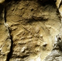
It is thought the first encampment was built during the bronze age and was modified at a couple of different times during the Iron Age. The northern rectangular enclosure is the most heavily defended with massive drystone walls thrown up all around particularly at the southern end where the walling is up to 8 metres high. There is the remains of what was once perhaps an entrance through the wall and several of the significant stones used in facing the wall have fossilised trilobites and other marine creatures in them.
It is signposted from nearby and there is a parking area provided a few hundred metres walk to the site. It is now regularly studied and being restored and the enclosed area is now a nature reserve with little signed walks.
")
The site generally consists of three enclosures, on a headland well protected on three sides by steep sided gorges cut by a couple of small streams.
The unprotected southern side has three ramparts of various size, dates and condition protecting the camp, the three ramparts not close together, and separating the three enclosures. It is thought the first encampment was built during the bronze age, and was modified at a couple of different times during the Iron Age.
The northern rectangular enclosure is the most heavily defended, with massive drystone walls thrown up all around, particularly at the southern end, where the walling is up to 8 metres high. There is the remains of what was once perhaps an entrance through the wall, and several of the significant stones used in facing the wall have fossilised trilobites and other marine creatures in them.
It is signposted from nearby, and there is a parking area provided a few hundred metres walk to the site. It is now regularly studied and being restored, and the enclosed area is now a nature reserve, with little signed walks.
More at FOCA
IMPORTANT NOTE: Positional co-ordinates taken from a gps reciever
You may be viewing yesterday's version of this page. To see the most up to date information please register for a free account.
")
Do not use the above information on other web sites or publications without permission of the contributor.
Click here to see more info for this site
Nearby sites
Click here to view sites on an interactive map of the areaKey: Red: member's photo, Blue: 3rd party photo, Yellow: other image, Green: no photo - please go there and take one, Grey: site destroyed
Download sites to:
KML (Google Earth)
GPX (GPS waypoints)
CSV (Garmin/Navman)
CSV (Excel)
To unlock full downloads you need to sign up as a Contributory Member. Otherwise downloads are limited to 50 sites.
Turn off the page maps and other distractions
Nearby sites listing. In the following links * = Image available
4.5km ENE 58° Dolmen dit Pierre-Levée (Fontaine)* Burial Chamber or Dolmen
6.2km E 81° Trun menhir Standing Stone (Menhir)
7.9km ESE 117° Menhir dit Pierre du Bourdeu Standing Stone (Menhir)
8.2km S 175° Moulins-sur-Orne burial chamber Burial Chamber or Dolmen
8.6km WSW 249° Tumulus des Hogues* Round Barrow(s)
8.7km WSW 250° Dolmen dit Pierre-aux-Bignes* Burial Chamber or Dolmen
12.3km S 175° Sarceaux burial chamber Burial Chamber or Dolmen
13.4km SW 224° La Courbe Burial Chamber or Dolmen
13.5km SW 225° La Pierre Tournoire, La Courbe* Standing Stone (Menhir)
14.0km SW 225° Camp du Bas de la Courbe Ancient Village or Settlement
14.1km E 82° Dolmen du Boijos Burial Chamber or Dolmen
14.5km SW 224° Vieux Chateaux Ancient Village or Settlement
15.2km SW 229° Menhir de la Courbe* Standing Stone (Menhir)
15.6km SW 235° Crève-Coeur Menhir Standing Stone (Menhir)
15.6km SE 132° La Pierre-Levée (Bourge-Saint-Leonard) Standing Stone (Menhir)
16.1km SE 133° La Pierre Levée (Silly)* Standing Stone (Menhir)
16.2km NW 315° Menhir de Soulangy* Standing Stone (Menhir)
17.4km NNW 330° Menhir d'Olendon* Standing Stone (Menhir)
18.8km NW 323° Langrais menhirs* Standing Stones
19.5km NW 321° Bons Tassilly polissoirs* Polissoir
19.5km NW 305° Menhir de la Grurie* Standing Stone (Menhir)
19.5km NW 321° Mont Joly* Ancient Village or Settlement
20.2km W 265° Val d'Orne menhir Standing Stone (Menhir)
20.2km W 265° Pierre de la Roussellière* Standing Stone (Menhir)
21.4km NW 307° Pierre du Pôt* Standing Stone (Menhir)
View more nearby sites and additional images


 We would like to know more about this location. Please feel free to add a brief description and any relevant information in your own language.
 Wir möchten mehr über diese Stätte erfahren. Bitte zögern Sie nicht, eine kurze Beschreibung und relevante Informationen in Deutsch hinzuzufügen.
 Nous aimerions en savoir encore un peu sur les lieux. S'il vous plaît n'hesitez pas à ajouter une courte description et tous les renseignements pertinents dans votre propre langue.
 Quisieramos informarnos un poco más de las lugares. No dude en añadir una breve descripción y otros datos relevantes en su propio idioma.