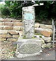
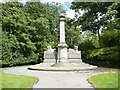
<< Our Photo Pages >> Samuel Laycock's Monument (Marsden) - Carving in England in Yorkshire (West)
Submitted by Anne T on Tuesday, 19 February 2019 Page Views: 1841
Multi-periodSite Name: Samuel Laycock's Monument (Marsden) Alternative Name: Carved Stone (Marsden Park)Country: England County: Yorkshire (West) Type: Carving
Nearest Town: Huddersfield Nearest Village: Marsden
Map Ref: SE0512011485
Latitude: 53.599909N Longitude: 1.924106W
Condition:
| 5 | Perfect |
| 4 | Almost Perfect |
| 3 | Reasonable but with some damage |
| 2 | Ruined but still recognisable as an ancient site |
| 1 | Pretty much destroyed, possibly visible as crop marks |
| 0 | No data. |
| -1 | Completely destroyed |
| 5 | Superb |
| 4 | Good |
| 3 | Ordinary |
| 2 | Not Good |
| 1 | Awful |
| 0 | No data. |
| 5 | Can be driven to, probably with disabled access |
| 4 | Short walk on a footpath |
| 3 | Requiring a bit more of a walk |
| 2 | A long walk |
| 1 | In the middle of nowhere, a nightmare to find |
| 0 | No data. |
| 5 | co-ordinates taken by GPS or official recorded co-ordinates |
| 4 | co-ordinates scaled from a detailed map |
| 3 | co-ordinates scaled from a bad map |
| 2 | co-ordinates of the nearest village |
| 1 | co-ordinates of the nearest town |
| 0 | no data |
Be the first person to rate this site - see the 'Contribute!' box in the right hand menu.
Internal Links:
External Links:
 (PID:77455)")
The Journal of Antiquities includes an entry for this Celtic-style carved stone to be found at the base of the memorial to poet Samuel Laycock - see their entry for the Medieval Stone Carving In Marsden Park, Marsden, West Yorkshire. The Journal tells us that whilst the carving looks, and has been described as being Celtic by local historians, it is likely to be medieval in origin, and may be as late as 14th to 16th century in date.
This Celtic sculpture is also recorded as part of Historic England List ID 1231655, which tells us this stone is "carved in low relief with a garland or crown of oak leaves, acorns and flowers. This stone was moved from another site in Marsden during the C19 and is believed to be Celtic in origin".
The Journal includes a photograph, a drawing of the motifs on the stone, a description and a list of reference sources for more information.
Note: Have you visited this site? Do you have any photographs or information to add? Do you know anything about the origin of this carved stone?
You may be viewing yesterday's version of this page. To see the most up to date information please register for a free account.
Do not use the above information on other web sites or publications without permission of the contributor.
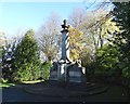
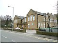
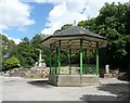
Nearby Images from Geograph Britain and Ireland:
©2013(licence)
©2008(licence)
©2008(licence)
©2008(licence)
©2008(licence)
The above images may not be of the site on this page, they are loaded from Geograph.
Please Submit an Image of this site or go out and take one for us!
Click here to see more info for this site
Nearby sites
Key: Red: member's photo, Blue: 3rd party photo, Yellow: other image, Green: no photo - please go there and take one, Grey: site destroyed
Download sites to:
KML (Google Earth)
GPX (GPS waypoints)
CSV (Garmin/Navman)
CSV (Excel)
To unlock full downloads you need to sign up as a Contributory Member. Otherwise downloads are limited to 50 sites.
Turn off the page maps and other distractions
Nearby sites listing. In the following links * = Image available
2.2km WSW 240° Pule Hill (Marsden) Cairn (SE03231039)
2.3km SW 233° Mount Rd stone* Marker Stone (SE033101)
3.0km SE 134° Rocking Stone (Meltham Moor) Natural Stone / Erratic / Other Natural Feature (SE07280944)
3.1km NE 37° Slaithwaite Cross Ancient Cross (SE0714)
3.7km SE 137° West Nab* Rock Outcrop (SE07670880)
3.7km WNW 291° March Hill Mesolithic Camp Ancient Village or Settlement (SE0163612804)
3.9km ESE 111° Oldfield Hill (Meltham) Ancient Village or Settlement (SE0874510097)
5.4km NNE 27° Rocking Stone (Golcar) Natural Stone / Erratic / Other Natural Feature (SE076163)
5.5km NNE 28° Whole Stone (Golcar) Natural Stone / Erratic / Other Natural Feature (SE077163)
5.5km WSW 244° Jackson's Barrow* Round Barrow(s) (SE00200905)
6.0km WNW 296° Way Stones (Moss Moor)* Natural Stone / Erratic / Other Natural Feature (SD997141)
6.0km N 359° Meg Dike Ancient Village or Settlement (SE04981749)
6.8km SSE 160° Black Hill Cairn (SE074051)
6.8km N 354° Ringstone Edge* Stone Circle (SE0443518251)
6.9km SSE 167° Holgate Howe Barrow Round Barrow(s) (SE067048)
7.0km WNW 300° Rocking Stone (Rishworth Moor) Natural Stone / Erratic / Other Natural Feature (SD990150)
7.2km S 170° Holgate Howe Cup & Ringmarks Rock Art (SE064044)
7.6km SSW 213° Pots and Pans Stone (Greenfield)* Natural Stone / Erratic / Other Natural Feature (SE0100805072)
7.9km NW 317° Cat Stones* Round Barrow(s) (SD99741727)
8.1km ENE 59° Crosland Moor Holy Well* Holy Well or Sacred Spring (SE121156)
8.2km NNE 27° St Helen's Well (Stainland) Holy Well or Sacred Spring (SE088188)
8.2km WSW 240° Delph Tumulus Round Barrow(s) (SD980074)
8.9km WNW 301° Blackstone Edge* Standing Stones (SD97521611)
8.9km WNW 301° Blackstone Edge* Rock Art (SD9741416007)
9.3km WNW 302° Robin Hood's Bed (Blackstone Edge) Natural Stone / Erratic / Other Natural Feature (SD9720416356)
View more nearby sites and additional images


 We would like to know more about this location. Please feel free to add a brief description and any relevant information in your own language.
 Wir möchten mehr über diese Stätte erfahren. Bitte zögern Sie nicht, eine kurze Beschreibung und relevante Informationen in Deutsch hinzuzufügen.
 Nous aimerions en savoir encore un peu sur les lieux. S'il vous plaît n'hesitez pas à ajouter une courte description et tous les renseignements pertinents dans votre propre langue.
 Quisieramos informarnos un poco más de las lugares. No dude en añadir una breve descripción y otros datos relevantes en su propio idioma.