<< Our Photo Pages >> Picnic Point Effigy Mounds - Artificial Mound in United States in Great Lakes Midwest
Submitted by stonetracker on Tuesday, 06 August 2024 Page Views: 931
Pre-ColumbianSite Name: Picnic Point Effigy Mounds Alternative Name: 47Da121Country: United States Region: Great Lakes Midwest Type: Artificial Mound
Nearest Town: Madison WI
Latitude: 43.085809N Longitude: 89.423055W
Condition:
| 5 | Perfect |
| 4 | Almost Perfect |
| 3 | Reasonable but with some damage |
| 2 | Ruined but still recognisable as an ancient site |
| 1 | Pretty much destroyed, possibly visible as crop marks |
| 0 | No data. |
| -1 | Completely destroyed |
| 5 | Superb |
| 4 | Good |
| 3 | Ordinary |
| 2 | Not Good |
| 1 | Awful |
| 0 | No data. |
| 5 | Can be driven to, probably with disabled access |
| 4 | Short walk on a footpath |
| 3 | Requiring a bit more of a walk |
| 2 | A long walk |
| 1 | In the middle of nowhere, a nightmare to find |
| 0 | No data. |
| 5 | co-ordinates taken by GPS or official recorded co-ordinates |
| 4 | co-ordinates scaled from a detailed map |
| 3 | co-ordinates scaled from a bad map |
| 2 | co-ordinates of the nearest village |
| 1 | co-ordinates of the nearest town |
| 0 | no data |
Internal Links:
External Links:
I have visited· I would like to visit
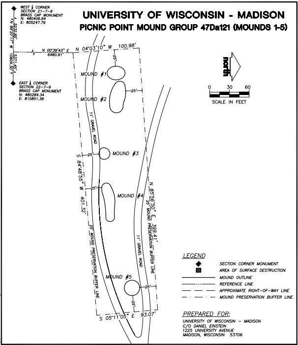
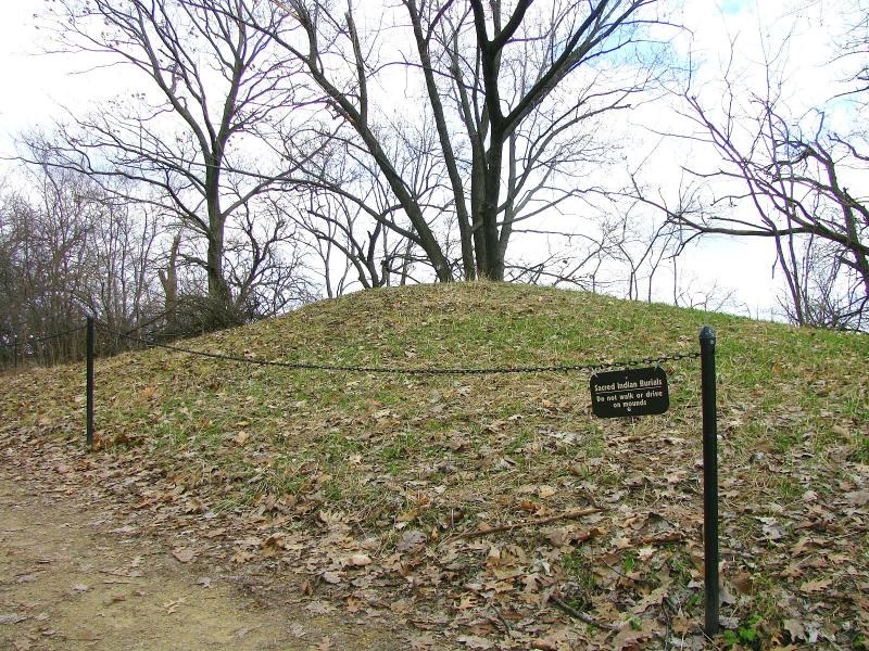
stonetracker visited on 1st Jul 2024 - their rating: Amb: 3 Access: 3 The mounds are on a peninsula in Lake Mendota on conservation land owned by the Univ of Wisc. They are accessible via the Lakeshore Trail. Parking is available at the trailhead for a fee. The first group of 5 mounds is about a 1/4 mile level walk from the lot, next to and just north of the trail. The last conical mound is another 600 ft east along the trail and just to its south.
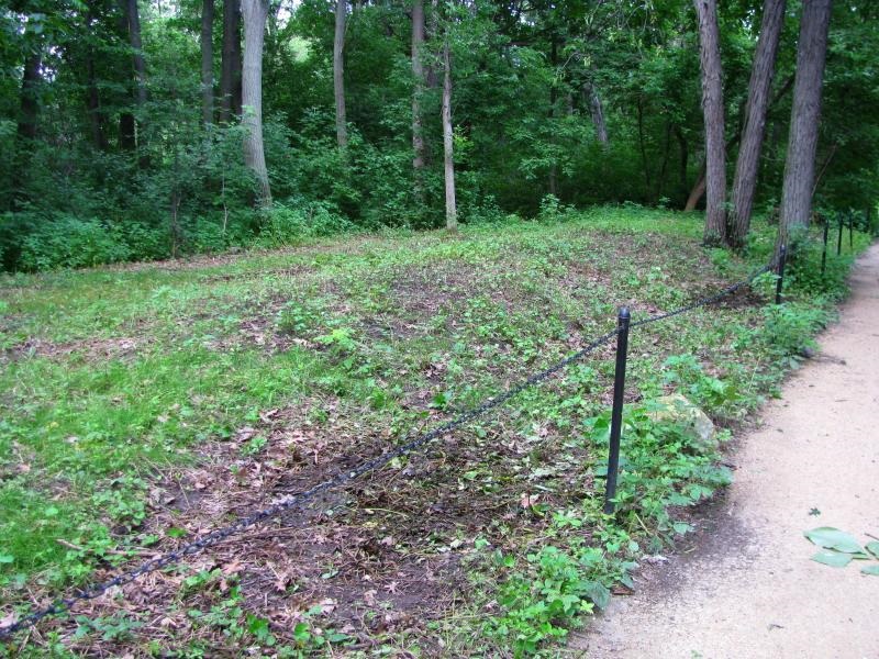
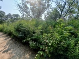
Unfortunately site maintenance seems to be cyclical at best. I was unable to find or positively identify any of the mounds due to summer overgrowth, suggesting that non growing seasons may present better viewing opportunities. There was also no obvious interpretation signage. However, Andrew Khitsun (the owner of the Wisconsin Mounds site) has posted a few photos with most of the overgrowth and some trees removed from the mounds. They are undated but I assume they are at least post-2000.
Obviously they have been better maintained in the past than currently.
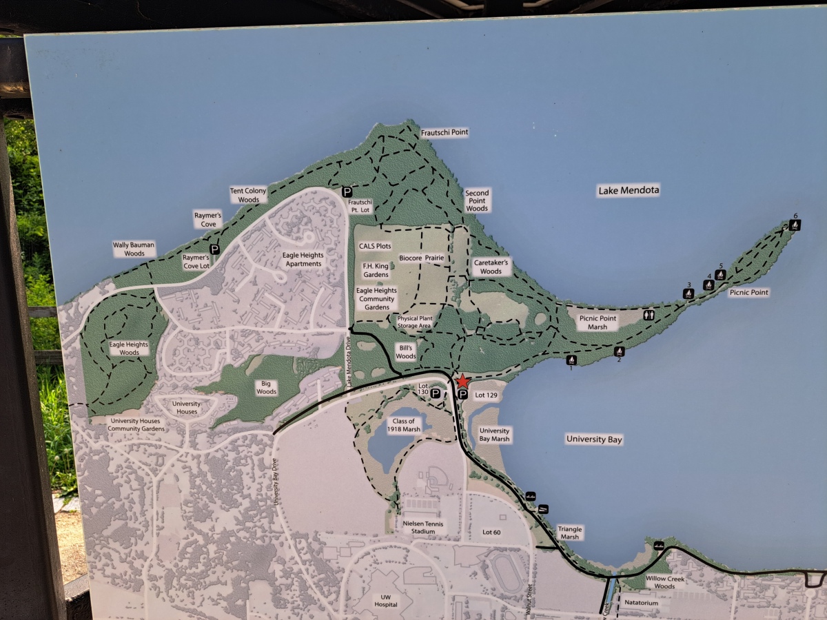
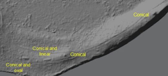
There once were seven mounds on Picnic Point, but one mound was destroyed prior to 1912 by relic hunters. Currently there are five extant mounds adjacent to the Lakeshore Path–across from Fire Circle #1. Three are conical, one is linear, and one oval. A sixth large conical mound about 600-700 ft east of the main group can be observed as you head out to the tip of the point, on the south side of the Lakeshore Path just before you reach the Narrows.
Source: Lakeshore Nature Preserve Website
You may be viewing yesterday's version of this page. To see the most up to date information please register for a free account.
Do not use the above information on other web sites or publications without permission of the contributor.
Click here to see more info for this site
Nearby sites
Click here to view sites on an interactive map of the areaKey: Red: member's photo, Blue: 3rd party photo, Yellow: other image, Green: no photo - please go there and take one, Grey: site destroyed
Download sites to:
KML (Google Earth)
GPX (GPS waypoints)
CSV (Garmin/Navman)
CSV (Excel)
To unlock full downloads you need to sign up as a Contributory Member. Otherwise downloads are limited to 50 sites.
Turn off the page maps and other distractions
Nearby sites listing. In the following links * = Image available
2.6km SSW 197° Forest Hill Cemetery* Artificial Mound
4.5km NNW 345° Governor Nelson State Park Effigy Mounds* Artificial Mound
4.9km ENE 68° Burrows Park Mound* Artificial Mound
5.3km NNE 23° Mendota Mental Health Institute Effigy Mounds* Artificial Mound
36.6km W 267° Circle Sanctuary Nature Preserve* Modern Stone Circle etc
38.4km W 267° Brighid's Spring at Circle Sanctuary* Holy Well or Sacred Spring
43.5km NNW 327° Devil's Lake Mounds* Artificial Mound
45.6km E 93° Aztalan State Park* Ancient Village or Settlement
48.0km ESE 119° Lake Koshkonong Mounds* Artificial Mound
49.1km NNW 336° Man Mound Park* Artificial Mound
49.8km ESE 118° The Finch Site Ancient Village or Settlement
72.3km SSE 154° Beloit College Mounds* Artificial Mound
73.0km NE 54° Nitschke Mounds State Park* Artificial Mound
94.3km SSE 163° Beattie Park Mound Group* Misc. Earthwork
97.0km E 95° Cutler Mound Group* Artificial Mound
112.1km ENE 68° Lizard Mound State Park* Artificial Mound
112.5km WNW 287° Tainter Cave Cave or Rock Shelter
119.4km WSW 237° Dunleith Mounds* Artificial Mound
129.7km W 274° Larsen Cave, Crawford Co* Rock Art
130.6km NNW 337° Cranberry Creek Mound Group Artificial Mound
137.3km ESE 107° Mound Cemetery (Racine) Barrow Cemetery
138.0km W 266° Wyalusing Mounds* Artificial Mound
138.7km SSW 205° Thomson Causeway Artificial Mound
141.9km W 267° Pikes Peak State Park Effigy Mounds* Artificial Mound
143.1km W 271° Effigy Mounds National Monument* Artificial Mound
View more nearby sites and additional images


 We would like to know more about this location. Please feel free to add a brief description and any relevant information in your own language.
 Wir möchten mehr über diese Stätte erfahren. Bitte zögern Sie nicht, eine kurze Beschreibung und relevante Informationen in Deutsch hinzuzufügen.
 Nous aimerions en savoir encore un peu sur les lieux. S'il vous plaît n'hesitez pas à ajouter une courte description et tous les renseignements pertinents dans votre propre langue.
 Quisieramos informarnos un poco más de las lugares. No dude en añadir una breve descripción y otros datos relevantes en su propio idioma.