

<< Text Pages >> Calverley Grounds - Standing Stones in England in Kent
Submitted by Andy B on Wednesday, 20 September 2006 Page Views: 8965
Neolithic and Bronze AgeSite Name: Calverley GroundsCountry: England
NOTE: This site is 0.833 km away from the location you searched for.
County: Kent Type: Standing Stones
Nearest Town: Tunbridge Wells
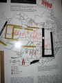
Map Ref: TQ588393
Latitude: 51.130965N Longitude: 0.268163E
Condition:
| 5 | Perfect |
| 4 | Almost Perfect |
| 3 | Reasonable but with some damage |
| 2 | Ruined but still recognisable as an ancient site |
| 1 | Pretty much destroyed, possibly visible as crop marks |
| 0 | No data. |
| -1 | Completely destroyed |
| 5 | Superb |
| 4 | Good |
| 3 | Ordinary |
| 2 | Not Good |
| 1 | Awful |
| 0 | No data. |
| 5 | Can be driven to, probably with disabled access |
| 4 | Short walk on a footpath |
| 3 | Requiring a bit more of a walk |
| 2 | A long walk |
| 1 | In the middle of nowhere, a nightmare to find |
| 0 | No data. |
| 5 | co-ordinates taken by GPS or official recorded co-ordinates |
| 4 | co-ordinates scaled from a detailed map |
| 3 | co-ordinates scaled from a bad map |
| 2 | co-ordinates of the nearest village |
| 1 | co-ordinates of the nearest town |
| 0 | no data |
Internal Links:
External Links:
I have visited· I would like to visit
JohRvs visited on 4th Mar 2018 - their rating: Cond: -1 Dog walk around the park with Helen. Standing Stones no longer exist.
We have been given the run around so far and told that there were no stones I have found at least 3 locals who remember them but no photos as yet. I wondered if anyone from this site may know anything or are interested in yet another mystery of Tunbridge Wells.
Kind Regards
Miranda Morland
Note: Do you know anything? Get in touch.
You may be viewing yesterday's version of this page. To see the most up to date information please register for a free account.
Do not use the above information on other web sites or publications without permission of the contributor.
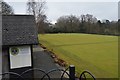
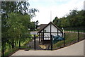
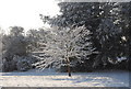
Nearby Images from Geograph Britain and Ireland:
©2017(licence)
©2011(licence)
©2010(licence)
©2013(licence)
©2010(licence)
The above images may not be of the site on this page, they are loaded from Geograph.
Please Submit an Image of this site or go out and take one for us!
Click here to see more info for this site
Nearby sites
Key: Red: member's photo, Blue: 3rd party photo, Yellow: other image, Green: no photo - please go there and take one, Grey: site destroyed
Download sites to:
KML (Google Earth)
GPX (GPS waypoints)
CSV (Garmin/Navman)
CSV (Excel)
To unlock full downloads you need to sign up as a Contributory Member. Otherwise downloads are limited to 50 sites.
Turn off the page maps and other distractions
Nearby sites listing. In the following links * = Image available
446m WNW 298° Tunbridge Wells Museum Museum (TQ584395)
817m WSW 237° Tunbridge Wells Chalybeate Spring* Holy Well or Sacred Spring (TQ58133883)
819m SW 234° Chalybeate Spring* Holy Well or Sacred Spring (TQ5815138798)
2.0km W 279° Toad Rock* Natural Stone / Erratic / Other Natural Feature (TQ5681539560)
2.0km W 277° Denny Bottom Rock Shelters Cave or Rock Shelter (TQ568395)
2.4km W 269° Happy Valley Cave or Rock Shelter (TQ564392)
2.8km WSW 254° High Rocks Rock Shelters* Cave or Rock Shelter (TQ56093842)
2.9km WSW 251° High Rocks Hillfort* Hillfort (TQ561383)
3.1km WSW 251° High Rocks Settlement Ancient Village or Settlement (TQ559382)
3.4km WSW 253° Adam's Well* Holy Well or Sacred Spring (TQ55623820)
4.9km NNE 25° Capel Castle Hill (Kent) Hillfort (TQ607438)
5.1km WSW 258° Harness Well Holy Well or Sacred Spring (TQ538381)
5.5km SSW 203° Eridge Old Park Caves and Spring Cave or Rock Shelter (TQ568342)
6.5km S 191° Saxonbury Fort Hillfort (TQ578329)
9.3km WNW 291° Stonewall Park Rock Shelters Cave or Rock Shelter (TQ49974241)
9.8km ESE 109° Lady Well (Lamberhurst)* Holy Well or Sacred Spring (TQ682364)
10.5km NW 305° The Chiding stone* Natural Stone / Erratic / Other Natural Feature (TQ50064509)
12.2km S 182° St Dunstan's Well Holy Well or Sacred Spring (TQ587271)
13.0km WSW 242° Lone Oak Spring Holy Well or Sacred Spring (TQ475328)
13.5km NE 43° Hob's pool Holy Well or Sacred Spring (TQ678494)
13.9km WSW 237° Greenwood Gate Clump Enclosure Ancient Village or Settlement (TQ47373127)
14.0km WSW 241° A.A.Milne & E.H.Shephard Memorial* Modern Stone Circle etc (TQ468321)
14.1km N 9° Plaxtol Not Known (by us) (TQ605533)
14.2km ESE 112° Lady well (Bedgebury) Holy Well or Sacred Spring (TQ7212534404)
14.3km ESE 113° The Lady's Well (Bedgebury) Holy Well or Sacred Spring (TQ72133414)
View more nearby sites and additional images


 We would like to know more about this location. Please feel free to add a brief description and any relevant information in your own language.
 Wir möchten mehr über diese Stätte erfahren. Bitte zögern Sie nicht, eine kurze Beschreibung und relevante Informationen in Deutsch hinzuzufügen.
 Nous aimerions en savoir encore un peu sur les lieux. S'il vous plaît n'hesitez pas à ajouter une courte description et tous les renseignements pertinents dans votre propre langue.
 Quisieramos informarnos un poco más de las lugares. No dude en añadir una breve descripción y otros datos relevantes en su propio idioma.