


<< Our Photo Pages >> Wadsley Common - Stone Circle in England in Yorkshire (South)
Submitted by Andy B on Friday, 30 March 2012 Page Views: 11702
Neolithic and Bronze AgeSite Name: Wadsley CommonCountry: England County: Yorkshire (South) Type: Stone Circle
Nearest Town: Sheffield Nearest Village: Wadsley
Map Ref: SK312906
Latitude: 53.411295N Longitude: 1.532099W
Condition:
| 5 | Perfect |
| 4 | Almost Perfect |
| 3 | Reasonable but with some damage |
| 2 | Ruined but still recognisable as an ancient site |
| 1 | Pretty much destroyed, possibly visible as crop marks |
| 0 | No data. |
| -1 | Completely destroyed |
| 5 | Superb |
| 4 | Good |
| 3 | Ordinary |
| 2 | Not Good |
| 1 | Awful |
| 0 | No data. |
| 5 | Can be driven to, probably with disabled access |
| 4 | Short walk on a footpath |
| 3 | Requiring a bit more of a walk |
| 2 | A long walk |
| 1 | In the middle of nowhere, a nightmare to find |
| 0 | No data. |
| 5 | co-ordinates taken by GPS or official recorded co-ordinates |
| 4 | co-ordinates scaled from a detailed map |
| 3 | co-ordinates scaled from a bad map |
| 2 | co-ordinates of the nearest village |
| 1 | co-ordinates of the nearest town |
| 0 | no data |
Internal Links:
External Links:
I have visited· I would like to visit
Andy B has visited here
")
They continue: "We were very excited to see a small circle of stones appearing on one of the drawings from the measurements made on the ground. This doesn't mean we have definitely discovered a Neolithic stone circle, but it does mean there is an interesting feature which merits further examination. Much more measuring will have to be done and experts will have to examine the resulting data before we can say what this circle of old stones is, but it was very interesting!"
More details below and on the Wadsley and Loxley Commoners' web site
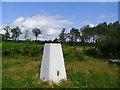
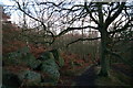
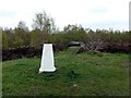
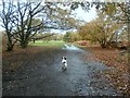
IMPORTANT NOTE: The location given is just for the common, not the circle itself
You may be viewing yesterday's version of this page. To see the most up to date information please register for a free account.
")
Do not use the above information on other web sites or publications without permission of the contributor.
Nearby Images from Geograph Britain and Ireland:

©2021(licence)
©2014(licence)
©2008(licence)
©2012(licence)
©2016(licence)
The above images may not be of the site on this page, they are loaded from Geograph.
Please Submit an Image of this site or go out and take one for us!
Click here to see more info for this site
Nearby sites
Key: Red: member's photo, Blue: 3rd party photo, Yellow: other image, Green: no photo - please go there and take one, Grey: site destroyed
Download sites to:
KML (Google Earth)
GPX (GPS waypoints)
CSV (Garmin/Navman)
CSV (Excel)
To unlock full downloads you need to sign up as a Contributory Member. Otherwise downloads are limited to 50 sites.
Turn off the page maps and other distractions
Nearby sites listing. In the following links * = Image available
4.3km SE 141° Weston Park Museum* Museum (SK3389487292)
4.9km WNW 294° St Nicholas (Bradfield) Ancient Cross (SK26729254)
5.4km NE 50° Ecclesfield* Ancient Cross (SK353941)
5.4km N 358° Burnt Hill Plantation* Rock Art (SK310960)
5.5km N 353° Dragon Well (Wharncliffe) Holy Well or Sacred Spring (SK305961)
5.9km SW 225° Ash Cabin Fort* Hillfort (SK271864)
5.9km SW 225° Ash Cabin standing stone* Standing Stone (Menhir) (SK270864)
6.1km SW 225° Ash Cabin Flat* Stone Circle (SK2693186251)
6.2km SW 233° Reddicar Clough (Hallam Moor) Cairn (SK26248688)
6.2km NNE 21° Robin Hood Well (Yorkshire South)* Holy Well or Sacred Spring (SK334964)
6.3km NW 305° Handsome Cross Ancient Cross (SK26019412)
6.4km WSW 237° New Hagg (Hallam Moors)* Standing Stone (Menhir) (SK2581587058)
6.6km E 87° Wincobank* Vitrified Fort (SK378910)
6.8km ESE 106° Darnall Common* Modern Stone Circle etc (SK378887)
7.0km NNW 336° Dragon's Well (Bolsterstone) Holy Well or Sacred Spring (SK28279697)
7.6km S 170° Ecclesall Woods* Rock Art (SK326831)
7.7km WNW 303° Bar Dyke (Yorkshire)* Misc. Earthwork (SK247947)
7.8km NNW 345° Deepcar Mesolithic Settlement* Ancient Village or Settlement (SK291981)
7.8km WNW 301° Bar Dyke Ring* Ring Cairn (SK245946)
7.8km WNW 301° Apronful of Stones (Bradfield) Cairn (SK2448094582)
7.9km NE 47° St. Helen's Well (Thorpe Hesley) Holy Well or Sacred Spring (SK370960)
8.7km SSW 200° Harrys Stone* Ancient Temple (SK282824)
9.0km SSW 199° God's Spring* Holy Well or Sacred Spring (SK283821)
9.4km SSW 193° Giant's Chair (Yorkshire)* Standing Stone (Menhir) (SK291814)
9.5km ENE 61° Scholes Wood* Hillfort (SK395952)
View more nearby sites and additional images


 We would like to know more about this location. Please feel free to add a brief description and any relevant information in your own language.
 Wir möchten mehr über diese Stätte erfahren. Bitte zögern Sie nicht, eine kurze Beschreibung und relevante Informationen in Deutsch hinzuzufügen.
 Nous aimerions en savoir encore un peu sur les lieux. S'il vous plaît n'hesitez pas à ajouter une courte description et tous les renseignements pertinents dans votre propre langue.
 Quisieramos informarnos un poco más de las lugares. No dude en añadir una breve descripción y otros datos relevantes en su propio idioma.