 with our Megalithic Portal iPhone app")


<< Our Photo Pages >> Dun Mhuirageul - Stone Fort or Dun in Scotland in Argyll
Submitted by SolarMegalith on Thursday, 09 February 2023 Page Views: 403
Iron Age and Later PrehistorySite Name: Dun MhuirageulCountry: Scotland County: Argyll Type: Stone Fort or Dun
Nearest Town: Taynuilt
Map Ref: NN01323008
Latitude: 56.420994N Longitude: 5.222879W
Condition:
| 5 | Perfect |
| 4 | Almost Perfect |
| 3 | Reasonable but with some damage |
| 2 | Ruined but still recognisable as an ancient site |
| 1 | Pretty much destroyed, possibly visible as crop marks |
| 0 | No data. |
| -1 | Completely destroyed |
| 5 | Superb |
| 4 | Good |
| 3 | Ordinary |
| 2 | Not Good |
| 1 | Awful |
| 0 | No data. |
| 5 | Can be driven to, probably with disabled access |
| 4 | Short walk on a footpath |
| 3 | Requiring a bit more of a walk |
| 2 | A long walk |
| 1 | In the middle of nowhere, a nightmare to find |
| 0 | No data. |
| 5 | co-ordinates taken by GPS or official recorded co-ordinates |
| 4 | co-ordinates scaled from a detailed map |
| 3 | co-ordinates scaled from a bad map |
| 2 | co-ordinates of the nearest village |
| 1 | co-ordinates of the nearest town |
| 0 | no data |
Internal Links:
External Links:
I have visited· I would like to visit
SolarMegalith visited on 4th Sep 2022 - their rating: Cond: 2 Amb: 4 Access: 3
")
This small dun occupies a heavily overgrown rocky knoll south of Taynuilt. The walls are built of particularly large and mostly moss-covered stones. There are two gaps in the wall, one of them probably constitutes an entrance.
Canmore entry
You may be viewing yesterday's version of this page. To see the most up to date information please register for a free account.
")
")
Do not use the above information on other web sites or publications without permission of the contributor.
Nearby Images from Geograph Britain and Ireland:
©2014(licence)
©2010(licence)
©2018(licence)
©2014(licence)
©2006(licence)
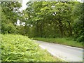
The above images may not be of the site on this page, they are loaded from Geograph.
Please Submit an Image of this site or go out and take one for us!
Click here to see more info for this site
Nearby sites
Key: Red: member's photo, Blue: 3rd party photo, Yellow: other image, Green: no photo - please go there and take one, Grey: site destroyed
Download sites to:
KML (Google Earth)
GPX (GPS waypoints)
CSV (Garmin/Navman)
CSV (Excel)
To unlock full downloads you need to sign up as a Contributory Member. Otherwise downloads are limited to 50 sites.
Turn off the page maps and other distractions
Nearby sites listing. In the following links * = Image available
1.1km N 351° Taynault (Lorn)* Standing Stone (Menhir) (NN01203115)
1.3km NW 319° Nelson's monument, Taynuilt* Standing Stone (Menhir) (NN00513109)
2.4km N 9° Dun Leigh* Stone Fort or Dun (NN01813243)
6.0km NW 308° Dun Chathach (Connel) Hillfort (NM96743401)
6.4km NW 316° Ardchattan Priory* Sculptured Stone (NM971349)
7.6km WSW 252° Clachadow* Cairn (NM93932806)
7.7km SE 145° Holy stone* Rock Art (NN0539923584)
8.6km WSW 256° Glenamacrie Dun* Stone Fort or Dun (NM92862836)
8.9km WSW 257° Clenamacrie Stone Row* Stone Row / Alignment (NM9251128550)
9.0km WSW 257° Glenamacrie Farm* Cairn (NM92452854)
9.0km NNE 21° Muirheadstone* Natural Stone / Erratic / Other Natural Feature (NN050383)
9.1km S 171° Auchachenna* Chambered Cairn (NN02372106)
9.1km NW 309° Achnaba A* Cairn (NM94453616)
9.2km NW 310° Achnaba B* Cairn (NM94533626)
9.2km NW 311° Achnaba E* Cairn (NM94593639)
9.3km W 259° Glenamachrie Cairn* Cairn (NM92132870)
9.4km NW 309° Achnaba D* Cairn (NM94283631)
9.5km NW 308° Achnaba C* Cairn (NM94093630)
9.8km W 274° Kilvaree standing stone* Standing Stone (Menhir) (NM91553124)
10.0km S 173° Rubha Barr Challtuinn* Cairn (NN021201)
10.2km SSE 156° Port Sonachan* Chambered Cairn (NN050206)
10.4km WNW 290° Connel Station (Oban) Standing Stone (Menhir) (NM91693408)
10.4km NW 304° Achnacreebeag* Chambered Cairn (NM92963639)
10.6km W 261° Diarmid's Grave* Cairn (NM9077828950)
10.6km W 261° Clach na Carraig* Standing Stone (Menhir) (NM9076728957)
View more nearby sites and additional images


 We would like to know more about this location. Please feel free to add a brief description and any relevant information in your own language.
 Wir möchten mehr über diese Stätte erfahren. Bitte zögern Sie nicht, eine kurze Beschreibung und relevante Informationen in Deutsch hinzuzufügen.
 Nous aimerions en savoir encore un peu sur les lieux. S'il vous plaît n'hesitez pas à ajouter une courte description et tous les renseignements pertinents dans votre propre langue.
 Quisieramos informarnos un poco más de las lugares. No dude en añadir una breve descripción y otros datos relevantes en su propio idioma.