 with our Megalithic Portal iPhone app")


<< Our Photo Pages >> Glenshellach - Rock Art in Scotland in Argyll
Submitted by caradoc68 on Tuesday, 24 January 2012 Page Views: 3684
Rock ArtSite Name: GlenshellachCountry: Scotland
NOTE: This site is 1.499 km away from the location you searched for.
County: Argyll Type: Rock Art
Nearest Town: Oban
Map Ref: NM8459027055
Latitude: 56.386532N Longitude: 5.491095W
Condition:
| 5 | Perfect |
| 4 | Almost Perfect |
| 3 | Reasonable but with some damage |
| 2 | Ruined but still recognisable as an ancient site |
| 1 | Pretty much destroyed, possibly visible as crop marks |
| 0 | No data. |
| -1 | Completely destroyed |
| 5 | Superb |
| 4 | Good |
| 3 | Ordinary |
| 2 | Not Good |
| 1 | Awful |
| 0 | No data. |
| 5 | Can be driven to, probably with disabled access |
| 4 | Short walk on a footpath |
| 3 | Requiring a bit more of a walk |
| 2 | A long walk |
| 1 | In the middle of nowhere, a nightmare to find |
| 0 | No data. |
| 5 | co-ordinates taken by GPS or official recorded co-ordinates |
| 4 | co-ordinates scaled from a detailed map |
| 3 | co-ordinates scaled from a bad map |
| 2 | co-ordinates of the nearest village |
| 1 | co-ordinates of the nearest town |
| 0 | no data |
Internal Links:
External Links:
")
NM84612702 and NM84582706.
Cup marked Stones (NR).
OS 1:10,000 map, (1976)
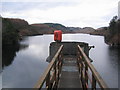
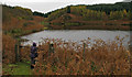
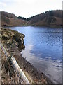
About half way along the north side of Loch Gleann a' Bhearraidh there is a granite boulder (1) 2.1 by 1.8m and 0.6m high. Lying in the water just offshore, it is normally visible but on occasions is submerged. On its level upper surface there are twelve plain cups measuring up to 80mm in diameter and 20mm in depth.
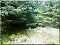
About 38m to the NW of (1) just outside the reservoir boundary fence is a small stone (2) 1.2 by 1.2m and 0.6m high. On its top is a single cup mark 50mm in diameter and 25mm deep.
RCAHMS 1975, visited May 1970; information from TS of R W Morris (visited September 1967)
You may be viewing yesterday's version of this page. To see the most up to date information please register for a free account.
")
Do not use the above information on other web sites or publications without permission of the contributor.
Nearby Images from Geograph Britain and Ireland:
©2006(licence)
©2011(licence)
©2006(licence)
©2015(licence)
©2009(licence)
The above images may not be of the site on this page, they are loaded from Geograph.
Please Submit an Image of this site or go out and take one for us!
Click here to see more info for this site
Nearby sites
Key: Red: member's photo, Blue: 3rd party photo, Yellow: other image, Green: no photo - please go there and take one, Grey: site destroyed
Download sites to:
KML (Google Earth)
GPX (GPS waypoints)
CSV (Garmin/Navman)
CSV (Excel)
To unlock full downloads you need to sign up as a Contributory Member. Otherwise downloads are limited to 50 sites.
Turn off the page maps and other distractions
Nearby sites listing. In the following links * = Image available
1.0km ENE 73° Ariogan Cairn* Cairn (NM85602731)
1.8km WSW 243° Dun Ormidale* Stone Fort or Dun (NM82902630)
2.5km WSW 242° Dun Gallanach* Stone Fort or Dun (NM823260)
2.9km S 178° Dunan Molach Stone Fort or Dun (NM84522416)
3.4km E 91° Dalinaneun Farm Cairn 3 Cairn (NM880268)
3.4km E 91° Serpent Mound - Loch Nell* Artificial Mound (NM880268)
3.4km E 93° Dalineun* Chambered Tomb (NM8799326710)
3.5km E 82° Killiechonich* Rock Art (NM88082736)
3.6km NW 313° Sidhean Riabhach* Cist (NM82092959)
3.6km E 99° Moleigh* Cairn (NM88082631)
3.6km ESE 103° Possible cairn at Kilmore* Cairn (NM88092609)
3.6km NNE 19° Macarthur Cave, Oban* Cave or Rock Shelter (NM85923043)
3.7km ESE 104° Dalinaneun Farm Cairn 2* Cairn (NM881260)
3.7km ESE 104° Cleigh* Misc. Earthwork (NM88112602)
3.8km E 94° Barnacarry* Crannog (NM88362662)
3.8km ESE 114° Cnoc Buidhe* Cairn (NM88032532)
3.9km NW 316° Slatrach Cairn Cairn (NM82043002)
4.0km ESE 113° Kilmore Cairn* Cairn (NM88172533)
4.0km N 7° Oban cup marked stone* Rock Art (NM85243097)
4.1km ESE 114° Kilmore House* Cairn (NM88292515)
4.5km N 5° Dunollie Stone Fort or Dun (NM85223148)
4.8km NNE 27° Pennyfuir Cairn Cairn (NM86993128)
5.0km ENE 72° Skull Shaped Stone - Loch Nell* Natural Stone / Erratic / Other Natural Feature (NM8939628383)
5.3km ENE 76° Rubha Na Moine* Crannog (NM89812807)
5.4km SSW 200° Kilninver Standing Stone (Menhir) (NM82502207)
View more nearby sites and additional images


 We would like to know more about this location. Please feel free to add a brief description and any relevant information in your own language.
 Wir möchten mehr über diese Stätte erfahren. Bitte zögern Sie nicht, eine kurze Beschreibung und relevante Informationen in Deutsch hinzuzufügen.
 Nous aimerions en savoir encore un peu sur les lieux. S'il vous plaît n'hesitez pas à ajouter une courte description et tous les renseignements pertinents dans votre propre langue.
 Quisieramos informarnos un poco más de las lugares. No dude en añadir una breve descripción y otros datos relevantes en su propio idioma.