


<< Our Photo Pages >> The Duck's Mouth - Holy Well or Sacred Spring in England in Nottinghamshire
Submitted by HOLYWELL on Monday, 18 February 2008 Page Views: 5099
Springs and Holy WellsSite Name: The Duck's MouthCountry: England
NOTE: This site is 4.281 km away from the location you searched for.
County: Nottinghamshire Type: Holy Well or Sacred Spring
Nearest Town: Tuxford Nearest Village: Laxton
Map Ref: SK724667
Latitude: 53.192468N Longitude: 0.917826W
Condition:
| 5 | Perfect |
| 4 | Almost Perfect |
| 3 | Reasonable but with some damage |
| 2 | Ruined but still recognisable as an ancient site |
| 1 | Pretty much destroyed, possibly visible as crop marks |
| 0 | No data. |
| -1 | Completely destroyed |
| 5 | Superb |
| 4 | Good |
| 3 | Ordinary |
| 2 | Not Good |
| 1 | Awful |
| 0 | No data. |
| 5 | Can be driven to, probably with disabled access |
| 4 | Short walk on a footpath |
| 3 | Requiring a bit more of a walk |
| 2 | A long walk |
| 1 | In the middle of nowhere, a nightmare to find |
| 0 | No data. |
| 5 | co-ordinates taken by GPS or official recorded co-ordinates |
| 4 | co-ordinates scaled from a detailed map |
| 3 | co-ordinates scaled from a bad map |
| 2 | co-ordinates of the nearest village |
| 1 | co-ordinates of the nearest town |
| 0 | no data |
Internal Links:
External Links:
")
The Duck's Mouth is probably one of the strangest names from an ancient spring. Sadly it is not much to look at, looking like a field drain ( which is all that it is practically, hence the low rating, as I would think the original site had been destroyed as there is no sign of any ancient works.). Water trickles out constantly and is said to be very cold even in the summer by some local residents. It obviously has flowed out at some rate during other times of the year or in the past because a deep gully has been formed from it. The water itself is also believed to be medicinal. Does the name suggest some 'pagan' origin?
Laxton of course is famous for the open field system which survives only here. I would not make a special journey for the spring but there is enough to look at in the village ( church, motte and bailey, etc )
You may be viewing yesterday's version of this page. To see the most up to date information please register for a free account.
")
Do not use the above information on other web sites or publications without permission of the contributor.
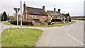
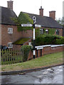
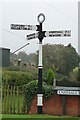
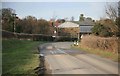
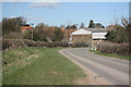
Nearby Images from Geograph Britain and Ireland:
©2016(licence)
©2014(licence)
©2019(licence)
©2010(licence)
©2011(licence)
The above images may not be of the site on this page, they are loaded from Geograph.
Please Submit an Image of this site or go out and take one for us!
Click here to see more info for this site
Nearby sites
Key: Red: member's photo, Blue: 3rd party photo, Yellow: other image, Green: no photo - please go there and take one, Grey: site destroyed
Download sites to:
KML (Google Earth)
GPX (GPS waypoints)
CSV (Garmin/Navman)
CSV (Excel)
To unlock full downloads you need to sign up as a Contributory Member. Otherwise downloads are limited to 50 sites.
Turn off the page maps and other distractions
Nearby sites listing. In the following links * = Image available
3.4km N 11° Holy well ( Tuxford ) Holy Well or Sacred Spring (SK7370)
5.1km NNE 25° Holy well (Tuxford) Holy Well or Sacred Spring (SK745714)
7.9km NNE 32° Kingshaugh* Hillfort (SK765735)
10.4km ESE 105° Besthorpe Ancient Village or Settlement (SK825641)
11.0km WNW 293° Budby Barrow* Round Barrow(s) (SK62187087)
11.5km NNE 13° Lady well (Headon)* Holy Well or Sacred Spring (SK7483877954)
12.5km W 278° Thynghowe* Artificial Mound (SK59936834)
13.1km S 191° Southwell Minster* Early Christian Sculptured Stone (SK70165378)
13.7km SE 128° Langford, Brough and Glebe Farm sites on the A46* Ancient Village or Settlement (SK833584)
14.0km SSW 197° St Catherine's Well (Westthorpe)* Holy Well or Sacred Spring (SK68565327)
14.0km N 8° Castle Hill (Nottinghamshire) Hillfort (SK741806)
14.3km S 174° Holy Trinity (Rolleston)* Ancient Cross (SK7418552503)
14.3km S 174° Rolleston Cross* Ancient Cross (SK7418052489)
14.7km SW 215° Hart's Well* Holy Well or Sacred Spring (SK6415254451)
14.8km SW 219° Combs Camp Hillfort (SK63145512)
15.5km SSE 154° Farndon Fields* Natural Stone / Erratic / Other Natural Feature (SK794528)
16.1km N 1° St John's Well (Welham) Holy Well or Sacred Spring (SK72558280)
16.1km SW 214° Oldox Camp* Hillfort (SK635532)
17.6km SW 232° Ashwell (Blidworth) Holy Well or Sacred Spring (SK586558)
18.1km SW 235° The Druid Stone (Blidworth)* Natural Stone / Erratic / Other Natural Feature (SK577560)
18.3km WSW 255° The Lady Well (Mansfield) Holy Well or Sacred Spring (SK548616)
18.4km W 269° Sookholme Bath* Holy Well or Sacred Spring (SK5466)
18.4km WSW 239° Friar Tuck's Well* Holy Well or Sacred Spring (SK568569)
18.5km SSE 159° Hawton Cursus Cursus (SK79294949)
19.8km S 170° Willow Rundle Spring* Holy Well or Sacred Spring (SK7602047230)
View more nearby sites and additional images


 We would like to know more about this location. Please feel free to add a brief description and any relevant information in your own language.
 Wir möchten mehr über diese Stätte erfahren. Bitte zögern Sie nicht, eine kurze Beschreibung und relevante Informationen in Deutsch hinzuzufügen.
 Nous aimerions en savoir encore un peu sur les lieux. S'il vous plaît n'hesitez pas à ajouter une courte description et tous les renseignements pertinents dans votre propre langue.
 Quisieramos informarnos un poco más de las lugares. No dude en añadir una breve descripción y otros datos relevantes en su propio idioma.