


<< Text Pages >> Green Castle 1 - Rock Art in England in Northumberland
Submitted by Anne T on Wednesday, 14 March 2018 Page Views: 1108
Rock ArtSite Name: Green Castle 1 Alternative Name: ERA-159; Beckensall 984Country: England County: Northumberland Type: Rock Art
Nearest Town: Wooler Nearest Village: Humbleton / Kirknewton
Map Ref: NT9784227949
Latitude: 55.545245N Longitude: 2.035757W
Condition:
| 5 | Perfect |
| 4 | Almost Perfect |
| 3 | Reasonable but with some damage |
| 2 | Ruined but still recognisable as an ancient site |
| 1 | Pretty much destroyed, possibly visible as crop marks |
| 0 | No data. |
| -1 | Completely destroyed |
| 5 | Superb |
| 4 | Good |
| 3 | Ordinary |
| 2 | Not Good |
| 1 | Awful |
| 0 | No data. |
| 5 | Can be driven to, probably with disabled access |
| 4 | Short walk on a footpath |
| 3 | Requiring a bit more of a walk |
| 2 | A long walk |
| 1 | In the middle of nowhere, a nightmare to find |
| 0 | No data. |
| 5 | co-ordinates taken by GPS or official recorded co-ordinates |
| 4 | co-ordinates scaled from a detailed map |
| 3 | co-ordinates scaled from a bad map |
| 2 | co-ordinates of the nearest village |
| 1 | co-ordinates of the nearest town |
| 0 | no data |
Be the first person to rate this site - see the 'Contribute!' box in the right hand menu.
Internal Links:
External Links:
Rock Art in Northumberland
This rock art panel was recorded by Beckensall as having four cups. The rock was not located in the recent NADRAP survey. For more information see England's Rock Art entry for ERA-159 Green Castle 1, which includes a brief description, and photographs and a drawing from the Beckensall Archive.
The original Beckensall record can be found at Internet Archive: Beckensall 984 Green Castle 1.
Please note this rock art panel is located on private land.
Note: Have you found this rock art panel? Do you have an accurate grid reference, photographs or information to add?
You may be viewing yesterday's version of this page. To see the most up to date information please register for a free account.
Do not use the above information on other web sites or publications without permission of the contributor.
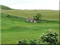
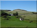
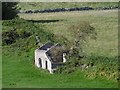
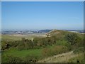
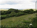
Nearby Images from Geograph Britain and Ireland:
©2012(licence)
©2016(licence)
©2016(licence)
©2016(licence)
©2019(licence)
The above images may not be of the site on this page, they are loaded from Geograph.
Please Submit an Image of this site or go out and take one for us!
Click here to see more info for this site
Nearby sites
Key: Red: member's photo, Blue: 3rd party photo, Yellow: other image, Green: no photo - please go there and take one, Grey: site destroyed
Download sites to:
KML (Google Earth)
GPX (GPS waypoints)
CSV (Garmin/Navman)
CSV (Excel)
To unlock full downloads you need to sign up as a Contributory Member. Otherwise downloads are limited to 50 sites.
Turn off the page maps and other distractions
Nearby sites listing. In the following links * = Image available
345m E 100° Green Castle 2 Rock Art (NT9818227887)
350m ESE 106° Green Castle Ringwork* Misc. Earthwork (NT9818027853)
802m NE 54° Highburn House 1 Rock Art (NT9849128424)
901m SE 136° The Kettles (Wooler)* Hillfort (NT98472730)
1.1km SE 141° Maiden Well (Kettle Hill)* Holy Well or Sacred Spring (NT9856427053)
1.2km WNW 285° Humbleton Hill* Hillfort (NT9670628252)
1.2km SE 137° Maiden Well (Northumberland) Holy Well or Sacred Spring (NT9866427082)
1.3km ENE 59° Tankerville Arms Hotel Cist* Cist (NT9894328604)
1.3km ENE 61° Tankerville Arms Cist* Cist (NT990286)
1.5km E 84° Wooler Cottage Wall Rock Art (NT993281)
1.8km NW 326° Bendor Stone* Standing Stone (Menhir) (NT9681929460)
2.2km SSW 208° Hart Heugh* Stone Circle (NT968260)
2.3km WNW 284° Harehope Hill* Hillfort (NT956285)
2.8km ENE 56° Weetwood Bridge Portable Rock Art (NU0018029500)
3.1km SSW 192° Carey Burn (Harthope Valley)* Ancient Village or Settlement (NT97172491)
3.1km E 92° Coldmartin 3 Rock Art (NU0095827816)
3.1km E 92° Coldmartin 2* Rock Art (NU0097627830)
3.2km WNW 291° White Law Hillfort (NT949291)
3.2km E 88° Coldmartin 4* Rock Art (NU0100628049)
3.2km E 89° Coldmartin 1* Rock Art (NU0103428019)
3.2km WNW 289° Gleads Cleugh Hillfort (NT948290)
3.2km ESE 109° Coldmartin Tower Rock Art (NU0090026910)
3.4km NW 325° West Akeld Steads Henge Henge (NT95883070)
3.5km E 84° Weetwood Moor North ab, ad & ae Rock Art (NU0130028300)
3.5km E 84° Weetwood Moor North B* Rock Art (NU0132028328)
View more nearby sites and additional images


 We would like to know more about this location. Please feel free to add a brief description and any relevant information in your own language.
 Wir möchten mehr über diese Stätte erfahren. Bitte zögern Sie nicht, eine kurze Beschreibung und relevante Informationen in Deutsch hinzuzufügen.
 Nous aimerions en savoir encore un peu sur les lieux. S'il vous plaît n'hesitez pas à ajouter une courte description et tous les renseignements pertinents dans votre propre langue.
 Quisieramos informarnos un poco más de las lugares. No dude en añadir una breve descripción y otros datos relevantes en su propio idioma.