


<< Text Pages >> Whitewall Nook Enclosure - Ancient Village or Settlement in England in Northumberland
Submitted by coldrum on Saturday, 03 May 2008 Page Views: 3494
Multi-periodSite Name: Whitewall Nook EnclosureCountry: England
NOTE: This site is 1.349 km away from the location you searched for.
County: Northumberland Type: Ancient Village or Settlement
Nearest Village: Redesmouth
Map Ref: NY855816
Latitude: 55.128559N Longitude: 2.228934W
Condition:
| 5 | Perfect |
| 4 | Almost Perfect |
| 3 | Reasonable but with some damage |
| 2 | Ruined but still recognisable as an ancient site |
| 1 | Pretty much destroyed, possibly visible as crop marks |
| 0 | No data. |
| -1 | Completely destroyed |
| 5 | Superb |
| 4 | Good |
| 3 | Ordinary |
| 2 | Not Good |
| 1 | Awful |
| 0 | No data. |
| 5 | Can be driven to, probably with disabled access |
| 4 | Short walk on a footpath |
| 3 | Requiring a bit more of a walk |
| 2 | A long walk |
| 1 | In the middle of nowhere, a nightmare to find |
| 0 | No data. |
| 5 | co-ordinates taken by GPS or official recorded co-ordinates |
| 4 | co-ordinates scaled from a detailed map |
| 3 | co-ordinates scaled from a bad map |
| 2 | co-ordinates of the nearest village |
| 1 | co-ordinates of the nearest town |
| 0 | no data |
Be the first person to rate this site - see the 'Contribute!' box in the right hand menu.
Internal Links:
External Links:
Ancient Village or Settlement in Northumberland
You may be viewing yesterday's version of this page. To see the most up to date information please register for a free account.
Do not use the above information on other web sites or publications without permission of the contributor.
Nearby Images from Geograph Britain and Ireland:
©2007(licence)
©2007(licence)
©2019(licence)
©2018(licence)
©2018(licence)
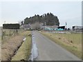
The above images may not be of the site on this page, they are loaded from Geograph.
Please Submit an Image of this site or go out and take one for us!
Click here to see more info for this site
Nearby sites
Key: Red: member's photo, Blue: 3rd party photo, Yellow: other image, Green: no photo - please go there and take one, Grey: site destroyed
Download sites to:
KML (Google Earth)
GPX (GPS waypoints)
CSV (Garmin/Navman)
CSV (Excel)
To unlock full downloads you need to sign up as a Contributory Member. Otherwise downloads are limited to 50 sites.
Turn off the page maps and other distractions
Nearby sites listing. In the following links * = Image available
1.1km NE 41° Redesmouth Settlement Ancient Village or Settlement (NY862824)
2.0km SSE 162° Lee Hall Well (Bellingham) Holy Well or Sacred Spring (NY861797)
2.1km ESE 115° High Countess Park Settlement Ancient Village or Settlement (NY874807)
2.3km NNE 29° Rede Settlement Ancient Village or Settlement (NY866836)
2.3km SSE 160° High Carry House (Birtley) Rock Art (NY8629079410)
2.4km E 87° Budeland Settlement Ancient Village or Settlement (NY879817)
2.5km NW 313° St Cuthbert's Well (Bellingham)* Holy Well or Sacred Spring (NY837833)
2.5km SSW 193° Houxty Cottage (Wark) Rock Art (NY8493279174)
2.8km SSE 150° Carry House Enclosure (Birtley Shields)* Ancient Village or Settlement (NY86877920)
3.4km SE 131° Mill Knock Settlement (Birtley)* Ancient Village or Settlement (NY88077936)
3.4km SE 134° Mill Knock Chalybeate Well (Birtley)* Holy Well or Sacred Spring (NY87987921)
3.6km SE 145° Piper Lane Standing Stone (Birtley)* Standing Stone (Menhir) (NY8757078675)
3.6km WNW 290° Crag Well (Bellingham)* Holy Well or Sacred Spring (NY8212282858)
3.7km SSE 154° West Park Camp (Birtley) Rock Art (NY87107830)
3.8km ESE 119° Lowshield Green Cairn 2* Cairn (NY88877974)
3.9km SE 124° Pitland Hills Barrow Round Barrow(s) (NY887794)
3.9km SE 126° Pitland Hills Barrow Rock Art* Rock Art (NY887793)
3.9km NW 314° Reenes Farm Rock Art (NY8266084340)
4.0km SW 229° Hetherington (Wark)* Ancient Village or Settlement (NY8248378964)
4.0km WSW 243° Shitlington* Marker Stone (NY8188879790)
4.0km ESE 103° Lowshield Green Cairn* Cairn (NY89448066)
4.3km SSE 148° Birtley Iona Cross* Ancient Cross (NY87797795)
5.6km ESE 105° Tone Hall Earthwork Misc. Earthwork (NY909801)
6.1km NE 49° Robin of Risingham (Woodburn)* Carving (NY90148564)
7.0km NNE 29° Woodhouse (West Woodburn)* Cairn (NY8888187732)
View more nearby sites and additional images


 We would like to know more about this location. Please feel free to add a brief description and any relevant information in your own language.
 Wir möchten mehr über diese Stätte erfahren. Bitte zögern Sie nicht, eine kurze Beschreibung und relevante Informationen in Deutsch hinzuzufügen.
 Nous aimerions en savoir encore un peu sur les lieux. S'il vous plaît n'hesitez pas à ajouter une courte description et tous les renseignements pertinents dans votre propre langue.
 Quisieramos informarnos un poco más de las lugares. No dude en añadir una breve descripción y otros datos relevantes en su propio idioma.